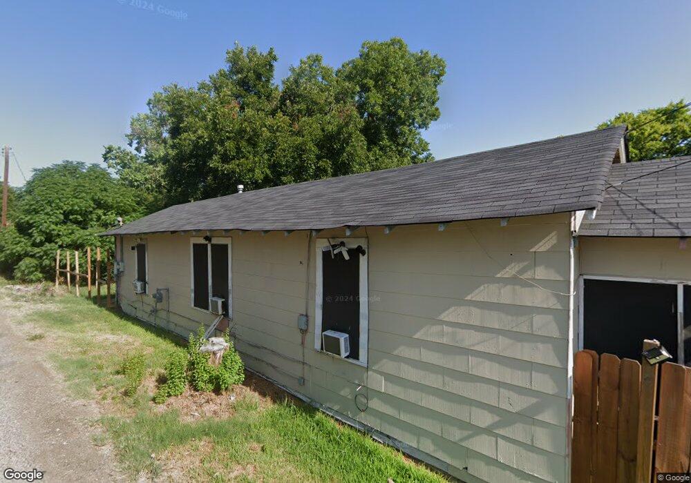
1712 Missouri Ave Shreveport, LA 71109
Queensborough NeighborhoodEstimated Value: $24,000 - $49,000
--
Bed
--
Bath
710
Sq Ft
$49/Sq Ft
Est. Value
About This Home
This home is located at 1712 Missouri Ave, Shreveport, LA 71109 and is currently estimated at $34,658, approximately $48 per square foot. 1712 Missouri Ave is a home with nearby schools including Judson Fundamental Elementary School, South Highlands Elementary, and Fairfield Magnet School.
Ownership History
Date
Name
Owned For
Owner Type
Purchase Details
Closed on
Jun 27, 2005
Sold by
Nectoux Joseph John
Bought by
Aiello Robert Michael
Current Estimated Value
Purchase Details
Closed on
Jun 18, 2005
Sold by
Nectoux Joseph John
Bought by
Aiello Robert Michael
Purchase Details
Closed on
Jun 14, 2005
Sold by
Nectoux Lehman Linda Gail
Bought by
Aiello Robert Michael
Purchase Details
Closed on
Jun 8, 2005
Sold by
Nectoux Jason Scott
Bought by
Aiello Robert Michaael
Purchase Details
Closed on
May 31, 2005
Sold by
Nectoux Tracy Marie
Bought by
Aiello Robert Michael
Create a Home Valuation Report for This Property
The Home Valuation Report is an in-depth analysis detailing your home's value as well as a comparison with similar homes in the area
Home Values in the Area
Average Home Value in this Area
Purchase History
| Date | Buyer | Sale Price | Title Company |
|---|---|---|---|
| Aiello Robert Michael | -- | None Available | |
| Aiello Robert Michael | -- | None Available | |
| Aiello Robert Michael | -- | None Available | |
| Aiello Robert Michaael | $2,000 | None Available | |
| Aiello Robert Michael | $2,000 | None Available |
Source: Public Records
Tax History Compared to Growth
Tax History
| Year | Tax Paid | Tax Assessment Tax Assessment Total Assessment is a certain percentage of the fair market value that is determined by local assessors to be the total taxable value of land and additions on the property. | Land | Improvement |
|---|---|---|---|---|
| 2024 | $228 | $1,462 | $377 | $1,085 |
| 2023 | $230 | $1,444 | $359 | $1,085 |
| 2022 | $230 | $1,444 | $359 | $1,085 |
| 2021 | $227 | $1,444 | $359 | $1,085 |
| 2020 | $227 | $1,444 | $359 | $1,085 |
| 2019 | $233 | $1,443 | $359 | $1,084 |
| 2018 | $186 | $1,443 | $359 | $1,084 |
| 2017 | $237 | $1,443 | $359 | $1,084 |
| 2015 | $58 | $450 | $360 | $90 |
| 2014 | $59 | $450 | $360 | $90 |
| 2013 | -- | $450 | $360 | $90 |
Source: Public Records
Map
Nearby Homes
- 2635 Lillian St
- 3129 Chestnut St
- 2631 Lillian St
- 2828 Darien St
- 2924 Harp St
- 2749 Darien St
- 2532 Lillian St
- 2620 Darien St
- 3206 Stonewall St
- 1713 Madison Ave
- 2408 Hearne Ave
- 3124 Stonewall St
- 3140 Stonewall St
- 1120 Madison Ave
- 3319 Lillian St
- 3117 Judson St
- 2811 Frederick St
- 3325 Sun Valley Ct
- 3131 Judson St
- 2712 Ashton St
- 1704 Missouri Ave
- 2800 W Maple St
- 2810 W Maple St
- 2806 W Maple St
- 1717 Missouri Ave
- 2822 W Maple St
- 2758 W Maple St
- 2758 W Maple St
- 2510 Missouri Ave
- 2824 W Maple St
- 2825 W Laurel St
- 2740 W Maple St
- 2826 W Maple St
- 2830 W Maple St
- 2830 W Maple St
- 2830 W Maple St
- 2830 W Maple St
- 2830 W Maple St
- 2830 W Maple St
- 2830 W Maple St