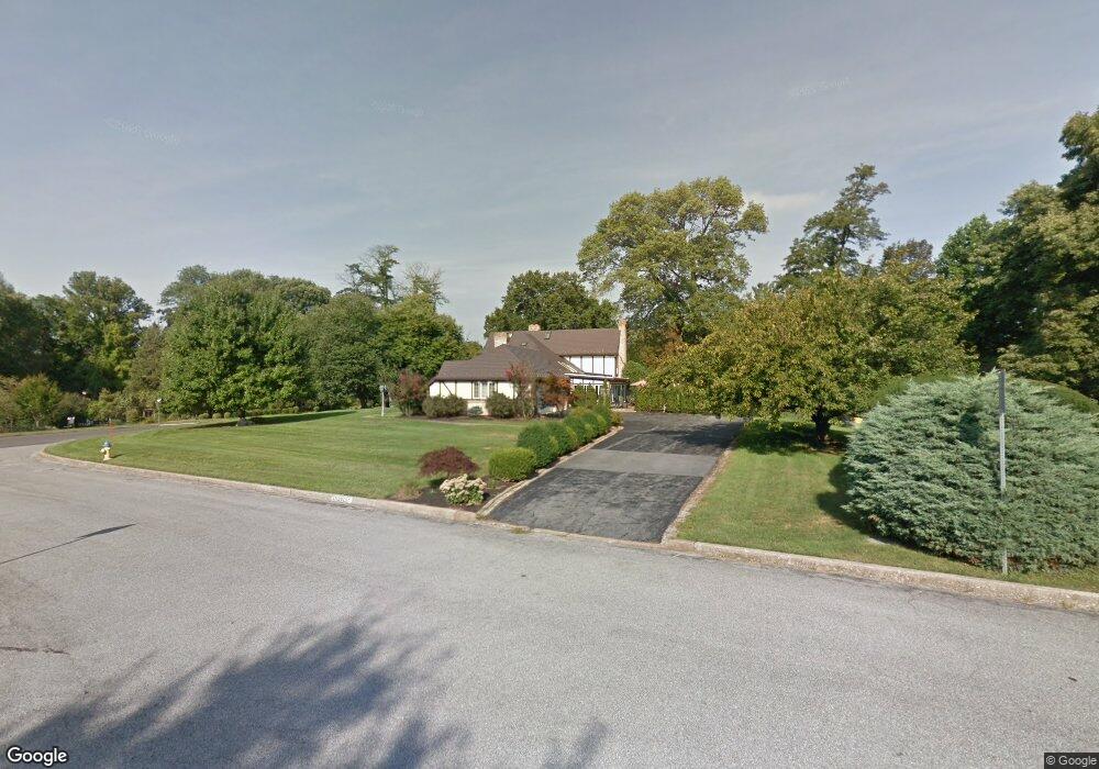
1712 Olmsted Way E Camp Hill, PA 17011
Lower Allen NeighborhoodEstimated Value: $870,422 - $1,026,000
5
Beds
6
Baths
4,526
Sq Ft
$207/Sq Ft
Est. Value
About This Home
This home is located at 1712 Olmsted Way E, Camp Hill, PA 17011 and is currently estimated at $937,474, approximately $207 per square foot. 1712 Olmsted Way E is a home located in Cumberland County with nearby schools including Highland Elementary School, New Cumberland Middle School, and Cedar Cliff High School.
Ownership History
Date
Name
Owned For
Owner Type
Purchase Details
Closed on
Mar 23, 2021
Sold by
Parikh Devendra B and Parikh Shobhana D
Bought by
Coldren Robert L and Kirkhuff Larry E
Current Estimated Value
Purchase Details
Closed on
Jan 28, 1999
Sold by
Lewis Gary D
Bought by
Parikh Devendra B
Home Financials for this Owner
Home Financials are based on the most recent Mortgage that was taken out on this home.
Original Mortgage
$210,000
Interest Rate
6.67%
Create a Home Valuation Report for This Property
The Home Valuation Report is an in-depth analysis detailing your home's value as well as a comparison with similar homes in the area
Home Values in the Area
Average Home Value in this Area
Purchase History
| Date | Buyer | Sale Price | Title Company |
|---|---|---|---|
| Coldren Robert L | $660,000 | Iron Valley Abstract Of Ctrl | |
| Parikh Devendra B | $382,500 | -- |
Source: Public Records
Mortgage History
| Date | Status | Borrower | Loan Amount |
|---|---|---|---|
| Previous Owner | Parikh Devendra B | $210,000 |
Source: Public Records
Tax History Compared to Growth
Tax History
| Year | Tax Paid | Tax Assessment Tax Assessment Total Assessment is a certain percentage of the fair market value that is determined by local assessors to be the total taxable value of land and additions on the property. | Land | Improvement |
|---|---|---|---|---|
| 2025 | $10,964 | $517,600 | $151,800 | $365,800 |
| 2024 | $10,482 | $517,600 | $151,800 | $365,800 |
| 2023 | $10,051 | $517,600 | $151,800 | $365,800 |
| 2022 | $9,892 | $517,600 | $151,800 | $365,800 |
| 2021 | $9,669 | $517,600 | $151,800 | $365,800 |
| 2020 | $9,477 | $517,600 | $151,800 | $365,800 |
| 2019 | $8,818 | $517,600 | $151,800 | $365,800 |
| 2018 | $8,588 | $517,600 | $151,800 | $365,800 |
| 2017 | $8,140 | $517,600 | $151,800 | $365,800 |
| 2016 | -- | $517,600 | $151,800 | $365,800 |
| 2015 | -- | $569,400 | $151,800 | $417,600 |
| 2014 | -- | $569,400 | $151,800 | $417,600 |
Source: Public Records
Map
Nearby Homes
- 8 Grinnel Dr
- 1711 Cedar Cliff Dr
- 8 Redwood Place
- 111 Juniper Dr
- 333 Blacksmith Rd
- 1704 Sherwood Rd
- 19 Cornell Dr
- 2 Commercial Dr
- 1506 Carlisle Rd
- 37 Creek Rd
- 1514 Carlisle Rd
- 710 Drexel Hills Blvd
- 1719 Locust St
- 220 Creek Rd
- 617 Brookhaven Rd
- 1609 Carlisle Rd
- 103 Parkview Rd
- 716 Elkwood Dr
- 115 Parkview Rd
- 144 Cricket Ln
- 1712 Olmsted Way W
- 1709 Olmsted Way E
- 1705 Olmsted Way E
- 1721 Olmsted Way W
- 1713 Olmsted Way W
- 1710 Olmsted Way E
- 1714 Olmsted Way E
- 1704 Olmsted Way E
- 1729 Cushing Green
- 1700 Olmsted Way E
- 1725 Cushing Green
- 1705 Edgar Ln
- 1737 Crisswell Place
- 1709 Edgar Ln
- 422 Candlewyck Rd
- 424 Candlewyck Rd
- 420 Candlewyck Rd
- 418 Candlewyck Rd
- 95 Green Lane Dr
- 1736 Crisswell Place