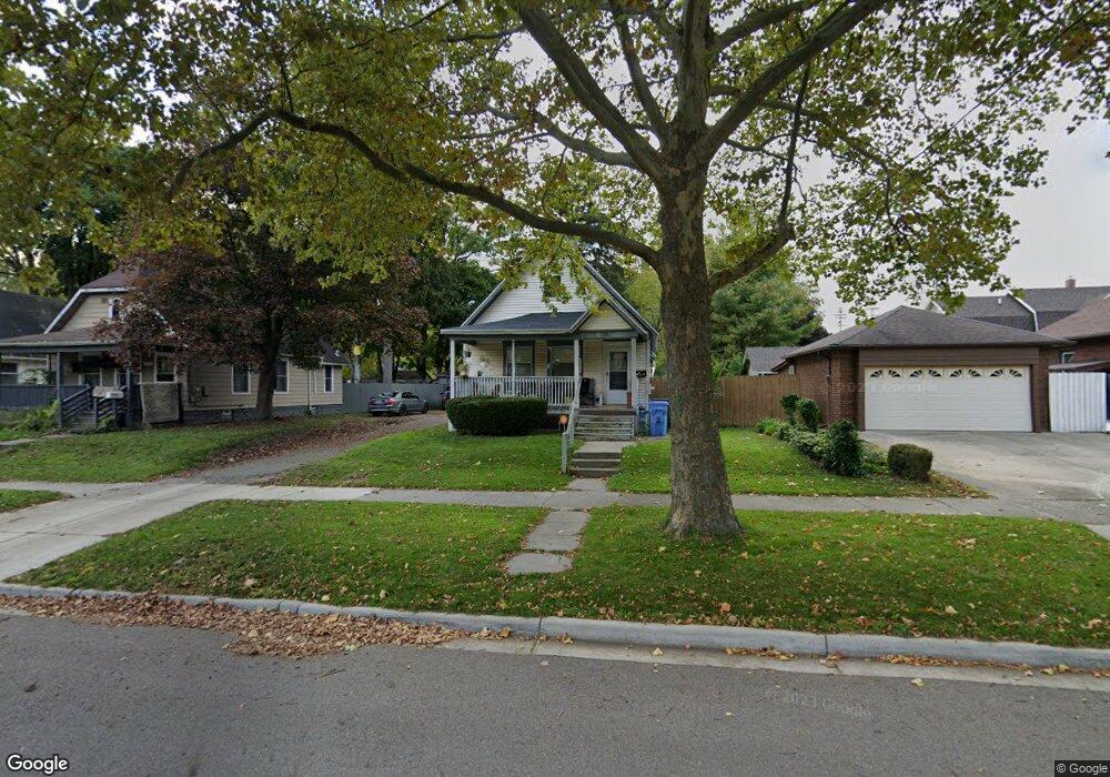
1712 Osband Ave Lansing, MI 48910
Moores Park NeighborhoodEstimated Value: $87,534 - $120,000
3
Beds
2
Baths
990
Sq Ft
$103/Sq Ft
Est. Value
About This Home
This home is located at 1712 Osband Ave, Lansing, MI 48910 and is currently estimated at $102,384, approximately $103 per square foot. 1712 Osband Ave is a home located in Ingham County with nearby schools including Averill Elementary School, Pattengill Academy, and J.W. Sexton High School.
Ownership History
Date
Name
Owned For
Owner Type
Purchase Details
Closed on
May 30, 2008
Sold by
Haney Robert M
Bought by
Terratrust Llc
Current Estimated Value
Purchase Details
Closed on
Jul 12, 2007
Sold by
Wiseman Philip and Wiseman Hope
Bought by
Novastar Mortgage Inc
Purchase Details
Closed on
Apr 8, 1998
Sold by
Wiseman Hope
Bought by
Wiseman Phillip and Wiseman Hope
Create a Home Valuation Report for This Property
The Home Valuation Report is an in-depth analysis detailing your home's value as well as a comparison with similar homes in the area
Home Values in the Area
Average Home Value in this Area
Purchase History
| Date | Buyer | Sale Price | Title Company |
|---|---|---|---|
| Terratrust Llc | -- | Diversified National Title | |
| Novastar Mortgage Inc | $64,669 | None Available | |
| Wiseman Phillip | -- | -- | |
| Wiseman Hope | $30,000 | -- |
Source: Public Records
Tax History
| Year | Tax Paid | Tax Assessment Tax Assessment Total Assessment is a certain percentage of the fair market value that is determined by local assessors to be the total taxable value of land and additions on the property. | Land | Improvement |
|---|---|---|---|---|
| 2025 | $2,620 | $42,700 | $4,500 | $38,200 |
| 2024 | $22 | $43,800 | $4,500 | $39,300 |
| 2023 | $2,466 | $38,200 | $4,500 | $33,700 |
| 2022 | $2,253 | $36,100 | $6,400 | $29,700 |
| 2021 | $2,201 | $32,600 | $4,600 | $28,000 |
| 2020 | $2,185 | $31,400 | $4,600 | $26,800 |
| 2019 | $2,110 | $28,700 | $4,600 | $24,100 |
| 2018 | $2,002 | $26,700 | $4,600 | $22,100 |
| 2017 | $1,926 | $26,700 | $4,600 | $22,100 |
| 2016 | $3,433 | $26,200 | $4,600 | $21,600 |
| 2015 | $3,433 | $25,100 | $9,135 | $15,965 |
| 2014 | $3,433 | $24,400 | $5,163 | $19,237 |
Source: Public Records
Map
Nearby Homes
- 1723 Osband Ave
- 717 Smith Ave
- 612 W Mount Hope Ave
- 815 Smith Ave
- 1824 Davis Ave
- 1917 Osband Ave
- 310 W Barnes Ave
- 712 Lenore Ave
- 900 W Mount Hope Ave
- 1017 W Barnes Ave
- 205 Moores River Dr
- 1319 Pico Ave
- 227 Woodlawn Ave
- 1400 Pico Ave
- 139 Woodlawn Ave
- 1116 George St
- 1114 Goodrich St
- 1408 Reo Ave
- 1406 Reo Ave
- 2001 S Martin Luther King Junior Blvd
- 1716 Osband Ave
- 601 W Barnes Ave
- 607 W Barnes Ave
- 611 W Barnes Ave
- 1720 Osband Ave
- 615 W Barnes Ave
- 612 Smith Ave
- 1724 Osband Ave
- 610 Smith Ave
- 616 Smith Ave
- 527 W Barnes Ave
- 1711 Osband Ave
- 620 Smith Ave
- 1715 Osband Ave
- 525 W Barnes Ave
- 623 W Barnes Ave
- 1719 Osband Ave
- 624 Smith Ave
- 521 W Barnes Ave
- 625 W Barnes Ave
Your Personal Tour Guide
Ask me questions while you tour the home.