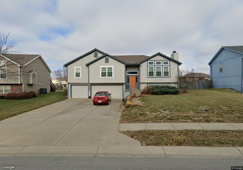
1712 Rolling Rock Rd Raymore, MO 64083
Estimated Value: $306,000 - $362,000
3
Beds
2
Baths
1,582
Sq Ft
$209/Sq Ft
Est. Value
About This Home
This home is located at 1712 Rolling Rock Rd, Raymore, MO 64083 and is currently estimated at $331,275, approximately $209 per square foot. 1712 Rolling Rock Rd is a home located in Cass County with nearby schools including Stonegate Elementary School, Raymore-Peculiar South Middle School, and Raymore-Peculiar Senior High School.
Ownership History
Date
Name
Owned For
Owner Type
Purchase Details
Closed on
Jul 23, 2024
Sold by
Martin Sarah K
Bought by
Martin Andrew S
Current Estimated Value
Purchase Details
Closed on
Nov 21, 2023
Sold by
Martin Deborah Ann
Bought by
Martin Sarah K and Martin Andrew Steven
Create a Home Valuation Report for This Property
The Home Valuation Report is an in-depth analysis detailing your home's value as well as a comparison with similar homes in the area
Home Values in the Area
Average Home Value in this Area
Purchase History
| Date | Buyer | Sale Price | Title Company |
|---|---|---|---|
| Martin Andrew S | -- | None Listed On Document | |
| Martin Sarah K | -- | None Listed On Document |
Source: Public Records
Tax History
| Year | Tax Paid | Tax Assessment Tax Assessment Total Assessment is a certain percentage of the fair market value that is determined by local assessors to be the total taxable value of land and additions on the property. | Land | Improvement |
|---|---|---|---|---|
| 2025 | $2,930 | $40,660 | $6,980 | $33,680 |
| 2024 | $2,930 | $36,000 | $6,350 | $29,650 |
| 2023 | $2,926 | $36,000 | $6,350 | $29,650 |
| 2022 | $2,635 | $32,210 | $6,350 | $25,860 |
| 2021 | $2,636 | $32,210 | $6,350 | $25,860 |
| 2020 | $2,591 | $31,100 | $6,350 | $24,750 |
| 2019 | $2,501 | $31,100 | $6,350 | $24,750 |
| 2018 | $2,305 | $27,680 | $5,290 | $22,390 |
| 2017 | $2,113 | $27,680 | $5,290 | $22,390 |
| 2016 | $2,113 | $26,340 | $5,290 | $21,050 |
| 2015 | $2,115 | $26,340 | $5,290 | $21,050 |
| 2014 | $2,115 | $26,340 | $5,290 | $21,050 |
| 2013 | -- | $26,340 | $5,290 | $21,050 |
Source: Public Records
Map
Nearby Homes
- 603 Old Paint Rd
- 1717 Overbrook Ln
- 1519 Colt Cir
- 709 Bluestem Ct
- 1510 Colt Cir
- 414 Eagle Glen Dr
- 415 Woodview Dr
- 411 Eagle Glen Dr
- 300 Dean Ave
- 1112 Carlisle Dr
- 1105 Creekside Ct
- 212 S Huntsman Blvd
- 1108 Yokley Dr
- 1103 Carlisle Dr
- 1601 Stasi Ave
- 112 S Westglen Dr
- 110 S Westglen Dr
- 901 W Lucy Webb Rd
- 1309 Larkspur Place
- 1228 Larkspur Place
- 1710 Rolling Rock Rd
- 1714 Rolling Rock Rd
- 1710 Rolling Rock N A
- 1709 Longhorn Ln
- 1711 Longhorn Ln
- 1708 Rolling Rock Rd
- 1716 Rolling Rock Rd
- 1707 Longhorn Ln
- 1713 Longhorn Ln
- 1711 Rolling Rock Rd
- 1713 Rolling Rock Rd
- 1709 Rolling Rock Rd
- 1717 Longhorn Ln
- 1706 Rolling Rock Rd
- 1705 Longhorn Ln
- 1715 Rolling Rock Rd
- 1718 Rolling Rock Rd
- 1719 Longhorn Ln
- 1704 Rolling Rock Rd
- 1710 Longhorn Ln
Your Personal Tour Guide
Ask me questions while you tour the home.