Estimated Value: $1,042,000 - $1,197,000
5
Beds
4
Baths
3,376
Sq Ft
$326/Sq Ft
Est. Value
About This Home
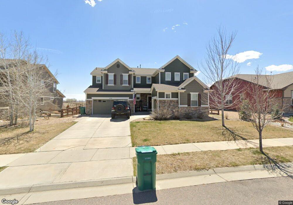
This home is located at 1712 Weston Cir, Erie, CO 80516 and is currently estimated at $1,099,074, approximately $325 per square foot. 1712 Weston Cir is a home with nearby schools including Red Hawk Elementary School, Erie Middle School, and Erie High School.
Ownership History
Date
Name
Owned For
Owner Type
Purchase Details
Closed on
Feb 21, 2024
Sold by
Wallace David W and Wallace Cherie L
Bought by
The True North Trust
Current Estimated Value
Purchase Details
Closed on
Jun 25, 2012
Sold by
Meritage Homes Of Colorado Inc
Bought by
Wallace David W
Home Financials for this Owner
Home Financials are based on the most recent Mortgage that was taken out on this home.
Original Mortgage
$375,476
Interest Rate
3.83%
Mortgage Type
New Conventional
Create a Home Valuation Report for This Property
The Home Valuation Report is an in-depth analysis detailing your home's value as well as a comparison with similar homes in the area
Home Values in the Area
Average Home Value in this Area
Purchase History
| Date | Buyer | Sale Price | Title Company |
|---|---|---|---|
| The True North Trust | -- | None Listed On Document | |
| Wallace David W | $469,345 | Heritage Title |
Source: Public Records
Mortgage History
| Date | Status | Borrower | Loan Amount |
|---|---|---|---|
| Previous Owner | Wallace David W | $375,476 |
Source: Public Records
Tax History Compared to Growth
Tax History
| Year | Tax Paid | Tax Assessment Tax Assessment Total Assessment is a certain percentage of the fair market value that is determined by local assessors to be the total taxable value of land and additions on the property. | Land | Improvement |
|---|---|---|---|---|
| 2025 | $8,734 | $68,757 | $15,788 | $52,969 |
| 2024 | $8,734 | $68,757 | $15,788 | $52,969 |
| 2023 | $8,636 | $76,259 | $21,407 | $58,538 |
| 2022 | $6,647 | $56,156 | $14,505 | $41,651 |
| 2021 | $6,764 | $57,772 | $14,922 | $42,850 |
| 2020 | $5,680 | $48,621 | $10,368 | $38,253 |
| 2019 | $5,665 | $48,621 | $10,368 | $38,253 |
| 2018 | $5,675 | $48,614 | $12,816 | $35,798 |
| 2017 | $5,417 | $53,746 | $14,169 | $39,577 |
| 2016 | $5,188 | $45,452 | $14,010 | $31,442 |
| 2015 | $4,979 | $38,383 | $17,353 | $21,030 |
| 2014 | $4,298 | $38,383 | $17,353 | $21,030 |
Source: Public Records
Map
Nearby Homes
- 873 Mcclure Way
- 936 Weston Cir
- 1600 Brimble Dr
- 859 Brimble Ct
- 717 Mcclure Ct
- 648 Brennan Cir
- 1205 Red Iron Ct
- 700 S Beshear Ct
- 671 Brennan Cir
- 602 Mathews Way
- 1182 Red Iron Ct
- 1673 Bain Dr
- 644 N Beshear Ct
- 688 Brennan Cir
- 1665 Bain Dr
- 1600 Bain Dr
- 549 Brennan Cir
- 1386 Avgare Way
- 634 Apex St
- 612 Apex St
- 1706 Weston Cir
- 1724 Weston Cir
- 1700 Weston Cir
- 915 Mcclure Way
- 916 Mcclure Way
- 944 Shuttleworth Dr
- 938 Shuttleworth Dr
- 917 Reese Ct
- 1684 Westin Dr
- 910 Mcclure Way
- 909 Mcclure Way
- 1736 Weston Cir
- 928 Shuttleworth Dr
- 971 Shuttleworth Dr
- 911 Reese Ct
- 903 Mcclure Way
- 1674 Westin Dr
- 959 Shuttleworth Dr
- 1720 Weston Cir
- 918 Shuttleworth Dr