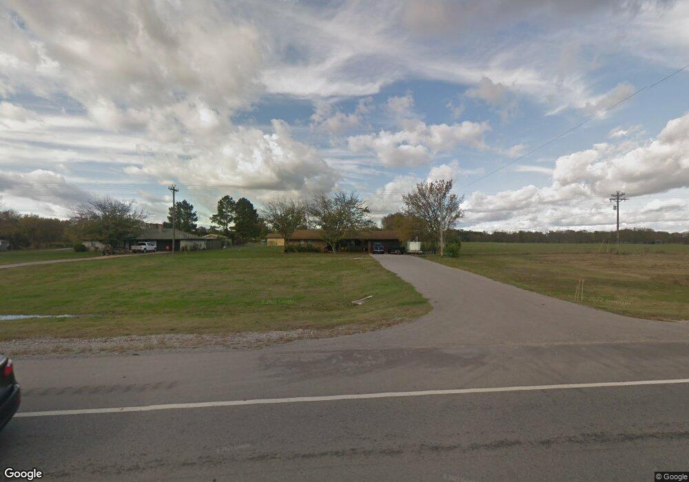
17126 Us Highway 70 Durant, OK 74701
Estimated Value: $191,000 - $239,915
3
Beds
2
Baths
1,587
Sq Ft
$136/Sq Ft
Est. Value
About This Home
This home is located at 17126 Us Highway 70, Durant, OK 74701 and is currently estimated at $215,229, approximately $135 per square foot. 17126 Us Highway 70 is a home located in Bryan County with nearby schools including Washington Irving Elementary School, Durant Middle School, and Durant Intermediate Elementary School.
Ownership History
Date
Name
Owned For
Owner Type
Purchase Details
Closed on
Jan 15, 2022
Sold by
Grover Jaggers Revocable Trust
Bought by
Keener Holdings Llc
Current Estimated Value
Purchase Details
Closed on
Sep 10, 2007
Sold by
Jackson Alphonso
Bought by
Keener Kevin Justin
Home Financials for this Owner
Home Financials are based on the most recent Mortgage that was taken out on this home.
Original Mortgage
$87,444
Interest Rate
6.7%
Mortgage Type
Unknown
Purchase Details
Closed on
Mar 5, 2007
Sold by
Fender Jason
Bought by
Secretary Of Hud
Purchase Details
Closed on
Nov 6, 2003
Sold by
Rowland Raymond and Rowland Sharon
Bought by
Fender Jason and Fender Tiffany
Purchase Details
Closed on
Nov 25, 1992
Sold by
Adams Larry and Adams Gwenna
Bought by
Rowland Raymond and Rowland Sharon
Create a Home Valuation Report for This Property
The Home Valuation Report is an in-depth analysis detailing your home's value as well as a comparison with similar homes in the area
Home Values in the Area
Average Home Value in this Area
Purchase History
| Date | Buyer | Sale Price | Title Company |
|---|---|---|---|
| Keener Holdings Llc | $150,000 | None Listed On Document | |
| Keener Holdings Llc | $150,000 | None Listed On Document | |
| Keener Kevin Justin | -- | None Available | |
| Secretary Of Hud | -- | None Available | |
| Fender Jason | $80,500 | -- | |
| Rowland Raymond | $56,000 | -- |
Source: Public Records
Mortgage History
| Date | Status | Borrower | Loan Amount |
|---|---|---|---|
| Previous Owner | Keener Kevin Justin | $87,444 |
Source: Public Records
Tax History Compared to Growth
Tax History
| Year | Tax Paid | Tax Assessment Tax Assessment Total Assessment is a certain percentage of the fair market value that is determined by local assessors to be the total taxable value of land and additions on the property. | Land | Improvement |
|---|---|---|---|---|
| 2024 | $1,331 | $13,667 | $1,848 | $11,819 |
| 2023 | $1,331 | $13,016 | $1,848 | $11,168 |
| 2022 | $1,222 | $13,016 | $1,848 | $11,168 |
| 2021 | $1,252 | $13,016 | $1,848 | $11,168 |
| 2020 | $1,209 | $12,586 | $1,616 | $10,970 |
| 2019 | $1,087 | $11,987 | $1,293 | $10,694 |
| 2018 | $1,026 | $11,415 | $1,316 | $10,099 |
| 2017 | $971 | $10,871 | $1,333 | $9,538 |
| 2016 | $932 | $10,354 | $1,334 | $9,020 |
| 2015 | $885 | $9,861 | $880 | $8,981 |
| 2014 | $884 | $9,861 | $880 | $8,981 |
Source: Public Records
Map
Nearby Homes
- 17096 US Highway 70
- 647 Sawmill Rd
- 177 Founders Ln
- 72 Horizon Cir
- 418 E2085 Rd
- 2551 U S 70
- 345 Kat's Ave
- 2 Sawmill Rd
- 209 Shell Ln
- 2220 Mason St
- 798 S Lone Oak Rd
- 589 Three Mile Rd
- 1836 Sawmill Rd
- 1702 Smith St
- 97 Loyal Ln
- 106 Loyal Ln
- 1 Three Mile Rd
- 0 N Mclean Rd Unit 2543532
- 131 S Mclean Dr
- 1503 Hillcrest Ave
- 17127 Us Highway 70
- 0 Moore Ln
- 72 Moore Ln
- 135 Brody's Way
- 0 Kat's Ave Unit 2000855
- 0 Kat's Ave Unit 2002407
- 0 Kat's Ave Unit 2002404
- 0 Kat's Ave Unit 2002410
- 0 Kat's Ave Unit 2002411
- 0 Kat's Ave Unit 2002414
- 0 Kat's Ave Unit 2002419
- 0 Kat's Ave Unit 2209610
- 44 Brody's Way
- 17193 Us Highway 70
- 259 Brody's Way
- 17319 Us Highway 70
- 452 Texas St
- 167 Brody's Way
- 224 Kats Ave
- 16924 Us Highway 70