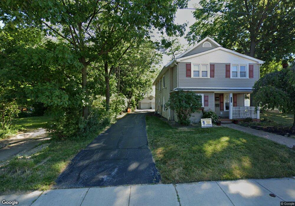
1713 E 290th St Wickliffe, OH 44092
Estimated Value: $266,000 - $378,000
7
Beds
3
Baths
1,650
Sq Ft
$185/Sq Ft
Est. Value
About This Home
This home is located at 1713 E 290th St, Wickliffe, OH 44092 and is currently estimated at $304,645, approximately $184 per square foot. 1713 E 290th St is a home located in Lake County with nearby schools including Wickliffe Elementary School, Wickliffe Middle School, and Wickliffe High School.
Ownership History
Date
Name
Owned For
Owner Type
Purchase Details
Closed on
Jun 27, 2017
Sold by
Mazzolini Barbara B and Mazzolini John M
Bought by
Mazzolini Mark J and Nuti Kathy
Current Estimated Value
Purchase Details
Closed on
May 24, 2017
Sold by
Mazzolini Barbara B and Mazzolini John M
Bought by
Mazzolini Mark J and Nuti Kathy
Purchase Details
Closed on
Apr 13, 2011
Sold by
Estate Of Marjorie J Mazzolini
Bought by
Mazzolini Mark J and Nuti Katheryn
Purchase Details
Closed on
Dec 7, 1989
Bought by
Mazzolini John M
Create a Home Valuation Report for This Property
The Home Valuation Report is an in-depth analysis detailing your home's value as well as a comparison with similar homes in the area
Home Values in the Area
Average Home Value in this Area
Purchase History
| Date | Buyer | Sale Price | Title Company |
|---|---|---|---|
| Mazzolini Mark J | $24,000 | Ohio Real Title | |
| Mazzolini Mark J | $24,000 | Ohio Real Title | |
| Mazzolini Mark J | -- | None Available | |
| Mazzolini John M | -- | -- |
Source: Public Records
Tax History
| Year | Tax Paid | Tax Assessment Tax Assessment Total Assessment is a certain percentage of the fair market value that is determined by local assessors to be the total taxable value of land and additions on the property. | Land | Improvement |
|---|---|---|---|---|
| 2025 | -- | $89,500 | $18,320 | $71,180 |
| 2024 | -- | $89,500 | $18,320 | $71,180 |
| 2023 | $8,104 | $65,900 | $15,500 | $50,400 |
| 2022 | $4,824 | $65,900 | $15,500 | $50,400 |
| 2021 | $4,844 | $65,900 | $15,500 | $50,400 |
| 2020 | $4,672 | $54,020 | $12,710 | $41,310 |
| 2019 | $4,670 | $54,020 | $12,710 | $41,310 |
| 2018 | $4,046 | $54,430 | $16,140 | $38,290 |
| 2017 | $3,925 | $54,430 | $16,140 | $38,290 |
| 2016 | $3,906 | $54,430 | $16,140 | $38,290 |
| 2015 | $3,839 | $54,430 | $16,140 | $38,290 |
| 2014 | $3,392 | $54,430 | $16,140 | $38,290 |
| 2013 | $3,391 | $54,430 | $16,140 | $38,290 |
Source: Public Records
Map
Nearby Homes
- 28900 Euclid Ave
- 28756 Hazel Ave
- 0 Green Ridge Dr
- 1354 Craneing Rd
- 29315 Nehls Park Dr
- 2715 Cabin Dr
- 1540 E 298th St
- 1526 E 298th St
- 27701 Mills Ave Unit 2G
- 1670 Hillandale Dr
- 815 E 272nd St
- 730 Hemlock Dr
- 670 Hemlock Dr
- 1719 E 300th St
- 29566 Shaker Dr
- 597 Hemlock Dr
- 591 Hemlock Dr
- 940 Talmadge Ave
- 27190 Zeman Ave
- 1597 Lee Terrace Dr Unit F11
- 1707 E 290th St
- 1717 E 290th St
- 1701 E 290th St
- 1725 E 290th St
- 1729 E 290th St
- 1712 E 291st St
- 1716 E 291st St
- 1706 E 291st St Unit Down
- 1706 E 291st St
- 1706 E 291st St Unit Upper
- 1710 E 290th St
- 1714 E 290th St
- 1722 E 291st St
- 1700 E 291st St
- 1735 E 290th St
- 1724 E 290th St
- 1700 E 290th St
- 1527 E 290th St
- 1536 E 291st St
- 1720 E 290th St
Your Personal Tour Guide
Ask me questions while you tour the home.