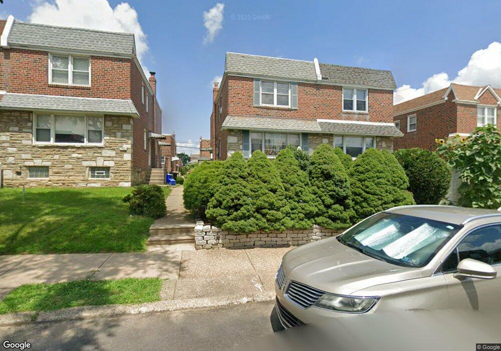
1713 Kendrick St Philadelphia, PA 19152
Rhawnhurst NeighborhoodEstimated Value: $329,844 - $352,000
3
Beds
2
Baths
1,354
Sq Ft
$251/Sq Ft
Est. Value
About This Home
This home is located at 1713 Kendrick St, Philadelphia, PA 19152 and is currently estimated at $339,961, approximately $251 per square foot. 1713 Kendrick St is a home with nearby schools including Farrell Louis H School, Northeast High School, and Tacony Academy Charter School.
Ownership History
Date
Name
Owned For
Owner Type
Purchase Details
Closed on
Apr 19, 2002
Sold by
Girard Kimberly L and Bonsall Kimberly L
Bought by
Desousa Ana Lucia Neves
Current Estimated Value
Home Financials for this Owner
Home Financials are based on the most recent Mortgage that was taken out on this home.
Original Mortgage
$123,830
Outstanding Balance
$52,212
Interest Rate
7.05%
Mortgage Type
FHA
Estimated Equity
$287,749
Purchase Details
Closed on
Oct 31, 1994
Sold by
Slutsky Harvey
Bought by
Bonsall Leroy H and Girard Kimberly L
Create a Home Valuation Report for This Property
The Home Valuation Report is an in-depth analysis detailing your home's value as well as a comparison with similar homes in the area
Home Values in the Area
Average Home Value in this Area
Purchase History
| Date | Buyer | Sale Price | Title Company |
|---|---|---|---|
| Desousa Ana Lucia Neves | $125,000 | -- | |
| Girard L Kimberly | -- | -- | |
| Bonsall Leroy H | $76,900 | -- |
Source: Public Records
Mortgage History
| Date | Status | Borrower | Loan Amount |
|---|---|---|---|
| Open | Desousa Ana Lucia Neves | $123,830 |
Source: Public Records
Tax History Compared to Growth
Tax History
| Year | Tax Paid | Tax Assessment Tax Assessment Total Assessment is a certain percentage of the fair market value that is determined by local assessors to be the total taxable value of land and additions on the property. | Land | Improvement |
|---|---|---|---|---|
| 2025 | $3,340 | $298,400 | $59,680 | $238,720 |
| 2024 | $3,340 | $298,400 | $59,680 | $238,720 |
| 2023 | $3,340 | $238,600 | $47,720 | $190,880 |
| 2022 | $2,844 | $238,600 | $47,720 | $190,880 |
| 2021 | $2,844 | $0 | $0 | $0 |
| 2020 | $2,844 | $0 | $0 | $0 |
| 2019 | $2,590 | $0 | $0 | $0 |
| 2018 | $2,398 | $0 | $0 | $0 |
| 2017 | $2,398 | $0 | $0 | $0 |
| 2016 | $2,398 | $0 | $0 | $0 |
| 2015 | $2,295 | $0 | $0 | $0 |
| 2014 | -- | $171,300 | $34,280 | $137,020 |
| 2012 | -- | $23,552 | $3,089 | $20,463 |
Source: Public Records
Map
Nearby Homes
- 1711 Kendrick St
- 1716 Bergen St
- 1804 Megargee St
- 1712 Tustin St
- 1828 Megargee St
- 1617 Solly Ave
- 1907 Tustin St
- 1832 Mower St
- 1834 Mower St
- 8606 Frontenac St
- 8614 Agusta St
- 1702 Arthur St
- 1704 Stanwood St
- 1625 Rhawn St
- 8523 Benton Ave
- 8562 Benton Ave
- 2155 Benson St
- 1718 Rhawn St
- 2162 Strahle St
- 1443 Rhawn St
- 1715 Kendrick St
- 1709 Kendrick St
- 1717 Kendrick St
- 1719 Kendrick St
- 1707 Kendrick St
- 1712 Bergen St
- 1714 Bergen St
- 1721 Kendrick St
- 1705 Kendrick St
- 1710 Bergen St
- 1708 Bergen St
- 1718 Bergen St
- 1706 Bergen St
- 1703 Kendrick St
- 1723 Kendrick St
- 1720 Bergen St
- 1704 Bergen St
- 1712 Kendrick St
- 1714 Kendrick St
- 1710 Kendrick St