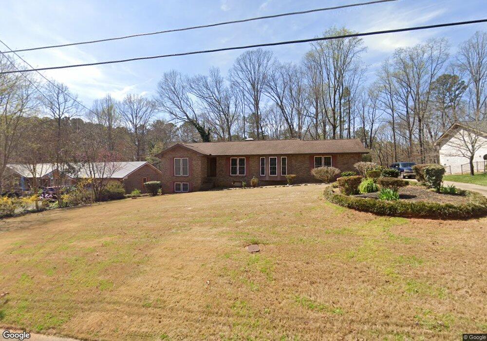
1713 Norton Estates Cir Unit 1 Snellville, GA 30078
Estimated Value: $384,866 - $413,000
3
Beds
3
Baths
1,545
Sq Ft
$256/Sq Ft
Est. Value
About This Home
This home is located at 1713 Norton Estates Cir Unit 1, Snellville, GA 30078 and is currently estimated at $395,217, approximately $255 per square foot. 1713 Norton Estates Cir Unit 1 is a home located in Gwinnett County with nearby schools including Brookwood Elementary School, Alton C. Crews Middle School, and Brookwood High School.
Ownership History
Date
Name
Owned For
Owner Type
Purchase Details
Closed on
Jul 30, 2001
Sold by
Spruill Janice L
Bought by
Reid Michael
Current Estimated Value
Home Financials for this Owner
Home Financials are based on the most recent Mortgage that was taken out on this home.
Original Mortgage
$164,900
Outstanding Balance
$62,171
Interest Rate
7%
Mortgage Type
New Conventional
Estimated Equity
$333,046
Create a Home Valuation Report for This Property
The Home Valuation Report is an in-depth analysis detailing your home's value as well as a comparison with similar homes in the area
Home Values in the Area
Average Home Value in this Area
Purchase History
| Date | Buyer | Sale Price | Title Company |
|---|---|---|---|
| Reid Michael | $164,900 | -- |
Source: Public Records
Mortgage History
| Date | Status | Borrower | Loan Amount |
|---|---|---|---|
| Open | Reid Michael | $164,900 |
Source: Public Records
Tax History Compared to Growth
Tax History
| Year | Tax Paid | Tax Assessment Tax Assessment Total Assessment is a certain percentage of the fair market value that is determined by local assessors to be the total taxable value of land and additions on the property. | Land | Improvement |
|---|---|---|---|---|
| 2025 | $927 | $158,600 | $22,200 | $136,400 |
| 2024 | $921 | $146,040 | $22,200 | $123,840 |
| 2023 | $921 | $153,120 | $24,800 | $128,320 |
| 2022 | $3,606 | $132,920 | $23,200 | $109,720 |
| 2021 | $2,859 | $94,680 | $14,800 | $79,880 |
| 2020 | $2,879 | $94,680 | $14,800 | $79,880 |
| 2019 | $2,581 | $83,560 | $14,800 | $68,760 |
| 2018 | $2,500 | $79,800 | $11,600 | $68,200 |
| 2016 | $2,241 | $66,760 | $11,600 | $55,160 |
| 2015 | $2,136 | $61,240 | $8,800 | $52,440 |
| 2014 | -- | $43,880 | $8,000 | $35,880 |
Source: Public Records
Map
Nearby Homes
- 3063 Bruckner Blvd
- 1845 Lisa Springs Dr
- 1953 Watson Park Dr
- 1686 Norton Estates Dr
- Kenwood Plan at Watson Park
- Stockbridge Plan at Watson Park
- Aiken Plan at Watson Park
- Lawrence Plan at Watson Park
- Easton Plan at Watson Park
- 1750 Manor Brook Way
- 1916 Oakwood Grove Dr Unit 1
- 3207 Aspen Cir SW
- 3075 Oak Meadow Dr
- 1809 Mornington Ln
- 1937 Crescent Dr
- 3173 Falconhurst Dr SW
- 1220 Edgebrook Ln
- 2691 Holly Springs Dr
- 1904 Britt Dr
- 1717 Norton Estates Cir
- 1709 Norton Estates Cir
- 0 Norton Estates Cir SW Unit 7255789
- 0 Norton Estates Cir SW Unit 8822940
- 0 Norton Estates Cir SW Unit 8679745
- 0 Norton Estates Cir SW Unit 8404703
- 0 Norton Estates Cir SW Unit 8251670
- 0 Norton Estates Cir SW Unit 8065587
- 0 Norton Estates Cir SW Unit 7573672
- 1648 Norton Estates Cir SW
- 1641 Norton Estates Cir SW
- 1721 Norton Estates Cir
- 1712 Norton Estates Cir
- 1708 Norton Estates Cir
- 1716 Norton Estates Cir Unit 1
- 1705 Norton Estates Cir
- 2042 Clay Rd
- 2387 Foley Park St
- 2062 Clay Rd
- 3070 Westpoint Cir