Estimated Value: $573,387
--
Bed
--
Bath
1,558
Sq Ft
$368/Sq Ft
Est. Value
About This Home
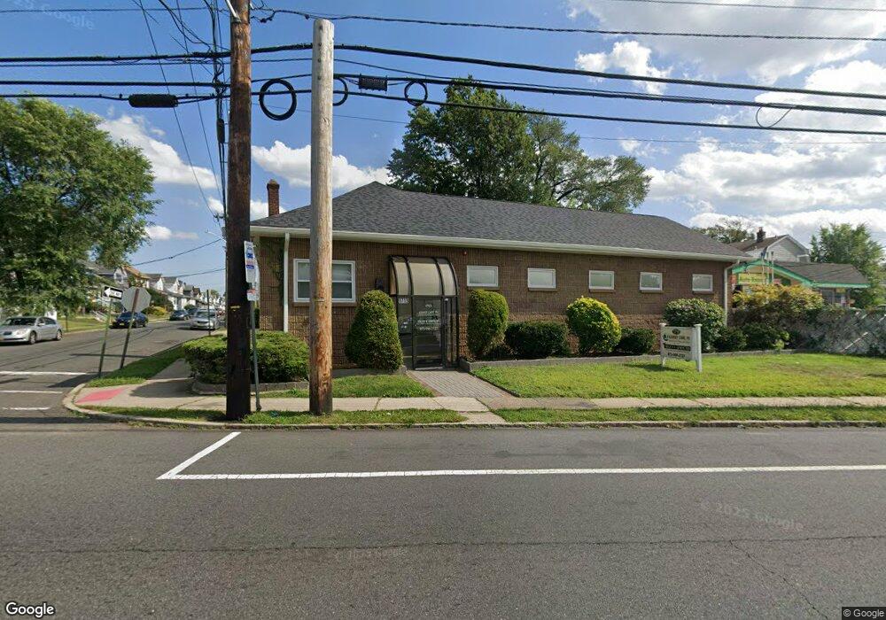
This home is located at 1713 Stuyvesant Ave, Union, NJ 07083 and is currently estimated at $573,387, approximately $368 per square foot. 1713 Stuyvesant Ave is a home located in Union County with nearby schools including Franklin Elementary School, Burnet Middle School, and Union High School.
Ownership History
Date
Name
Owned For
Owner Type
Purchase Details
Closed on
Apr 17, 2018
Sold by
City Standard Data Incorporated
Bought by
Kidney Care Pa
Current Estimated Value
Purchase Details
Closed on
Jan 29, 2015
Sold by
Main 4850 Real Estate Llc
Bought by
City Standard Data Incorporated
Home Financials for this Owner
Home Financials are based on the most recent Mortgage that was taken out on this home.
Original Mortgage
$180,375
Interest Rate
3.9%
Mortgage Type
Commercial
Purchase Details
Closed on
Nov 17, 2011
Sold by
1713 Stuyvesant Avenue Llc
Bought by
Main 4850 Real Estate Llc
Purchase Details
Closed on
Sep 30, 2003
Sold by
Eden Richard
Bought by
1713 Stuyvesant Ave Llc
Create a Home Valuation Report for This Property
The Home Valuation Report is an in-depth analysis detailing your home's value as well as a comparison with similar homes in the area
Home Values in the Area
Average Home Value in this Area
Purchase History
| Date | Buyer | Sale Price | Title Company |
|---|---|---|---|
| Kidney Care Pa | $300,000 | Clear Skies Title Agency Llc | |
| City Standard Data Incorporated | $240,500 | None Available | |
| Main 4850 Real Estate Llc | -- | Lawyers Title Insurance Corp | |
| 1713 Stuyvesant Ave Llc | $370,000 | -- |
Source: Public Records
Mortgage History
| Date | Status | Borrower | Loan Amount |
|---|---|---|---|
| Previous Owner | City Standard Data Incorporated | $180,375 |
Source: Public Records
Tax History Compared to Growth
Tax History
| Year | Tax Paid | Tax Assessment Tax Assessment Total Assessment is a certain percentage of the fair market value that is determined by local assessors to be the total taxable value of land and additions on the property. | Land | Improvement |
|---|---|---|---|---|
| 2025 | $12,852 | $57,500 | $22,400 | $35,100 |
| 2024 | $12,460 | $57,500 | $22,400 | $35,100 |
| 2023 | $12,460 | $57,500 | $22,400 | $35,100 |
| 2022 | $12,027 | $57,500 | $22,400 | $35,100 |
| 2021 | $11,735 | $57,500 | $22,400 | $35,100 |
| 2020 | $11,501 | $57,500 | $22,400 | $35,100 |
| 2019 | $11,346 | $57,500 | $22,400 | $35,100 |
| 2018 | $11,153 | $57,500 | $22,400 | $35,100 |
| 2017 | $10,988 | $57,500 | $22,400 | $35,100 |
| 2016 | $10,720 | $57,500 | $22,400 | $35,100 |
| 2015 | $10,543 | $57,500 | $22,400 | $35,100 |
| 2014 | $10,306 | $57,500 | $22,400 | $35,100 |
Source: Public Records
Map
Nearby Homes
- 2043-2045 Ostwood Terrace
- 1683 Van Ness Terrace
- 179 Hollywood Ave
- 26 Van Ness Terrace
- 1672 Edmund Terrace
- 25 Evelyn Ct
- 37 Menzel Ave
- 29 Schaefer Rd
- 1481 Walker Ave
- 2105 Melrose Pkwy
- 1552 Elaine Terrace
- 74 Hughes St
- 1589 Edmund Terrace
- 6 Field Rd
- 1630 Andrew St
- 168 Jacoby St
- 79 Coolidge St
- 75 Coolidge St
- 1517 Lindy Terrace
- 1584 Andrew St
- 1713 Stuyvesant Ave Unit 1
- 1990 Ostwood Terrace
- 1991 William St
- 1988 Ostwood Terrace
- 1985 William St
- 1984 Ostwood Terrace
- 1981 William St
- 1708 Stuyvesant Ave Unit 1
- 1979 William St
- 1982 Ostwood Terrace
- 1987 Ostwood Terrace
- 1977 William St
- 1730 Stuyvesant Ave
- 1980 Ostwood Terrace
- 1985 Ostwood Terrace
- 1975 William St
- 1983 Ostwood Terrace
- 1976 Ostwood Terrace
- 1981 Ostwood Terrace
- 1971 William St