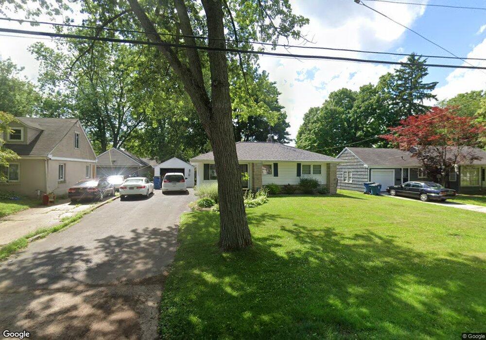
1713 Upland Dr Kalamazoo, MI 49048
Estimated Value: $177,000 - $208,000
3
Beds
1
Bath
1,272
Sq Ft
$150/Sq Ft
Est. Value
About This Home
This home is located at 1713 Upland Dr, Kalamazoo, MI 49048 and is currently estimated at $190,393, approximately $149 per square foot. 1713 Upland Dr is a home located in Kalamazoo County with nearby schools including Northeastern Elementary School, Linden Grove Middle School, and Kalamazoo Central High School.
Ownership History
Date
Name
Owned For
Owner Type
Purchase Details
Closed on
Apr 29, 2024
Sold by
Lynn Brown Trust and Hanezewski Whitney
Bought by
Trollinger Neita
Current Estimated Value
Purchase Details
Closed on
Jul 19, 2017
Sold by
Brown Lynn M
Bought by
Brown Lynn and Lynn Brown Trust
Home Financials for this Owner
Home Financials are based on the most recent Mortgage that was taken out on this home.
Original Mortgage
$46,500
Interest Rate
3.91%
Mortgage Type
New Conventional
Purchase Details
Closed on
Nov 26, 2002
Sold by
Carey Patrick T and Carey Mary M
Bought by
Brown Lynn M
Create a Home Valuation Report for This Property
The Home Valuation Report is an in-depth analysis detailing your home's value as well as a comparison with similar homes in the area
Home Values in the Area
Average Home Value in this Area
Purchase History
| Date | Buyer | Sale Price | Title Company |
|---|---|---|---|
| Trollinger Neita | -- | None Listed On Document | |
| Brown Lynn | -- | Attorney | |
| Brown Lynn M | -- | Devon Title Company | |
| Brown Lynn M | $96,500 | None Available |
Source: Public Records
Mortgage History
| Date | Status | Borrower | Loan Amount |
|---|---|---|---|
| Previous Owner | Brown Lynn M | $46,500 |
Source: Public Records
Tax History
| Year | Tax Paid | Tax Assessment Tax Assessment Total Assessment is a certain percentage of the fair market value that is determined by local assessors to be the total taxable value of land and additions on the property. | Land | Improvement |
|---|---|---|---|---|
| 2025 | $433 | $94,700 | $0 | $0 |
| 2024 | $421 | $80,000 | $0 | $0 |
| 2023 | $401 | $70,700 | $0 | $0 |
| 2022 | $1,998 | $65,400 | $0 | $0 |
| 2021 | $1,875 | $56,800 | $0 | $0 |
| 2020 | $1,845 | $52,000 | $0 | $0 |
| 2019 | $1,816 | $47,400 | $0 | $0 |
| 2018 | $1,718 | $40,200 | $0 | $0 |
| 2017 | $0 | $40,200 | $0 | $0 |
| 2016 | -- | $35,900 | $0 | $0 |
| 2015 | -- | $32,300 | $0 | $0 |
| 2014 | -- | $31,000 | $0 | $0 |
Source: Public Records
Map
Nearby Homes
- 1728 Texel Dr
- 1734 Texel Dr
- 2820 Texel Dr Unit 282022
- 1503 Texel Dr
- 3011 E Main St
- 3519 Oak Tree Dr
- 2117 Lakewood Dr
- 2407 Fairfield Ave
- 1020 Avondale Cir
- 926 Washburn Ave
- 2516 Fairfield Ave
- 1008 Cooper Ave
- 708 Gayle Ave
- 803 Ira Ave
- 1308 Colgrove Ave
- 905 Cooper Ave
- 2120 E Main St
- 561 Arthur Ave
- 1824 Humphrey St
- 3039 Casper St
- 1709 Upland Dr
- 1721 Upland Dr
- 1727 Upland Dr
- 1701 Upland Dr
- 1714 Sunnyside Dr
- 1708 Sunnyside Dr
- 1724 Sunnyside Dr
- 1702 Sunnyside Dr
- 1714 Upland Dr
- 1619 Upland Dr
- 1722 Upland Dr
- 1710 Upland Dr
- 1803 Upland Dr
- 1726 Upland Dr Unit 1
- 1734 Sunnyside Dr
- 1702 Upland Dr
- 1620 Sunnyside Dr
- 1732 Upland Dr
- 1620 Upland Dr
- 1804 Sunnyside Dr
Your Personal Tour Guide
Ask me questions while you tour the home.