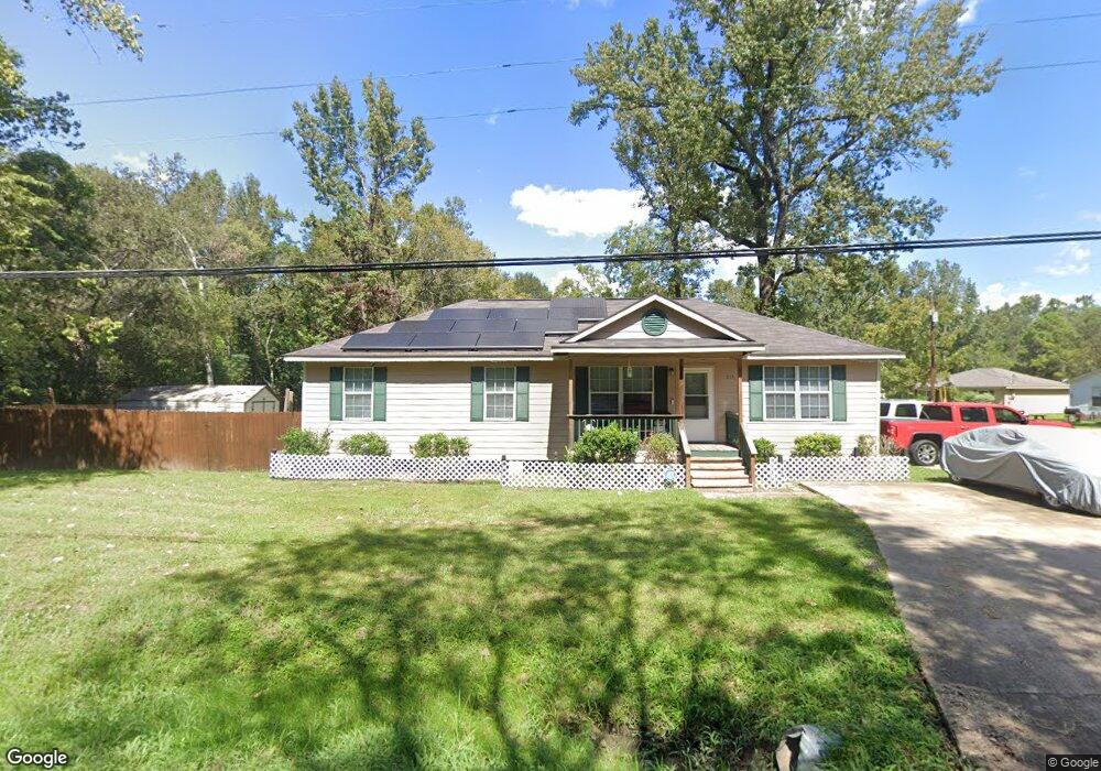
1713 Wood Ave Lufkin, TX 75901
Estimated Value: $144,746 - $187,000
--
Bed
--
Bath
1,352
Sq Ft
$122/Sq Ft
Est. Value
About This Home
This home is located at 1713 Wood Ave, Lufkin, TX 75901 and is currently estimated at $164,937, approximately $121 per square foot. 1713 Wood Ave is a home located in Angelina County with nearby schools including Kurth Primary School, Anderson Elementary School, and Lufkin Middle School.
Ownership History
Date
Name
Owned For
Owner Type
Purchase Details
Closed on
Sep 24, 2015
Sold by
Ditech Financial Llc
Bought by
Davis Anthony Dewayne
Current Estimated Value
Purchase Details
Closed on
Sep 1, 2015
Sold by
Dodd Derick D
Bought by
Ditech Financial Llc
Purchase Details
Closed on
Aug 25, 2010
Sold by
Walter Mortgage Co Llc
Bought by
Dodd Derick D
Purchase Details
Closed on
Feb 1, 2006
Sold by
Rainey Geneva
Bought by
Davis Janis
Create a Home Valuation Report for This Property
The Home Valuation Report is an in-depth analysis detailing your home's value as well as a comparison with similar homes in the area
Home Values in the Area
Average Home Value in this Area
Purchase History
| Date | Buyer | Sale Price | Title Company |
|---|---|---|---|
| Davis Anthony Dewayne | -- | Attorney | |
| Ditech Financial Llc | $72,740 | None Available | |
| Dodd Derick D | -- | None Available | |
| Davis Janis | -- | None Available |
Source: Public Records
Mortgage History
| Date | Status | Borrower | Loan Amount |
|---|---|---|---|
| Closed | Davis Anthony Dewayne | $0 |
Source: Public Records
Tax History Compared to Growth
Tax History
| Year | Tax Paid | Tax Assessment Tax Assessment Total Assessment is a certain percentage of the fair market value that is determined by local assessors to be the total taxable value of land and additions on the property. | Land | Improvement |
|---|---|---|---|---|
| 2025 | $2,525 | $120,820 | $10,010 | $110,810 |
| 2024 | $2,491 | $119,220 | $10,010 | $109,210 |
| 2023 | $2,166 | $118,600 | $10,010 | $108,590 |
| 2022 | $2,257 | $99,740 | $2,710 | $97,030 |
| 2021 | $2,219 | $90,140 | $2,710 | $87,430 |
| 2020 | $2,012 | $81,890 | $2,710 | $79,180 |
| 2019 | $2,155 | $82,910 | $2,710 | $80,200 |
| 2018 | $1,934 | $80,920 | $2,710 | $78,210 |
| 2017 | $1,934 | $81,140 | $4,720 | $76,420 |
| 2016 | $1,899 | $79,670 | $4,720 | $74,950 |
| 2015 | $1,545 | $79,260 | $4,720 | $74,540 |
| 2014 | $1,545 | $74,520 | $4,720 | $69,800 |
Source: Public Records
Map
Nearby Homes
- 417 Stark St
- 210 Madison St
- 1504 May St
- 115 Ward St
- 1618 Paul Ave
- 2000 Paul Ave
- 1911 Paul Ave
- 606 Englewood Dr
- ID 13148,13149 Farm-To-market 841
- 2114 E Lufkin Ave
- 1000 Linkwood Dr
- 2410 Ford Chapel Rd
- 2105 Paul Ave
- 1012 Linkwood Dr
- 1902 Pine Burr St
- 301 Cunningham Dr
- 1709 Bennie St
- Lot 12 Shady Elm
- 313 Hunters Creek Dr
- 200 Cunningham Dr