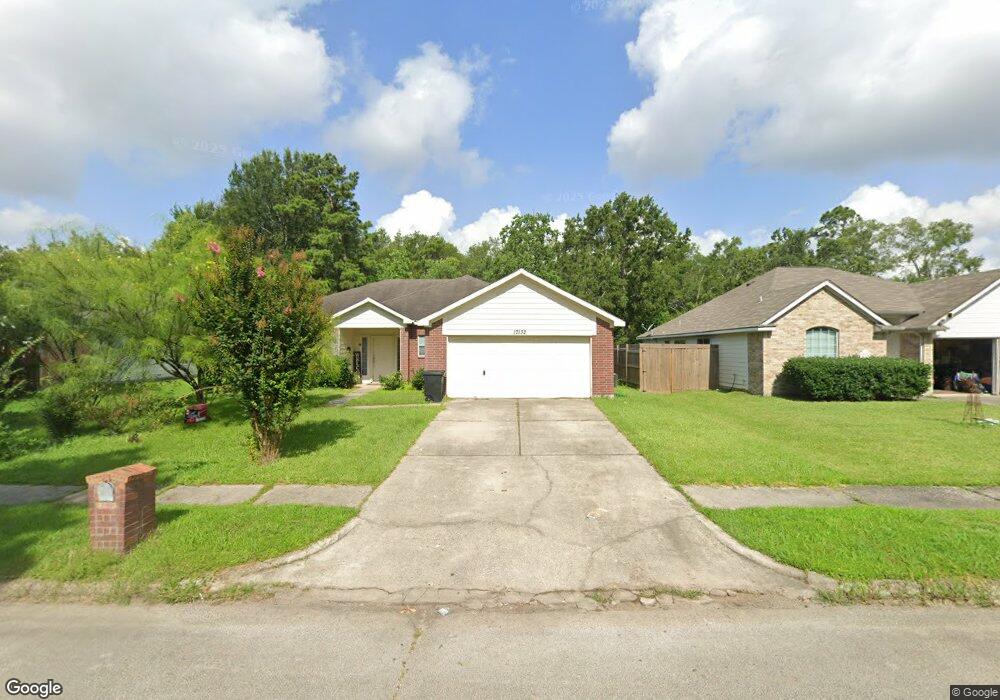
17132 Gleneagle Dr S Conroe, TX 77385
Estimated Value: $260,806 - $287,000
4
Beds
2
Baths
1,755
Sq Ft
$156/Sq Ft
Est. Value
About This Home
This home is located at 17132 Gleneagle Dr S, Conroe, TX 77385 and is currently estimated at $273,452, approximately $155 per square foot. 17132 Gleneagle Dr S is a home located in Montgomery County with nearby schools including Suchma Elementary School, Irons J High School, and Oak Ridge High School.
Ownership History
Date
Name
Owned For
Owner Type
Purchase Details
Closed on
Mar 8, 2005
Sold by
Kendall Homes Corp
Bought by
Alvarado Wilfredo
Current Estimated Value
Home Financials for this Owner
Home Financials are based on the most recent Mortgage that was taken out on this home.
Original Mortgage
$120,641
Outstanding Balance
$71,463
Interest Rate
8.25%
Mortgage Type
Purchase Money Mortgage
Estimated Equity
$201,989
Purchase Details
Closed on
May 25, 2004
Sold by
Wu Roslyn Wang
Bought by
Alvarado Karen
Purchase Details
Closed on
Sep 26, 1991
Sold by
Commonwealth Savings
Bought by
Alvarado Karen
Create a Home Valuation Report for This Property
The Home Valuation Report is an in-depth analysis detailing your home's value as well as a comparison with similar homes in the area
Home Values in the Area
Average Home Value in this Area
Purchase History
| Date | Buyer | Sale Price | Title Company |
|---|---|---|---|
| Alvarado Wilfredo | -- | Chicago Title Insurance Co | |
| Alvarado Karen | -- | -- | |
| Alvarado Karen | -- | -- |
Source: Public Records
Mortgage History
| Date | Status | Borrower | Loan Amount |
|---|---|---|---|
| Open | Alvarado Wilfredo | $120,641 |
Source: Public Records
Tax History Compared to Growth
Tax History
| Year | Tax Paid | Tax Assessment Tax Assessment Total Assessment is a certain percentage of the fair market value that is determined by local assessors to be the total taxable value of land and additions on the property. | Land | Improvement |
|---|---|---|---|---|
| 2025 | $3,346 | $236,336 | -- | -- |
| 2024 | $3,741 | $214,851 | $32,480 | $182,371 |
| 2023 | $3,741 | $234,890 | $32,480 | $222,250 |
| 2022 | $4,381 | $213,540 | $32,480 | $207,680 |
| 2021 | $5,064 | $194,130 | $32,480 | $166,830 |
| 2020 | $4,868 | $176,480 | $32,480 | $149,570 |
| 2019 | $4,628 | $160,440 | $13,920 | $165,570 |
| 2018 | $3,474 | $145,850 | $13,920 | $139,530 |
| 2017 | $3,896 | $132,590 | $13,920 | $148,980 |
| 2016 | $3,542 | $120,540 | $13,920 | $127,700 |
| 2015 | $2,778 | $109,580 | $13,920 | $118,240 |
| 2014 | $2,778 | $99,620 | $13,920 | $85,700 |
Source: Public Records
Map
Nearby Homes
- 17129 Sprawling Oaks Dr
- 9863 Swan Ct
- 10255 S Goshawk Trail
- 17128 Spindle Oaks Dr
- 10325 S Goshawk Trail
- 10329 S Goshawk Trail
- 17105 Upland Bent Ct
- 17058 Gleneagle Dr S
- 9253 Inland Leather Ln
- 9291 Inland Leather Ln
- TBC/ Spindle Oaks
- 9715 Migrant Hawker Ct
- 10202 S Goshawk Trail
- 9727 Migrant Hawker Ct
- 9955 Preserve Way
- 8231 Horsetail Ct
- 10029 Red Beadtree Place
- 6342 Big Oaks Dr
- 17015 Ash Leaf Way
- 17254 Rookery Ct
- 17136 Gleneagle Dr S
- 17128 Gleneagle Dr S
- 17124 Gleneagle Dr S
- 17135 Gleneagle Dr S
- 17144 Gleneagle Dr S
- 17116 Gleneagle Dr S
- 17148 Gleneagle Dr S
- 9906 Robin Ct
- 17139 Gleneagle Dr S
- 9901 Robin Ct
- 0 Sprawling Oaks Drives
- 000 Glen Oaks Dr
- 17152 Gleneagle Dr S
- 9910 Robin Ct
- 32311 Golden Oaks Dr
- 17143 Gleneagle Dr S
- 6374 Shady Oaks Dr
- 9905 Robin Ct
- 9909 Robin Ct
- 17147 Gleneagle Dr S