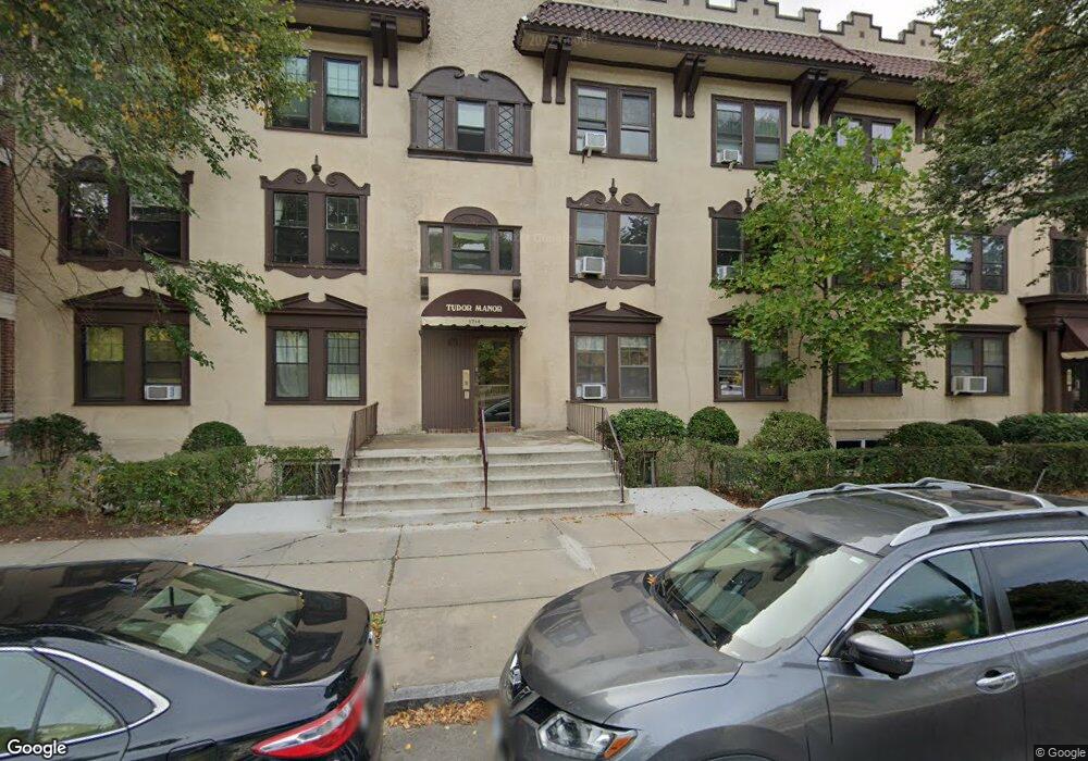
1714 Commonwealth Ave Unit 5 Brighton, MA 02135
Commonwealth NeighborhoodEstimated Value: $452,000 - $512,000
2
Beds
1
Bath
763
Sq Ft
$626/Sq Ft
Est. Value
About This Home
This home is located at 1714 Commonwealth Ave Unit 5, Brighton, MA 02135 and is currently estimated at $478,006, approximately $626 per square foot. 1714 Commonwealth Ave Unit 5 is a home located in Suffolk County with nearby schools including Shaloh House Jewish Day School, St Columbkille Partnership School, and Bais Yaakov Of Boston High School.
Ownership History
Date
Name
Owned For
Owner Type
Purchase Details
Closed on
Jun 8, 1998
Sold by
Lite Rt
Bought by
Bregman Laura F and Bregman Lorraine
Current Estimated Value
Create a Home Valuation Report for This Property
The Home Valuation Report is an in-depth analysis detailing your home's value as well as a comparison with similar homes in the area
Home Values in the Area
Average Home Value in this Area
Purchase History
| Date | Buyer | Sale Price | Title Company |
|---|---|---|---|
| Bregman Laura F | $99,000 | -- |
Source: Public Records
Mortgage History
| Date | Status | Borrower | Loan Amount |
|---|---|---|---|
| Open | Bregman Laura F | $143,000 | |
| Closed | Bregman Laura F | $140,000 | |
| Closed | Bregman Laura F | $170,000 |
Source: Public Records
Tax History Compared to Growth
Tax History
| Year | Tax Paid | Tax Assessment Tax Assessment Total Assessment is a certain percentage of the fair market value that is determined by local assessors to be the total taxable value of land and additions on the property. | Land | Improvement |
|---|---|---|---|---|
| 2025 | $4,888 | $422,100 | $0 | $422,100 |
| 2024 | $4,216 | $386,800 | $0 | $386,800 |
| 2023 | $4,154 | $386,800 | $0 | $386,800 |
| 2022 | $3,970 | $364,900 | $0 | $364,900 |
| 2021 | $3,893 | $364,900 | $0 | $364,900 |
| 2020 | $3,617 | $342,500 | $0 | $342,500 |
| 2019 | $3,539 | $335,800 | $0 | $335,800 |
| 2018 | $3,290 | $313,900 | $0 | $313,900 |
| 2017 | $3,079 | $290,700 | $0 | $290,700 |
| 2016 | $2,934 | $266,700 | $0 | $266,700 |
| 2015 | $2,996 | $247,400 | $0 | $247,400 |
| 2014 | $2,829 | $224,900 | $0 | $224,900 |
Source: Public Records
Map
Nearby Homes
- 1710 Commonwealth Ave Unit 3
- 1691 Commonwealth Ave Unit 31
- 8 Kinross Rd Unit 2
- 140 Kilsyth Rd Unit 8
- 24 Selkirk Rd Unit 24-4
- 15 Colliston Rd Unit 6
- 1669 Commonwealth Ave Unit 3
- 57 Nottinghill Rd
- 36 Cummings Rd Unit 1
- 1666 Commonwealth Ave Unit 24
- 38 Ransom Rd Unit 12
- 36 Colborne Rd
- 56-58 Selkirk Rd
- 65 Strathmore Rd Unit 49
- 1650 Commonwealth Ave Unit 304
- 1641 Commonwealth Ave Unit 20
- 47 Englewood Ave
- 37 Englewood Ave Unit 3
- 97 Strathmore Rd Unit 4
- 1789 Commonwealth Ave
- 1714 Commonwealth Ave Unit 8
- 1714 Commonwealth Ave Unit 7
- 1714 Commonwealth Ave Unit 6
- 1714 Commonwealth Ave Unit 4
- 1714 Commonwealth Ave Unit 3
- 1714 Commonwealth Ave Unit 2
- 1714 Commonwealth Ave Unit 1
- 1714 Commonwealth Ave Unit 17
- 1714 Commonwealth Ave Unit 18
- 1714 Commonwealth Ave
- 1714 Commonwealth Ave Unit Parking
- 1718 Commonwealth Ave Unit 8
- 1718 Commonwealth Ave Unit 7
- 1718 Commonwealth Ave Unit 6
- 1718 Commonwealth Ave Unit 5
- 1718 Commonwealth Ave Unit 4
- 1718 Commonwealth Ave Unit 3
- 1718 Commonwealth Ave Unit 2
- 1718 Commonwealth Ave Unit 1
- 1718 Commonwealth Ave