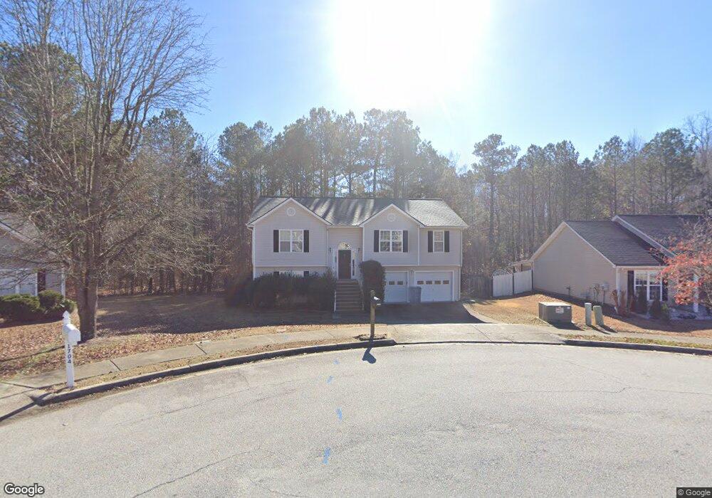
1714 Fort Shawnee Trace Unit 6 Dacula, GA 30019
Estimated Value: $395,000 - $411,000
4
Beds
2
Baths
1,509
Sq Ft
$265/Sq Ft
Est. Value
About This Home
This home is located at 1714 Fort Shawnee Trace Unit 6, Dacula, GA 30019 and is currently estimated at $400,219, approximately $265 per square foot. 1714 Fort Shawnee Trace Unit 6 is a home located in Gwinnett County with nearby schools including Fort Daniel Elementary School, Frank N. Osborne Middle School, and Mill Creek High School.
Ownership History
Date
Name
Owned For
Owner Type
Purchase Details
Closed on
Jun 29, 2006
Sold by
Abreu Miriam
Bought by
Schultz John
Current Estimated Value
Home Financials for this Owner
Home Financials are based on the most recent Mortgage that was taken out on this home.
Original Mortgage
$178,500
Outstanding Balance
$108,322
Interest Rate
7.25%
Mortgage Type
New Conventional
Estimated Equity
$291,897
Purchase Details
Closed on
Nov 29, 2001
Sold by
Crown Park Hms/Appalachee Llc
Bought by
Abreu Miriam
Home Financials for this Owner
Home Financials are based on the most recent Mortgage that was taken out on this home.
Original Mortgage
$129,600
Interest Rate
6.5%
Mortgage Type
FHA
Create a Home Valuation Report for This Property
The Home Valuation Report is an in-depth analysis detailing your home's value as well as a comparison with similar homes in the area
Home Values in the Area
Average Home Value in this Area
Purchase History
| Date | Buyer | Sale Price | Title Company |
|---|---|---|---|
| Schultz John | $178,500 | -- | |
| Abreu Miriam | $135,900 | -- |
Source: Public Records
Mortgage History
| Date | Status | Borrower | Loan Amount |
|---|---|---|---|
| Open | Schultz John | $178,500 | |
| Previous Owner | Abreu Miriam | $129,600 |
Source: Public Records
Tax History Compared to Growth
Tax History
| Year | Tax Paid | Tax Assessment Tax Assessment Total Assessment is a certain percentage of the fair market value that is determined by local assessors to be the total taxable value of land and additions on the property. | Land | Improvement |
|---|---|---|---|---|
| 2025 | $4,354 | $165,800 | $36,080 | $129,720 |
| 2024 | $4,272 | $155,280 | $29,600 | $125,680 |
| 2023 | $4,272 | $148,480 | $29,600 | $118,880 |
| 2022 | $0 | $134,160 | $24,800 | $109,360 |
| 2021 | $3,218 | $103,560 | $18,640 | $84,920 |
| 2020 | $2,920 | $88,680 | $17,120 | $71,560 |
| 2019 | $2,843 | $88,680 | $17,120 | $71,560 |
| 2018 | $2,669 | $80,640 | $15,600 | $65,040 |
| 2016 | $2,480 | $70,920 | $12,400 | $58,520 |
| 2015 | $2,343 | $63,560 | $10,400 | $53,160 |
| 2014 | -- | $56,880 | $10,400 | $46,480 |
Source: Public Records
Map
Nearby Homes
- 1720 Fort Daniels Trail
- 1655 Brisbane Dr
- 2425 Fort Daniels Dr Unit 3A
- 2416 Moultrie Ct
- 1603 Fort Perry Way
- 1573 Vinings Ct
- 1717 Willoughby Dr
- 2431 Lance Ridge Way
- 2032 Shin Ct NE
- 2439 Canter Brook Ct Unit 1
- 1867 Willoughby Dr
- 1827 Scouts Walk
- 2706 Captain Ct
- 2346 Hampton Park Dr Unit I
- 2305 Braselton Hwy
- 1965 Holland Park Dr NE
- 2021 Braselton Hwy
- 2628 Adair Trail
- 2765 Daniel Park Run Unit 3
- 1704 Fort Shawnee Trace NE
- 1724 Fort Shawnee Trace Unit 6
- 1704 Fort Shawnee Trace
- 1734 Fort Shawnee Trace
- 1701 Fort Shawnee Trace
- 1707 Mountain Fort Way Unit 6
- 1706 Mountain Fort Way
- 1717 Mountain Fort Way Unit 6
- 1716 Mountain Fort Way Unit 1716
- 1716 Mountain Fort Way
- 1710 Fort Daniels Trail
- 1710 Fort Daniels Trail Unit 5
- 1727 Mountain Fort Way
- 1754 Fort Shawnee Trace Unit 6
- 1761 Fort Shawnee Trace
- 1700 Fort Daniels Trail Unit 5
- 1726 Mountain Fort Way Unit 6
- 1764 Fort Shawnee Trace Unit 6
- 1737 Mountain Fort Way
- 1730 Fort Daniels Trail