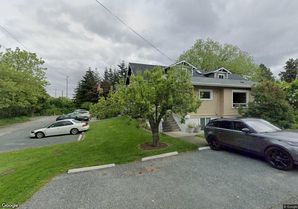
1714 Grant St Bellingham, WA 98225
York NeighborhoodEstimated Value: $996,000 - $1,483,000
6
Beds
6
Baths
4,572
Sq Ft
$260/Sq Ft
Est. Value
About This Home
This home is located at 1714 Grant St, Bellingham, WA 98225 and is currently estimated at $1,189,748, approximately $260 per square foot. 1714 Grant St is a home with nearby schools including Lowell Elementary School, Fairhaven Middle School, and Sehome High School.
Ownership History
Date
Name
Owned For
Owner Type
Purchase Details
Closed on
May 9, 2013
Sold by
Staveland Rob
Bought by
Illman Lance
Current Estimated Value
Purchase Details
Closed on
Dec 28, 2007
Sold by
Illman Lance
Bought by
Aiki Homes Inc
Home Financials for this Owner
Home Financials are based on the most recent Mortgage that was taken out on this home.
Original Mortgage
$94,250
Interest Rate
6.21%
Mortgage Type
Purchase Money Mortgage
Create a Home Valuation Report for This Property
The Home Valuation Report is an in-depth analysis detailing your home's value as well as a comparison with similar homes in the area
Home Values in the Area
Average Home Value in this Area
Purchase History
| Date | Buyer | Sale Price | Title Company |
|---|---|---|---|
| Illman Lance | -- | None Available | |
| Staveland Rob | -- | None Available | |
| Aiki Homes Inc | -- | Chicago Title Insurance |
Source: Public Records
Mortgage History
| Date | Status | Borrower | Loan Amount |
|---|---|---|---|
| Previous Owner | Aiki Homes Inc | $94,250 |
Source: Public Records
Tax History Compared to Growth
Tax History
| Year | Tax Paid | Tax Assessment Tax Assessment Total Assessment is a certain percentage of the fair market value that is determined by local assessors to be the total taxable value of land and additions on the property. | Land | Improvement |
|---|---|---|---|---|
| 2024 | $9,936 | $1,245,719 | $261,698 | $984,021 |
| 2023 | $9,936 | $1,277,360 | $268,345 | $1,009,015 |
| 2022 | $8,118 | $1,101,192 | $231,336 | $869,856 |
| 2021 | $7,964 | $873,962 | $183,600 | $690,362 |
| 2020 | $7,183 | $809,224 | $170,000 | $639,224 |
| 2019 | $6,430 | $705,435 | $149,733 | $555,702 |
| 2018 | $6,475 | $633,191 | $134,433 | $498,758 |
| 2017 | $5,593 | $545,161 | $115,740 | $429,421 |
| 2016 | $4,890 | $492,081 | $103,860 | $388,221 |
| 2015 | $4,795 | $447,910 | $94,860 | $353,050 |
| 2014 | -- | $424,962 | $90,000 | $334,962 |
| 2013 | -- | $78,750 | $78,750 | $0 |
Source: Public Records
Map
Nearby Homes
- 1724 Iron St
- 5 XX Gladstone St
- 1470 James St
- 910 Gladstone St Unit 205
- 2111 Franklin St
- 2019 Cornwall Ave
- 1309 Billy Frank Jr St
- 1234 Grant St
- 1126 N Forest St
- 1356 Orleans St
- 1031 N State St Unit 107
- 1031 N State St Unit 209
- 2432 Grant St
- 1025 Granary Ave Unit 503
- 1025 Granary Ave Unit 404
- 1025 Granary Ave Unit 306
- 1025 Granary Ave Unit 506
- 1025 Granary Ave Unit 501-A
- 1025 Granary Ave Unit 307-B
- 1025 Granary Ave Unit 408
- 1710 Grant St
- 1706 Grant St
- 1702 Grant St
- 1711 Humboldt St
- 1717 Humboldt St
- 1707 Humboldt St
- 1725 Humboldt St
- 1701 Humboldt St
- 1636 Grant St
- 1632 Grant St
- 1639 Humboldt St
- 1630 Grant St
- 1633 Humboldt St
- 1712 Humboldt St
- 1718 Humboldt St
- 1708 Humboldt St
- 1704 Humboldt St
- 1720 Humboldt St
- 0 Humboldt St
- 1626 Grant St