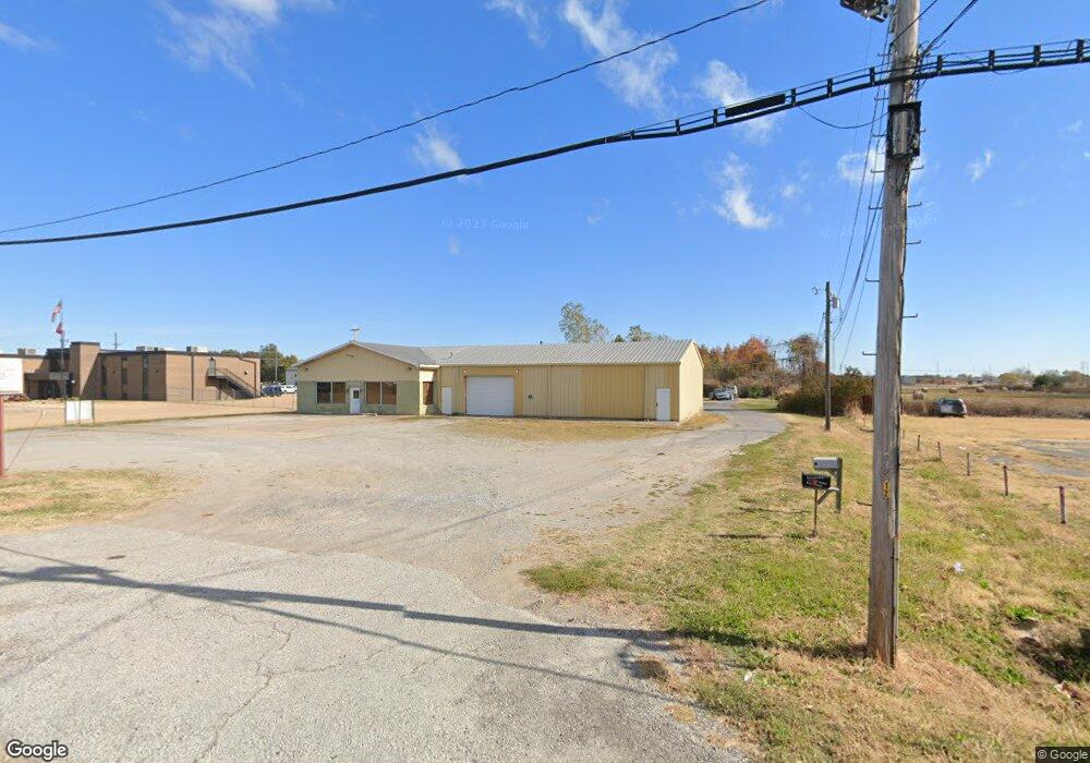
1714 S Division St Blytheville, AR 72315
--
Bed
--
Bath
7,840
Sq Ft
1.25
Acres
About This Home
This home is located at 1714 S Division St, Blytheville, AR 72315. 1714 S Division St is a home located in Mississippi County with nearby schools including Blytheville Primary School, Blytheville Elementary School, and Blytheville Middle School.
Ownership History
Date
Name
Owned For
Owner Type
Purchase Details
Closed on
Jan 2, 2015
Sold by
Meador Gary and Meador Judi
Bought by
Meador Gary and Meador Judi
Purchase Details
Closed on
Jan 1, 2015
Sold by
Meador Gary and Meador Judi
Bought by
Meador Gary and Meador Judi
Purchase Details
Closed on
Jan 2, 2000
Sold by
Meador Truman A and Meador Freda
Bought by
Meador Gary and Meador Judi
Purchase Details
Closed on
Jan 1, 2000
Sold by
Meador Truman A and Meador Freda
Bought by
Meador Gary and Meador Judi
Purchase Details
Closed on
Jan 2, 1997
Sold by
Meador Auto Sales
Bought by
Meador Truman A and Meador Freda
Purchase Details
Closed on
Jan 1, 1997
Sold by
Meador Auto Sales
Bought by
Meador Truman A and Meador Freda
Purchase Details
Closed on
Jan 2, 1981
Bought by
Meador Auto Sales
Purchase Details
Closed on
Jan 1, 1981
Bought by
Meador Auto Sales
Create a Home Valuation Report for This Property
The Home Valuation Report is an in-depth analysis detailing your home's value as well as a comparison with similar homes in the area
Home Values in the Area
Average Home Value in this Area
Purchase History
| Date | Buyer | Sale Price | Title Company |
|---|---|---|---|
| Meador Gary | -- | -- | |
| Meador Gary | -- | -- | |
| Meador Gary | -- | -- | |
| Meador Gary | -- | -- | |
| Meador Truman A | -- | -- | |
| Meador Truman A | -- | -- | |
| Meador Auto Sales | -- | -- | |
| Meador Auto Sales | -- | -- |
Source: Public Records
Tax History Compared to Growth
Tax History
| Year | Tax Paid | Tax Assessment Tax Assessment Total Assessment is a certain percentage of the fair market value that is determined by local assessors to be the total taxable value of land and additions on the property. | Land | Improvement |
|---|---|---|---|---|
| 2025 | $2,036 | $37,570 | $7,260 | $30,310 |
| 2024 | $1,580 | $37,570 | $7,260 | $30,310 |
| 2023 | $1,580 | $37,570 | $7,260 | $30,310 |
| 2022 | $1,448 | $37,570 | $7,260 | $30,310 |
| 2021 | $1,639 | $27,955 | $7,260 | $20,695 |
| 2020 | -- | $27,955 | $7,260 | $20,695 |
| 2019 | -- | -- | $7,260 | $20,695 |
| 2018 | -- | -- | $7,260 | $20,695 |
| 2017 | -- | -- | $7,260 | $27,764 |
| 2015 | -- | -- | $7,260 | $27,764 |
| 2013 | -- | -- | $7,260 | $27,764 |
Source: Public Records
Map
Nearby Homes
- 1252 S 10th St
- 1603 Basin St
- 707 Henderson St
- 1810 Stuart St
- 1810 Stewart St
- .62 acre S 16th St
- 3315 S Division St
- 916 S 21st St
- 1610 Harmon St
- TBD S Highway 61
- 1005 S Franklin St
- 00 Trent Rd
- 413 S 21st St
- 2411 Carolyn St
- 1005 S Lilly St
- 411 S Lilly St
- 1704 W Main St
- 1702 S Ruddle Rd
- 0 W Walnut St
- 1512 W Walnut St
- 3333 S Division St
- 1598 S Division St
- 1703 S Division St
- 1304 N Lee Cir
- 1306 N Lee Cir
- 1596 N Us Highway 61
- 1201 N Lee Cir
- 1308 N Lee Cir
- 1305 N Lee Cir
- 1309 N Lee Cir
- 1312 N Lee Cir
- 1311 N Lee Cir
- 1314 N Lee Cir
- 1313 N Lee Cir
- 1200 S Lee Cir
- 1204 S Lee Cir
- 1316 N Lee Cir
- 1315 N Lee Cir
- 1208 S Lee Cir
- 1317 N Lee Cir