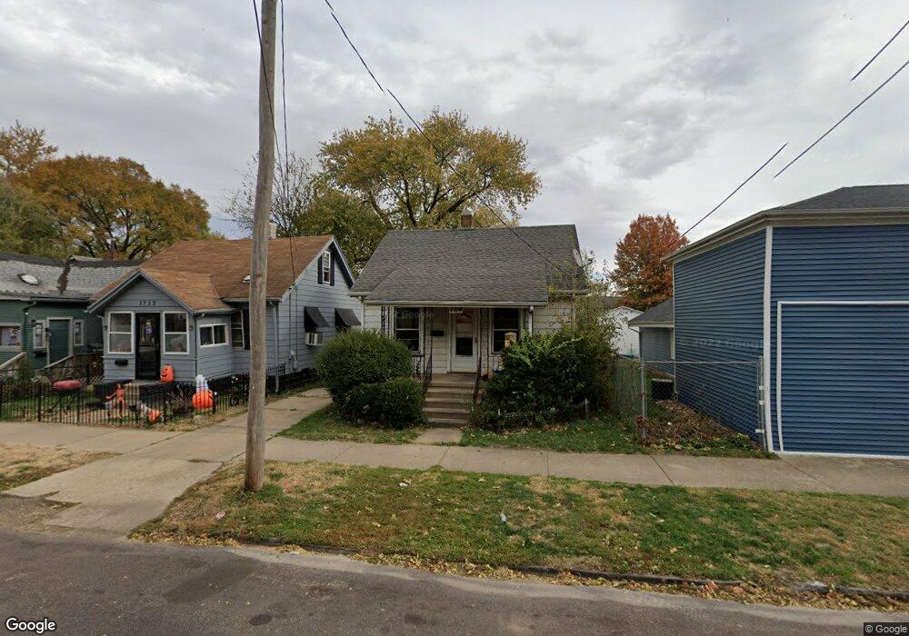
1714 S Stanley St Peoria, IL 61605
Estimated Value: $24,000 - $98,996
1
Bed
1
Bath
550
Sq Ft
$98/Sq Ft
Est. Value
About This Home
This home is located at 1714 S Stanley St, Peoria, IL 61605 and is currently estimated at $53,749, approximately $97 per square foot. 1714 S Stanley St is a home with nearby schools including Annie Jo Gordon Community Learning Center, Manual High School, and Christ Lutheran School.
Ownership History
Date
Name
Owned For
Owner Type
Purchase Details
Closed on
Mar 19, 2024
Sold by
Bayle Hubert
Bought by
Chicago Title Land Trust
Current Estimated Value
Purchase Details
Closed on
Mar 7, 2022
Sold by
Jones Ellisia L
Bought by
Bayle Hubert
Purchase Details
Closed on
Aug 29, 2018
Sold by
Craven Cary A and Craven Marsha L
Bought by
Jones Ellisia L
Purchase Details
Closed on
Jul 26, 2004
Bought by
Craven Cary A and Craven Marsha L
Create a Home Valuation Report for This Property
The Home Valuation Report is an in-depth analysis detailing your home's value as well as a comparison with similar homes in the area
Home Values in the Area
Average Home Value in this Area
Purchase History
| Date | Buyer | Sale Price | Title Company |
|---|---|---|---|
| Chicago Title Land Trust | -- | Chicago Title | |
| Bayle Hubert | $17,000 | None Listed On Document | |
| Jones Ellisia L | $11,500 | None Listed On Document | |
| Craven Cary A | $13,000 | -- |
Source: Public Records
Tax History Compared to Growth
Tax History
| Year | Tax Paid | Tax Assessment Tax Assessment Total Assessment is a certain percentage of the fair market value that is determined by local assessors to be the total taxable value of land and additions on the property. | Land | Improvement |
|---|---|---|---|---|
| 2024 | $477 | $5,270 | $770 | $4,500 |
| 2023 | $455 | $4,840 | $710 | $4,130 |
| 2022 | $380 | $3,940 | $640 | $3,300 |
| 2021 | $373 | $3,750 | $610 | $3,140 |
| 2020 | $372 | $3,710 | $600 | $3,110 |
| 2019 | $377 | $3,780 | $610 | $3,170 |
| 2018 | $397 | $4,080 | $660 | $3,420 |
| 2017 | $397 | $4,120 | $670 | $3,450 |
| 2016 | $386 | $4,120 | $670 | $3,450 |
| 2015 | $403 | $4,040 | $660 | $3,380 |
| 2014 | $404 | $4,380 | $660 | $3,720 |
| 2013 | -- | $4,440 | $670 | $3,770 |
Source: Public Records
Map
Nearby Homes
- 1831 S Westmoreland Ave
- 2600 W Fremont St
- 1929 S Stanley St
- 2506 W Humboldt St
- 2701 W Hayes St
- 2505 W Humboldt St
- 1421 S Livingston St
- 2714 W Fremont St
- 1526 S Lydia Ave
- 2723 W Hayes St
- 1619 S Easton Ave
- 2304 W Malone St
- 2819 W Seibold St
- 1410 S Easton Ave
- 1509 S Western Ave
- 1533 S Idaho St
- 2310 W Garden St
- 1831 S Kneer Ave
- 2010 W Garden St
- 2329 W Marquette St
- 2339 W Grinnell St
- 1712 S Stanley St
- 1710 S Stanley St
- 1708 S Stanley St
- 1713 S Stanley St
- 1709 S Stanley St
- 1707 S Stanley St
- 1715 S Arago St
- 1719 S Arago St
- 1702 S Stanley St
- 1709 S Arago St
- 1705 S Stanley St
- 2407 W Grinnell St
- 1713 S Arago St
- 1700 S Stanley St
- 1801 S Stanley St
- 1707 S Arago St
- 1804 S Stanley St
- 1805 S Stanley St
- 1703 S Arago St