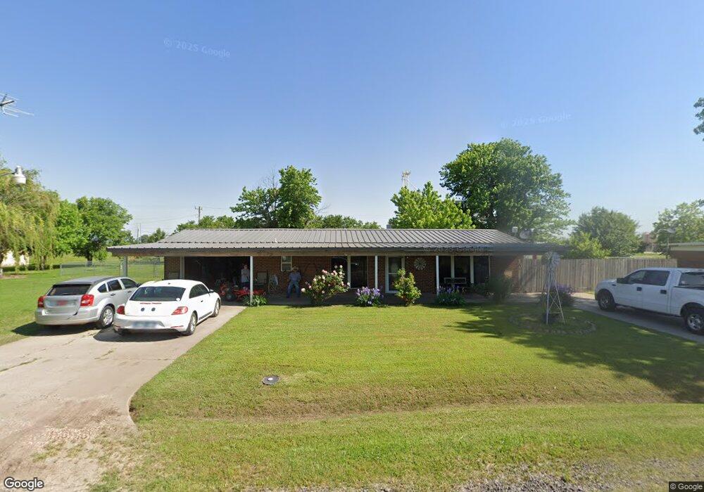
17143 Darren Ave El Reno, OK 73036
Estimated Value: $120,000 - $167,000
2
Beds
2
Baths
1,188
Sq Ft
$126/Sq Ft
Est. Value
About This Home
This home is located at 17143 Darren Ave, El Reno, OK 73036 and is currently estimated at $149,455, approximately $125 per square foot. 17143 Darren Ave is a home located in Canadian County with nearby schools including Banner School.
Ownership History
Date
Name
Owned For
Owner Type
Purchase Details
Closed on
Apr 10, 2003
Sold by
Bennett Nicky L
Bought by
Cureton James S and Cureton Nicky L
Current Estimated Value
Home Financials for this Owner
Home Financials are based on the most recent Mortgage that was taken out on this home.
Original Mortgage
$8,243
Outstanding Balance
$3,513
Interest Rate
5.64%
Estimated Equity
$145,942
Purchase Details
Closed on
May 24, 1996
Sold by
Brown Ames E and Brown Helen M
Purchase Details
Closed on
Jan 17, 1996
Sold by
Lair,Sylvan G Trustee
Create a Home Valuation Report for This Property
The Home Valuation Report is an in-depth analysis detailing your home's value as well as a comparison with similar homes in the area
Home Values in the Area
Average Home Value in this Area
Purchase History
| Date | Buyer | Sale Price | Title Company |
|---|---|---|---|
| Cureton James S | -- | -- | |
| -- | $47,000 | -- | |
| -- | $46,900 | -- | |
| -- | -- | -- |
Source: Public Records
Mortgage History
| Date | Status | Borrower | Loan Amount |
|---|---|---|---|
| Open | Cureton James S | $8,243 |
Source: Public Records
Tax History Compared to Growth
Tax History
| Year | Tax Paid | Tax Assessment Tax Assessment Total Assessment is a certain percentage of the fair market value that is determined by local assessors to be the total taxable value of land and additions on the property. | Land | Improvement |
|---|---|---|---|---|
| 2024 | $612 | $9,023 | $331 | $8,692 |
| 2023 | $612 | $9,022 | $390 | $8,632 |
| 2022 | $617 | $9,022 | $452 | $8,570 |
| 2021 | $621 | $9,023 | $497 | $8,526 |
| 2020 | $613 | $9,022 | $600 | $8,422 |
| 2019 | $596 | $8,760 | $600 | $8,160 |
| 2018 | $585 | $8,505 | $600 | $7,905 |
| 2017 | $570 | $8,257 | $600 | $7,657 |
| 2016 | $541 | $8,257 | $600 | $7,657 |
| 2015 | $484 | $7,783 | $600 | $7,183 |
| 2014 | $484 | $7,556 | $600 | $6,956 |
Source: Public Records
Map
Nearby Homes
- 11020 N Banner Rd
- 3501 Manning Farms Blvd
- 4160 N Gregory Rd
- 4115 S Manning Rd
- 8592 Beth Ln
- 8652 Beth Ln
- 8384 Rip Way
- 8664 Rip Way
- 8634 Rip Way
- 8454 Rip Way
- 3550 N Manning Rd
- 8604 Rip Way
- 8574 Rip Way
- 7145 S Manning Rd
- 8626 Kayce St
- 8545 Kayce St
- 8625 Kayce St
- 8655 Kayce St
- 8595 Kayce St
- 4747 Dutton Cir
- 17164 Darren Ave
- 17127 Darren Ave
- 17183 Darren Ave
- 17103 Darren Ave
- 17088 Darren Ave
- 17067 Darren Ave
- 17208 Darren Ave
- 17064 Darren Ave
- 9225 Us Highway 66 E
- 17211 Darren Ave
- 17048 White St
- 17043 Darren Ave
- 17032 Darren Ave
- 17021 Darren Ave
- 17051 White St
- 4065 N Banner Rd
- 3905 N Banner Rd
- 3905 N Banner Rd
- 3855 N Banner Rd
- 4115 N Banner Rd