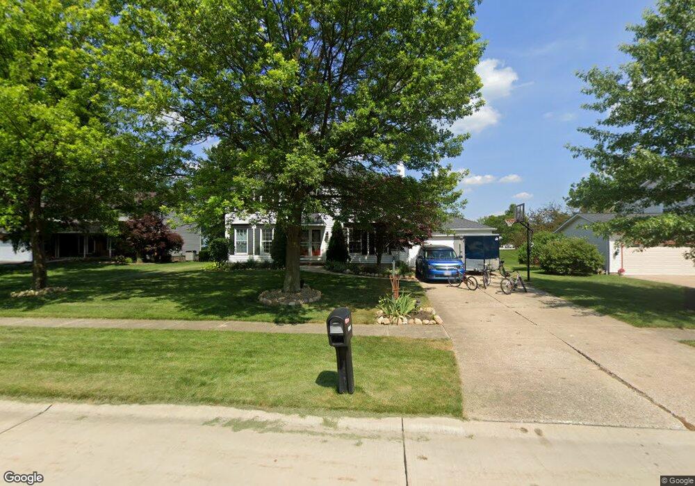
17149 S Red Rock Dr Strongsville, OH 44136
Estimated Value: $373,330 - $404,000
4
Beds
3
Baths
2,436
Sq Ft
$160/Sq Ft
Est. Value
About This Home
This home is located at 17149 S Red Rock Dr, Strongsville, OH 44136 and is currently estimated at $390,833, approximately $160 per square foot. 17149 S Red Rock Dr is a home located in Cuyahoga County with nearby schools including Strongsville High School.
Ownership History
Date
Name
Owned For
Owner Type
Purchase Details
Closed on
Jul 17, 2009
Sold by
Jenkins Ruth A and Jakubcin Ruth A
Bought by
Kolar Denis and Kolar Milica Alagic
Current Estimated Value
Home Financials for this Owner
Home Financials are based on the most recent Mortgage that was taken out on this home.
Original Mortgage
$170,000
Outstanding Balance
$111,009
Interest Rate
5.32%
Mortgage Type
Purchase Money Mortgage
Estimated Equity
$279,824
Purchase Details
Closed on
Feb 6, 1990
Sold by
Jakubcin Robert S
Bought by
Jenkins Ruth A
Purchase Details
Closed on
Mar 3, 1989
Sold by
Cedroni Ernest
Bought by
Jakubcin Robert S
Purchase Details
Closed on
May 7, 1982
Sold by
Merrill Lynch Relocation
Bought by
Cedroni Ernest
Purchase Details
Closed on
Nov 23, 1979
Bought by
Butcher Alan D
Purchase Details
Closed on
Jan 1, 1977
Bought by
Colony Bldrs Inc
Create a Home Valuation Report for This Property
The Home Valuation Report is an in-depth analysis detailing your home's value as well as a comparison with similar homes in the area
Home Values in the Area
Average Home Value in this Area
Purchase History
| Date | Buyer | Sale Price | Title Company |
|---|---|---|---|
| Kolar Denis | $190,000 | -- | |
| Jenkins Ruth A | -- | -- | |
| Jakubcin Robert S | $145,000 | -- | |
| Cedroni Ernest | $89,000 | -- | |
| Merrill Lynch Relocation | -- | -- | |
| Butcher Alan D | $95,000 | -- | |
| Colony Bldrs Inc | -- | -- |
Source: Public Records
Mortgage History
| Date | Status | Borrower | Loan Amount |
|---|---|---|---|
| Open | Kolar Denis | $170,000 |
Source: Public Records
Tax History Compared to Growth
Tax History
| Year | Tax Paid | Tax Assessment Tax Assessment Total Assessment is a certain percentage of the fair market value that is determined by local assessors to be the total taxable value of land and additions on the property. | Land | Improvement |
|---|---|---|---|---|
| 2024 | $4,914 | $104,650 | $22,435 | $82,215 |
| 2023 | $5,464 | $87,260 | $22,750 | $64,510 |
| 2022 | $5,424 | $87,260 | $22,750 | $64,510 |
| 2021 | $5,381 | $87,260 | $22,750 | $64,510 |
| 2020 | $4,988 | $71,540 | $18,660 | $52,890 |
| 2019 | $4,841 | $204,400 | $53,300 | $151,100 |
| 2018 | $4,298 | $71,540 | $18,660 | $52,890 |
| 2017 | $4,312 | $65,000 | $14,770 | $50,230 |
| 2016 | $4,277 | $64,510 | $14,770 | $49,740 |
| 2015 | $4,305 | $64,510 | $14,770 | $49,740 |
| 2014 | $4,305 | $64,510 | $14,770 | $49,740 |
Source: Public Records
Map
Nearby Homes
- 16486 S Red Rock Dr
- 17130 Golden Star Dr
- 18229 Howe Rd
- 17159 Turkey Meadow Ln
- 16650 Lanier Ave
- 17682 Drake Rd
- 16711 Beech Cir
- 16450 Howe Rd
- 17024 Bear Creek Ln
- 18294 Drake Rd
- 14985 Camden Cir
- 17934 Cambridge Oval
- 18987 Laurell Cir
- 18411 Yorktown Oval
- 19694 Benbow Rd
- 15604-REAR Boston Rd
- 3550 Boston Rd
- 19740 Benbow Rd
- 14132 Walking Stick Way
- 15188 Trails Landing
- 17153 S Red Rock Dr
- 17145 S Red Rock Dr
- 17141 S Red Rock Dr
- 16472 S Red Rock Dr
- 17150 S Red Rock Dr
- 17146 S Red Rock Dr
- 17139 S Red Rock Dr
- 16235 Drake Rd
- 17138 S Red Rock Dr
- 17142 S Red Rock Dr
- 16453 S Red Rock Dr
- 17147 Misty Lake Dr
- 16461 S Red Rock Dr
- 17842 Blazing Star Dr
- 17149 Misty Lake Dr
- 17876 Blazing Star Dr
- 17150 Golden Star Dr
- 17145 Misty Lake Dr
- 17808 Blazing Star Dr
- 17151 Misty Lake Dr