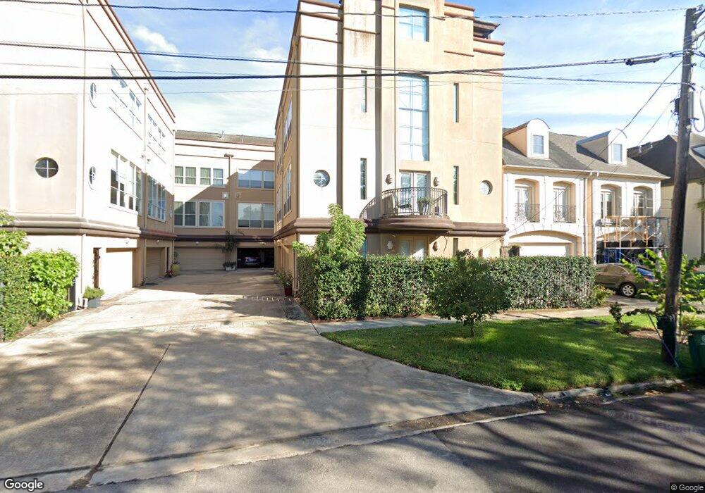
1715 Brun St Houston, TX 77019
Montrose NeighborhoodEstimated Value: $565,141 - $713,000
2
Beds
3
Baths
2,443
Sq Ft
$270/Sq Ft
Est. Value
About This Home
This home is located at 1715 Brun St, Houston, TX 77019 and is currently estimated at $658,785, approximately $269 per square foot. 1715 Brun St is a home located in Harris County with nearby schools including Baker Montessori, Lanier Middle School, and Lamar High School.
Ownership History
Date
Name
Owned For
Owner Type
Purchase Details
Closed on
Jan 8, 2024
Sold by
Mclaughlin Megan Zeece
Bought by
Mclaughlin Evan Nelson
Current Estimated Value
Purchase Details
Closed on
Aug 25, 2014
Sold by
Klaes Chaz and Jeter Tany
Bought by
Mclaughlin Evan N and Mclaughlin Megan Z
Home Financials for this Owner
Home Financials are based on the most recent Mortgage that was taken out on this home.
Original Mortgage
$47,800
Interest Rate
4.15%
Mortgage Type
New Conventional
Purchase Details
Closed on
Aug 11, 2011
Sold by
Chen Todd E and Chen Anyta S
Bought by
Klaes Chaz and Jeter Tany
Purchase Details
Closed on
Sep 19, 2005
Sold by
Chen Tonia Ross
Bought by
Chen Todd Edward
Home Financials for this Owner
Home Financials are based on the most recent Mortgage that was taken out on this home.
Original Mortgage
$37,600
Interest Rate
5.65%
Mortgage Type
Unknown
Purchase Details
Closed on
Dec 9, 2002
Sold by
Cendant Mobility Financial Corp
Bought by
Chen Todd E and Ross Tonia L
Home Financials for this Owner
Home Financials are based on the most recent Mortgage that was taken out on this home.
Original Mortgage
$275,920
Interest Rate
5.12%
Purchase Details
Closed on
Oct 10, 2002
Sold by
Tugendhat Andres and Tugendhat Karin
Bought by
Cendant Mobility Financial Corp
Home Financials for this Owner
Home Financials are based on the most recent Mortgage that was taken out on this home.
Original Mortgage
$275,920
Interest Rate
5.12%
Purchase Details
Closed on
Sep 19, 2002
Sold by
Lundstrom Bruce D and Lundstrom Vonnie L
Bought by
G W Baker Enterprises Inc
Purchase Details
Closed on
Feb 11, 2000
Sold by
Foster Gary L
Bought by
Tietz Roger D and Tietz Sally A
Purchase Details
Closed on
May 29, 1998
Sold by
G W Baker Enterprises Inc
Bought by
Tugendhat Andres
Home Financials for this Owner
Home Financials are based on the most recent Mortgage that was taken out on this home.
Original Mortgage
$210,400
Interest Rate
7.2%
Create a Home Valuation Report for This Property
The Home Valuation Report is an in-depth analysis detailing your home's value as well as a comparison with similar homes in the area
Home Values in the Area
Average Home Value in this Area
Purchase History
| Date | Buyer | Sale Price | Title Company |
|---|---|---|---|
| Mclaughlin Evan Nelson | -- | None Listed On Document | |
| Mclaughlin Evan N | -- | First American Title | |
| Klaes Chaz | -- | Stewart Title | |
| Chen Todd Edward | -- | Stewart Title Company | |
| Chen Todd E | -- | Alamo Title Company | |
| Cendant Mobility Financial Corp | -- | Alamo Title Company | |
| G W Baker Enterprises Inc | -- | Charter Title Company | |
| Tietz Roger D | -- | Stewart Title | |
| Tugendhat Andres | -- | Regency Title |
Source: Public Records
Mortgage History
| Date | Status | Borrower | Loan Amount |
|---|---|---|---|
| Previous Owner | Mclaughlin Evan N | $47,800 | |
| Previous Owner | Mclaughlin Evan N | $382,400 | |
| Previous Owner | Chen Todd Edward | $37,600 | |
| Previous Owner | Chen Todd Edward | $300,800 | |
| Previous Owner | Chen Todd E | $275,920 | |
| Previous Owner | Tugendhat Andres | $210,400 | |
| Closed | Tugendhat Andres | $26,300 | |
| Closed | Chen Todd E | $51,735 |
Source: Public Records
Tax History Compared to Growth
Tax History
| Year | Tax Paid | Tax Assessment Tax Assessment Total Assessment is a certain percentage of the fair market value that is determined by local assessors to be the total taxable value of land and additions on the property. | Land | Improvement |
|---|---|---|---|---|
| 2025 | $8,041 | $567,370 | $201,300 | $366,070 |
| 2024 | $8,041 | $531,356 | $201,300 | $330,056 |
| 2023 | $8,041 | $536,004 | $201,300 | $334,704 |
| 2022 | $10,706 | $486,222 | $201,300 | $284,922 |
| 2021 | $10,732 | $460,450 | $192,150 | $268,300 |
| 2020 | $11,186 | $461,924 | $192,150 | $269,774 |
| 2019 | $11,755 | $464,551 | $123,200 | $341,351 |
| 2018 | $10,002 | $506,467 | $123,200 | $383,267 |
| 2017 | $13,439 | $506,467 | $123,200 | $383,267 |
| 2016 | $13,439 | $506,467 | $123,200 | $383,267 |
| 2015 | $7,711 | $512,009 | $123,200 | $388,809 |
| 2014 | $7,711 | $436,900 | $107,800 | $329,100 |
Source: Public Records
Map
Nearby Homes
- 1712 Mcduffie St
- 1711 Huldy St Unit A
- 1810 Hazard St Unit A
- 1606 Hazard St
- 1909 Brun St Unit 17
- 1909 Brun St Unit 16
- 1601 S Shepherd Dr Unit 20
- 1601 S Shepherd Dr Unit 29
- 1601 S Shepherd Dr Unit 138
- 1509 Mcduffie St
- 1910 Huldy St Unit A
- 1956 Vermont St
- 2105 Del Monte Dr
- 1822 Morse St Unit A
- 2008 Hazard St
- 1510 Morse St
- 2100 Welch St Unit C113
- 2100 Welch St Unit C101
- 2027 Huldy St
- 1606 Woodhead St