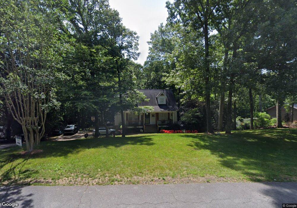
1715 Mountain Trace Canton, GA 30114
Estimated Value: $381,000 - $405,000
3
Beds
2
Baths
1,830
Sq Ft
$214/Sq Ft
Est. Value
About This Home
This home is located at 1715 Mountain Trace, Canton, GA 30114 and is currently estimated at $392,169, approximately $214 per square foot. 1715 Mountain Trace is a home located in Cherokee County with nearby schools including Sixes Elementary School, Freedom Middle School, and Woodstock High School.
Ownership History
Date
Name
Owned For
Owner Type
Purchase Details
Closed on
Dec 31, 2013
Sold by
Mullins Todd
Bought by
Jt Investments Llc
Current Estimated Value
Purchase Details
Closed on
Jan 22, 2002
Sold by
Morris Chester L and Morris Sarah O
Bought by
Mullins Todd and Mullins Amanda
Home Financials for this Owner
Home Financials are based on the most recent Mortgage that was taken out on this home.
Original Mortgage
$128,976
Interest Rate
7.14%
Mortgage Type
FHA
Create a Home Valuation Report for This Property
The Home Valuation Report is an in-depth analysis detailing your home's value as well as a comparison with similar homes in the area
Home Values in the Area
Average Home Value in this Area
Purchase History
We collect this data history from publicly available records. To have your information removed, we recommend requesting removal directly through your county’s website.
| Date | Buyer | Sale Price | Title Company |
|---|---|---|---|
| Jt Investments Llc | -- | -- | |
| Mullins Todd | $131,000 | -- |
Source: Public Records
Mortgage History
We collect this data history from publicly available records. To have your information removed, we recommend requesting removal directly through your county’s website.
| Date | Status | Borrower | Loan Amount |
|---|---|---|---|
| Previous Owner | Mullins Todd | $128,976 |
Source: Public Records
Tax History
| Year | Tax Paid | Tax Assessment Tax Assessment Total Assessment is a certain percentage of the fair market value that is determined by local assessors to be the total taxable value of land and additions on the property. | Land | Improvement |
|---|---|---|---|---|
| 2025 | $3,567 | $158,132 | $28,000 | $130,132 |
| 2024 | $3,309 | $145,172 | $28,000 | $117,172 |
| 2023 | $2,608 | $132,532 | $16,880 | $115,652 |
| 2022 | $2,462 | $103,532 | $16,880 | $86,652 |
| 2021 | $2,405 | $92,252 | $16,880 | $75,372 |
| 2020 | $2,174 | $82,212 | $14,800 | $67,412 |
| 2019 | $2,011 | $75,040 | $14,000 | $61,040 |
| 2018 | $1,803 | $66,800 | $14,000 | $52,800 |
| 2017 | $1,652 | $149,300 | $12,800 | $46,920 |
| 2016 | $1,553 | $139,100 | $12,800 | $42,840 |
| 2015 | $1,526 | $135,500 | $12,800 | $41,400 |
| 2014 | $1,330 | $118,600 | $10,800 | $36,640 |
Source: Public Records
Map
Nearby Homes
- 2550 Mountain Brook Rd
- 1955 Mountain Trace
- 102 Ozark Trail
- 423 Crestmont Ln
- 206 Sawtooth Ct
- 508 Crestmont Ln
- 246 Manous Way
- 121 Brookhaven Ln
- 319 Hillgrove Dr
- 118 Brookhaven Ln
- 225 Manous Way
- 800 E Shore Dr
- 182 Overlook Ridge Way
- 1898 Marble Quarry Rd
- 114 Kimberly Rd
- 741 E Shore Dr
- 180 Wentworth Dr
- 804 Sienna Woods Ln
- 3161 Marble Quarry Rd
- 701 Silver Mist Way
- 1735 Mountain Trace
- 1705 Mountain Trace
- 1710 Mountain Trace
- 1685 Mountain Trace
- 1690 Mountain Trace
- 1755 Mountain Trace
- 1740 Mountain Trace
- 1670 Mountain Trace
- 1665 Mountain Trace
- 1760 Mountain Trace
- 1775 Mountain Trace
- 1775 Mountain Trace Unit 30
- 712 Creekwood Ln
- 714 Creekwood Ln
- 1645 Mountain Trace
- 716 Creekwood Ln
- 1780 Mountain Trace
- 2560 Mountain Brook Rd
- 718 Creekwood Ln
- 1795 Mountain Trace
Your Personal Tour Guide
Ask me questions while you tour the home.