Estimated Value: $431,250 - $512,000
3
Beds
1
Bath
1,320
Sq Ft
$352/Sq Ft
Est. Value
About This Home
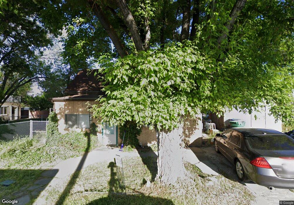
This home is located at 1715 N 900 W, Lehi, UT 84043 and is currently estimated at $465,063, approximately $352 per square foot. 1715 N 900 W is a home located in Utah County with nearby schools including Lehi Elementary School, Lehi Junior High School, and Lehi High School.
Ownership History
Date
Name
Owned For
Owner Type
Purchase Details
Closed on
May 10, 2018
Sold by
L D Family Holdings Llc
Bought by
Jdh State Llc
Current Estimated Value
Purchase Details
Closed on
Sep 16, 2016
Sold by
Smith Bicki
Bought by
L & D Family Holdings Llc
Home Financials for this Owner
Home Financials are based on the most recent Mortgage that was taken out on this home.
Original Mortgage
$152,000
Interest Rate
3.45%
Mortgage Type
Purchase Money Mortgage
Purchase Details
Closed on
Jun 9, 2004
Sold by
Smith Bicki and Smith Bicky
Bought by
Smith Bicki
Purchase Details
Closed on
Apr 9, 2004
Sold by
Yates Robert W and Yates Darcee R
Bought by
Smith Ricky
Create a Home Valuation Report for This Property
The Home Valuation Report is an in-depth analysis detailing your home's value as well as a comparison with similar homes in the area
Home Values in the Area
Average Home Value in this Area
Purchase History
| Date | Buyer | Sale Price | Title Company |
|---|---|---|---|
| Jdh State Llc | -- | Vanguard Title Ins Agneyc Ll | |
| L & D Family Holdings Llc | -- | First American Title | |
| Smith Bicki | -- | Empire Land Title Company | |
| Smith Ricky | -- | Empire Land Title Company | |
| Yates Robert W | -- | Empire Land Title Company |
Source: Public Records
Mortgage History
| Date | Status | Borrower | Loan Amount |
|---|---|---|---|
| Previous Owner | L & D Family Holdings Llc | $152,000 |
Source: Public Records
Tax History Compared to Growth
Tax History
| Year | Tax Paid | Tax Assessment Tax Assessment Total Assessment is a certain percentage of the fair market value that is determined by local assessors to be the total taxable value of land and additions on the property. | Land | Improvement |
|---|---|---|---|---|
| 2025 | $1,548 | $189,640 | $197,500 | $147,300 |
| 2024 | $1,548 | $181,115 | $0 | $0 |
| 2023 | $1,446 | $183,755 | $0 | $0 |
| 2022 | $1,518 | $186,945 | $0 | $0 |
| 2021 | $1,328 | $247,400 | $97,400 | $150,000 |
| 2020 | $1,252 | $230,400 | $90,200 | $140,200 |
| 2019 | $1,127 | $215,600 | $90,200 | $125,400 |
| 2018 | $1,118 | $202,300 | $82,500 | $119,800 |
| 2017 | $988 | $94,985 | $0 | $0 |
| 2016 | $892 | $79,640 | $0 | $0 |
| 2015 | $847 | $71,775 | $0 | $0 |
Source: Public Records
Map
Nearby Homes
- 1011 W Mountain Way Unit 316
- 1610 N 1125 W
- 902 W 1500 N
- 1249 W 1800 N
- 1272 W 1800 N
- 424 W 1700 N
- 1332 W 1500 N
- 1301 N 900 W Unit 12
- 2287 N 750 W
- 497 W 2200 N
- 516 W 2280 N
- 1132 Titan Dr
- 1627 W Boxwood Dr Unit 110
- 1659 W Boxwood Dr Unit 109
- 1648 N 1900 W
- 1882 N 2230 St W Unit 24
- 2191 W Swift Fox Dr Unit 274
- 999 Empire St
- 2184 W Cape Fox Way N Unit 220
- 1920 N 2230 St W Unit 27
- 910 W State St
- 936 W Big Ln Unit H301
- 962 W State St
- 894 W State St
- 1515 N 900 W
- 915 W State St
- 870 W State St
- 1005 W Mountain Way Unit 315
- 983 W Hacklberry Unit 152
- 983 W Hacklberry Unit 141
- 841 Hollow Ct
- 901 W State St
- 841 W Hollow Ct
- 1891 Hollow Ct
- 980 W State St
- 839 Hollow Ct
- 839 W Hollow Ct Unit 28
- 839 W Hollow Ct
- 1893 Hollow Ct
- 3536 N 900 W Unit 1448