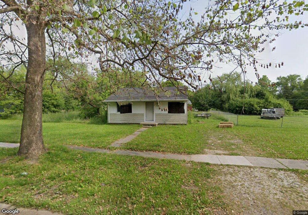
1715 Polly St Flint, MI 48505
Northeast Village NeighborhoodEstimated Value: $32,000 - $37,000
2
Beds
1
Bath
768
Sq Ft
$45/Sq Ft
Est. Value
About This Home
This home is located at 1715 Polly St, Flint, MI 48505 and is currently estimated at $34,500, approximately $44 per square foot. 1715 Polly St is a home located in Genesee County with nearby schools including Brownell STEM Academy, The New Standard Academy, and Richfield Public School Academy.
Ownership History
Date
Name
Owned For
Owner Type
Purchase Details
Closed on
Dec 20, 2022
Sold by
Genesee County Treasurer
Bought by
Genesee County Land Bank Authority
Current Estimated Value
Purchase Details
Closed on
Oct 3, 2017
Sold by
Cherry Deborah L
Bought by
Babbitt Markice
Purchase Details
Closed on
Oct 8, 2015
Sold by
Edwards D J
Bought by
Servico Inc
Purchase Details
Closed on
Oct 4, 2002
Sold by
Davis Michael
Bought by
Servico Inc
Create a Home Valuation Report for This Property
The Home Valuation Report is an in-depth analysis detailing your home's value as well as a comparison with similar homes in the area
Home Values in the Area
Average Home Value in this Area
Purchase History
| Date | Buyer | Sale Price | Title Company |
|---|---|---|---|
| Genesee County Land Bank Authority | -- | -- | |
| Babbitt Markice | -- | None Available | |
| Servico Inc | -- | Attorney | |
| Servico Inc | $6,000 | Guaranty Title Company |
Source: Public Records
Tax History Compared to Growth
Tax History
| Year | Tax Paid | Tax Assessment Tax Assessment Total Assessment is a certain percentage of the fair market value that is determined by local assessors to be the total taxable value of land and additions on the property. | Land | Improvement |
|---|---|---|---|---|
| 2025 | -- | $0 | $0 | $0 |
| 2024 | -- | $0 | $0 | $0 |
| 2023 | -- | $0 | $0 | $0 |
| 2022 | $0 | $3,400 | $0 | $0 |
| 2021 | $506 | $5,100 | $0 | $0 |
| 2020 | $480 | $3,500 | $0 | $0 |
| 2019 | $480 | $3,200 | $0 | $0 |
| 2018 | $438 | $3,100 | $0 | $0 |
| 2017 | $361 | $0 | $0 | $0 |
| 2016 | $359 | $0 | $0 | $0 |
| 2015 | -- | $0 | $0 | $0 |
| 2014 | -- | $0 | $0 | $0 |
| 2012 | -- | $2,800 | $0 | $0 |
Source: Public Records
Map
Nearby Homes
- 1704 E Webster Rd
- 5910 N Dort Hwy
- E E Carpenter Rd
- 1218 E Piper Ave
- 5919 Western Rd
- 1320 E Cornell Ave
- 5501 Western Rd
- 946 E Bundy Ave
- 2910 Hampstead Dr
- 5220 Western Rd
- 2710 Eaton Place
- 4923 Alpha Way
- 2802 Eaton Place
- 802 E Russell Ave
- 1404 E Kurtz Ave
- 738 E York Ave
- 1151 E Cornell Ave
- 2801 Epsilon Trail
- 418 E Foss Ave
- 1023 E Princeton Ave