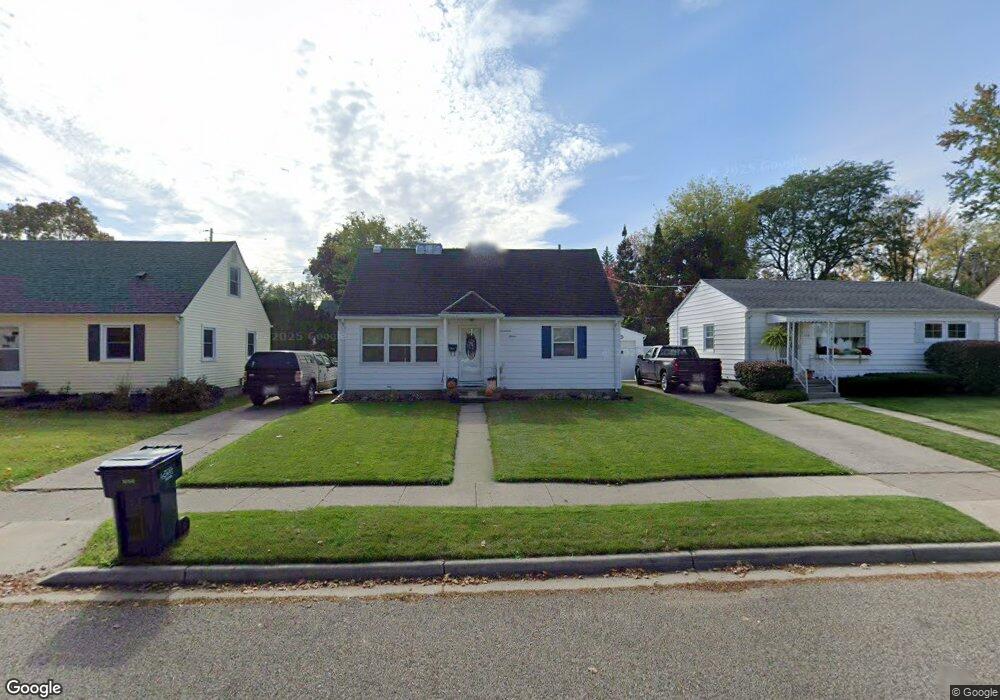
1715 W Rundle Ave Lansing, MI 48910
Colonial Village NeighborhoodEstimated Value: $138,397 - $179,000
--
Bed
--
Bath
1,020
Sq Ft
$160/Sq Ft
Est. Value
About This Home
This home is located at 1715 W Rundle Ave, Lansing, MI 48910 and is currently estimated at $163,349, approximately $160 per square foot. 1715 W Rundle Ave is a home located in Ingham County with nearby schools including Averill Elementary School, Attwood School, and J.W. Sexton High School.
Ownership History
Date
Name
Owned For
Owner Type
Purchase Details
Closed on
Aug 8, 2019
Sold by
Galatian Andrea L
Bought by
Galatian Andrea L
Current Estimated Value
Purchase Details
Closed on
Apr 28, 2000
Sold by
Metts David J
Bought by
Galatian Andrea L
Home Financials for this Owner
Home Financials are based on the most recent Mortgage that was taken out on this home.
Original Mortgage
$82,200
Outstanding Balance
$28,602
Interest Rate
8.24%
Mortgage Type
VA
Estimated Equity
$134,747
Purchase Details
Closed on
Sep 23, 1996
Sold by
Sherman William and Sherman Kathleen
Bought by
Metts David J and Metts Stacey J
Create a Home Valuation Report for This Property
The Home Valuation Report is an in-depth analysis detailing your home's value as well as a comparison with similar homes in the area
Home Values in the Area
Average Home Value in this Area
Purchase History
| Date | Buyer | Sale Price | Title Company |
|---|---|---|---|
| Galatian Andrea L | -- | None Available | |
| Galatian Andrea L | $80,000 | -- | |
| Metts David J | $67,000 | -- |
Source: Public Records
Mortgage History
| Date | Status | Borrower | Loan Amount |
|---|---|---|---|
| Open | Galatian Andrea L | $82,200 |
Source: Public Records
Tax History Compared to Growth
Tax History
| Year | Tax Paid | Tax Assessment Tax Assessment Total Assessment is a certain percentage of the fair market value that is determined by local assessors to be the total taxable value of land and additions on the property. | Land | Improvement |
|---|---|---|---|---|
| 2025 | $2,880 | $62,800 | $8,800 | $54,000 |
| 2024 | $23 | $63,100 | $8,800 | $54,300 |
| 2023 | $2,700 | $56,500 | $8,800 | $47,700 |
| 2022 | $2,435 | $51,200 | $7,500 | $43,700 |
| 2021 | $2,384 | $47,000 | $5,800 | $41,200 |
| 2020 | $2,369 | $45,100 | $5,800 | $39,300 |
| 2019 | $2,271 | $39,800 | $5,800 | $34,000 |
| 2018 | $2,129 | $39,700 | $5,800 | $33,900 |
| 2017 | $2,038 | $39,700 | $5,800 | $33,900 |
| 2016 | $1,949 | $36,300 | $5,800 | $30,500 |
| 2015 | $1,949 | $35,500 | $11,552 | $23,948 |
| 2014 | $1,949 | $34,700 | $9,041 | $25,659 |
Source: Public Records
Map
Nearby Homes
- 1618 Loraine Ave
- 1607 Holly Way
- 2039 Holly Way
- 3125 Boston Blvd
- 1404 Kelsey Ave
- 2812 Pleasant Grove Rd
- 2920 Pleasant Grove Rd Unit 1
- 1420 Poxson Ave
- 2118 Marion Ave
- 1120 Kelsey Ave
- 2409 Victor Ave
- 2515 S Martin Luther King Junior Blvd
- 1032 Kelsey Ave
- 1312 W Mount Hope Ave
- 1315 Goodrich St
- 3312 Pleasant Grove Rd
- 1740 Wellington Rd Unit 103
- 2505 Hanover Dr
- 2310 Stirling Ave
- 924 Loa St
- 1719 W Rundle Ave
- 1711 W Rundle Ave
- 1725 W Rundle Ave
- 1705 W Rundle Ave
- 1714 Victor Ave
- 1710 Victor Ave
- 1704 Victor Ave
- 1729 W Rundle Ave
- 1701 W Rundle Ave
- 1714 W Rundle Ave
- 1710 W Rundle Ave
- 1728 Victor Ave
- 1700 Victor Ave
- 1704 W Rundle Ave
- 1724 W Rundle Ave
- 2701 Boston Blvd
- 1700 W Rundle Ave
- 1728 W Rundle Ave
- 2715 Boston Blvd
- 1628 Victor Ave