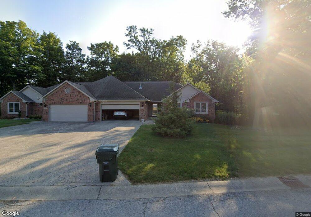
1715 Walnut Trace Greenfield, IN 46140
Estimated Value: $295,103 - $380,000
4
Beds
3
Baths
2,768
Sq Ft
$119/Sq Ft
Est. Value
About This Home
This home is located at 1715 Walnut Trace, Greenfield, IN 46140 and is currently estimated at $328,776, approximately $118 per square foot. 1715 Walnut Trace is a home located in Hancock County with nearby schools including J.B. Stephens Elementary School, Maxwell Intermediate School, and Greenfield Central Junior High School.
Ownership History
Date
Name
Owned For
Owner Type
Purchase Details
Closed on
Aug 13, 2018
Sold by
Hickerson Catherine E
Bought by
Essington Sharon K
Current Estimated Value
Home Financials for this Owner
Home Financials are based on the most recent Mortgage that was taken out on this home.
Original Mortgage
$60,000
Outstanding Balance
$20,361
Interest Rate
4.5%
Mortgage Type
New Conventional
Estimated Equity
$308,415
Purchase Details
Closed on
Sep 28, 2007
Sold by
Advantage Enterprises Llc
Bought by
Barnhart Jeffrey A and Barnhart Catherine A
Home Financials for this Owner
Home Financials are based on the most recent Mortgage that was taken out on this home.
Original Mortgage
$239,900
Interest Rate
6.49%
Mortgage Type
New Conventional
Create a Home Valuation Report for This Property
The Home Valuation Report is an in-depth analysis detailing your home's value as well as a comparison with similar homes in the area
Home Values in the Area
Average Home Value in this Area
Purchase History
| Date | Buyer | Sale Price | Title Company |
|---|---|---|---|
| Essington Sharon K | $279,000 | Ata National Title Group Of | |
| Barnhart Jeffrey A | -- | None Available |
Source: Public Records
Mortgage History
| Date | Status | Borrower | Loan Amount |
|---|---|---|---|
| Open | Essington Sharon K | $60,000 | |
| Previous Owner | Barnhart Jeffrey A | $239,900 |
Source: Public Records
Tax History
| Year | Tax Paid | Tax Assessment Tax Assessment Total Assessment is a certain percentage of the fair market value that is determined by local assessors to be the total taxable value of land and additions on the property. | Land | Improvement |
|---|---|---|---|---|
| 2024 | $2,822 | $296,800 | $60,000 | $236,800 |
| 2023 | $2,822 | $278,300 | $60,000 | $218,300 |
| 2022 | $2,580 | $263,800 | $35,700 | $228,100 |
| 2021 | $2,595 | $260,700 | $35,700 | $225,000 |
| 2020 | $2,595 | $260,800 | $35,700 | $225,100 |
| 2019 | $2,487 | $250,000 | $35,700 | $214,300 |
| 2018 | $2,569 | $255,200 | $35,700 | $219,500 |
| 2017 | $2,467 | $245,000 | $35,700 | $209,300 |
| 2016 | $2,428 | $240,700 | $35,000 | $205,700 |
| 2014 | $2,448 | $242,700 | $35,000 | $207,700 |
| 2013 | -- | $245,100 | $35,000 | $210,100 |
Source: Public Records
Map
Nearby Homes
- 0 Walnut Trace Unit MBR21978938
- 1761 Walnut Trace
- 00 Fields Blvd
- 615 Firefly Ct
- 767 Oakleaf Dr
- 810 Rosebud Ln
- 783 Oakleaf Trail
- 572 Firefly Ct
- 219 E Mckenzie Rd
- 2367 Collins Way
- 1804 Gunnison Dr
- 1364 Lexington Trail
- 1247 Maumee Ct
- 1733 River Birch Dr
- 1581 Dale Ct
- Lot 1 Rockfield Estates
- 1757 River Birch Dr
- 825 W Muskegon Dr
- 1789 River Birch Dr
- 1267 Gunnison Dr
- 1715 Walnut Trace
- 1717 Walnut Trace
- 1717 Walnut Trace
- 0 - Lot 5A Walnut Trace
- 0 - Lot 8B Walnut Trace
- 0 - Lot 8A Walnut Trace
- 0 - Lot 5B Walnut Trace
- 0 - Lot 1B Walnut Trace
- 0 Lot 1A Walnut Trace
- 1719 Walnut Trace
- 1719 Walnut Trace
- 0 Walnut Trace Unit MBR21847995
- 0 - Lot 24B Walnut Trace
- 0 - Lot 23B Walnut Trace
- 0 - Lot 23A Walnut Trace
- 0 - Lot 22A Walnut Trace
- 0 - Lot 24A Walnut Trace
Your Personal Tour Guide
Ask me questions while you tour the home.