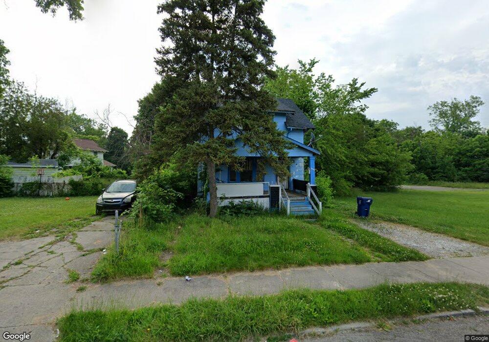
1716 Adams Ave Flint, MI 48505
King Avenue Plus NeighborhoodEstimated Value: $29,000 - $53,087
3
Beds
1
Bath
1,240
Sq Ft
$34/Sq Ft
Est. Value
About This Home
This home is located at 1716 Adams Ave, Flint, MI 48505 and is currently estimated at $42,522, approximately $34 per square foot. 1716 Adams Ave is a home located in Genesee County with nearby schools including Brownell STEM Academy, Flint Cultural Center Academy, and WAY Academy of Flint.
Ownership History
Date
Name
Owned For
Owner Type
Purchase Details
Closed on
Feb 10, 2011
Sold by
Luster Rosetta
Bought by
Hoey Sarita
Current Estimated Value
Purchase Details
Closed on
Feb 7, 2008
Sold by
Stair Philip G and Genesee County Land Bank Autho
Bought by
Luster Rosetta
Purchase Details
Closed on
Jun 1, 2007
Sold by
The Genesee County Land Bank Authority
Bought by
Luster Rosetta
Purchase Details
Closed on
Feb 22, 2007
Sold by
Kildee Daniel T and Genesee County Treasurer
Bought by
Genesee County Land Bank Authority
Create a Home Valuation Report for This Property
The Home Valuation Report is an in-depth analysis detailing your home's value as well as a comparison with similar homes in the area
Home Values in the Area
Average Home Value in this Area
Purchase History
| Date | Buyer | Sale Price | Title Company |
|---|---|---|---|
| Hoey Sarita | -- | None Available | |
| Luster Rosetta | $6,000 | None Available | |
| Luster Rosetta | $6,000 | None Available | |
| Genesee County Land Bank Authority | $1,461 | None Available |
Source: Public Records
Mortgage History
| Date | Status | Borrower | Loan Amount |
|---|---|---|---|
| Closed | Luster Rosetta | $0 |
Source: Public Records
Tax History Compared to Growth
Tax History
| Year | Tax Paid | Tax Assessment Tax Assessment Total Assessment is a certain percentage of the fair market value that is determined by local assessors to be the total taxable value of land and additions on the property. | Land | Improvement |
|---|---|---|---|---|
| 2025 | $558 | $8,300 | $0 | $0 |
| 2024 | $530 | $8,000 | $0 | $0 |
| 2023 | $529 | $6,000 | $0 | $0 |
| 2022 | $0 | $4,500 | $0 | $0 |
| 2021 | $529 | $5,100 | $0 | $0 |
| 2020 | $501 | $4,900 | $0 | $0 |
| 2019 | $1,137 | $5,000 | $0 | $0 |
| 2018 | $459 | $4,400 | $0 | $0 |
| 2017 | $451 | $0 | $0 | $0 |
| 2016 | $449 | $0 | $0 | $0 |
| 2015 | -- | $0 | $0 | $0 |
| 2014 | -- | $0 | $0 | $0 |
| 2012 | -- | $4,600 | $0 | $0 |
Source: Public Records
Map
Nearby Homes
- 235 Page St
- 1606 Garland St
- 329 E Wood St
- 325 W Paterson St
- 317 W Witherbee St
- 562 E Witherbee St
- 1303 Root St
- 1645 Seminole St
- 1016 Garland St
- 115 W Baker St
- 217 W 7th Ave
- 506 Green St
- 218 E Jackson Ave
- 1706 Wilberforce Cir
- 805 Columbia Dr
- 1409 Prospect St
- 1802 Mackin Rd
- 2913
- 2913 Martin Luther King Ave
- 2302 Mallery St