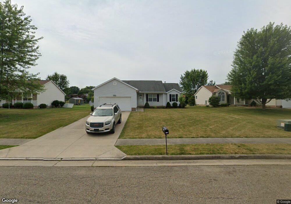
1716 Briarwood St Louisville, OH 44641
Estimated Value: $253,000 - $286,000
3
Beds
2
Baths
1,556
Sq Ft
$173/Sq Ft
Est. Value
About This Home
This home is located at 1716 Briarwood St, Louisville, OH 44641 and is currently estimated at $268,973, approximately $172 per square foot. 1716 Briarwood St is a home located in Stark County with nearby schools including Louisville High School and St. Thomas Aquinas High School & Middle School.
Ownership History
Date
Name
Owned For
Owner Type
Purchase Details
Closed on
Jun 7, 2011
Sold by
Bole Micahel A and Bole Stephanie M
Bought by
Bole Stephanie M
Current Estimated Value
Purchase Details
Closed on
Sep 9, 2005
Sold by
Schalmo Builders Inc
Bought by
Bole Michael A and Bole Stephanie M
Home Financials for this Owner
Home Financials are based on the most recent Mortgage that was taken out on this home.
Original Mortgage
$100,000
Interest Rate
6.34%
Mortgage Type
Fannie Mae Freddie Mac
Create a Home Valuation Report for This Property
The Home Valuation Report is an in-depth analysis detailing your home's value as well as a comparison with similar homes in the area
Home Values in the Area
Average Home Value in this Area
Purchase History
| Date | Buyer | Sale Price | Title Company |
|---|---|---|---|
| Bole Stephanie M | -- | Attorney | |
| Bole Michael A | $159,100 | None Available |
Source: Public Records
Mortgage History
| Date | Status | Borrower | Loan Amount |
|---|---|---|---|
| Closed | Bole Michael A | $100,000 |
Source: Public Records
Tax History Compared to Growth
Tax History
| Year | Tax Paid | Tax Assessment Tax Assessment Total Assessment is a certain percentage of the fair market value that is determined by local assessors to be the total taxable value of land and additions on the property. | Land | Improvement |
|---|---|---|---|---|
| 2025 | -- | $72,840 | $15,510 | $57,330 |
| 2024 | -- | $72,840 | $15,510 | $57,330 |
| 2023 | $2,745 | $63,880 | $14,630 | $49,250 |
| 2022 | $1,648 | $63,880 | $14,630 | $49,250 |
| 2021 | $1,808 | $63,880 | $14,630 | $49,250 |
| 2020 | $2,265 | $56,950 | $13,200 | $43,750 |
| 2019 | $2,352 | $58,910 | $13,200 | $45,710 |
| 2018 | $2,343 | $58,910 | $13,200 | $45,710 |
| 2017 | $2,199 | $53,350 | $11,590 | $41,760 |
| 2016 | $2,244 | $53,350 | $11,590 | $41,760 |
| 2015 | $2,251 | $53,350 | $11,590 | $41,760 |
| 2014 | $92 | $46,100 | $10,010 | $36,090 |
| 2013 | $1,050 | $46,100 | $10,010 | $36,090 |
Source: Public Records
Map
Nearby Homes
- 1715 High St
- 1812 E Broad St
- 2110 Edmar St
- 641 S Nickelplate St
- 520 S Silver St
- 308 Superior St
- 728 E Broad St
- 908 Sand Lot Cir
- 0 Michigan Blvd
- 2015 E Main St
- 3390 Meese Rd NE
- 510 S Bauman Ct
- 204 E Broad St
- 107 E Broad St
- 325 Lincoln Ave
- 1702 View Pointe Ave
- 1170 Winding Ridge Ave
- 1639 Horizon Dr
- 8225 Georgetown St
- 910 Crosswyck Cir
- 1704 Briarwood St
- 1728 Briarwood St
- 58 Briarwood St
- 1707 Opal St
- 1680 Briarwood St
- 1055 S Marion Ave
- 1721 Opal St
- 1085 S Marion Ave
- 1025 S Marion Ave
- 59 Briarwood St
- 1739 Briarwood St
- 1715 Briarwood St
- 1727 Briarwood St
- 1631 Opal St
- 1695 Briarwood St
- 1731 Opal St
- 1660 Briarwood St
- 1665 Briarwood St
- 915 S Marion Ave
- 1710 Opal St