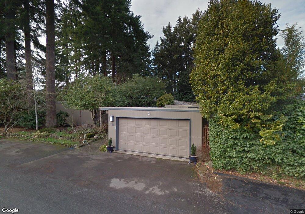
17167 Cedar Rd Lakeoswego, OR 97035
Blue Heron NeighborhoodEstimated Value: $1,167,129 - $1,268,000
3
Beds
2
Baths
2,483
Sq Ft
$496/Sq Ft
Est. Value
About This Home
This home is located at 17167 Cedar Rd, Lakeoswego, OR 97035 and is currently estimated at $1,231,032, approximately $495 per square foot. 17167 Cedar Rd is a home located in Clackamas County with nearby schools including Lakeridge Middle School, Lakeridge High School, and The Children's Hour Academy.
Ownership History
Date
Name
Owned For
Owner Type
Purchase Details
Closed on
May 10, 2021
Sold by
Mulholland Meaghan and Dunn Charles W
Bought by
Davidson Brian Scott and Davidson Roxanne Marie
Current Estimated Value
Home Financials for this Owner
Home Financials are based on the most recent Mortgage that was taken out on this home.
Original Mortgage
$787,200
Outstanding Balance
$711,881
Interest Rate
3.1%
Mortgage Type
New Conventional
Estimated Equity
$519,151
Purchase Details
Closed on
Nov 20, 2019
Sold by
Mulholland Meaghan and Dunn Charles W
Bought by
Mulholland Meaghan and Dunn Charles W
Purchase Details
Closed on
Mar 14, 2018
Sold by
Bitzer Franklin Arthur and Bitzer Susan Elizabeth
Bought by
Mullholland Meaghan and Dunn Charles W
Home Financials for this Owner
Home Financials are based on the most recent Mortgage that was taken out on this home.
Original Mortgage
$558,750
Interest Rate
4.22%
Mortgage Type
New Conventional
Purchase Details
Closed on
Aug 17, 2006
Sold by
Bitzer Susan E
Bought by
Bitzer Franklin Arthur and Bitzer Susan Elizabeth
Purchase Details
Closed on
Oct 12, 2004
Sold by
Thompson Douglas R and Thompson Darlene F
Bought by
Bitzer Franklin A and Bitzer Susan E
Home Financials for this Owner
Home Financials are based on the most recent Mortgage that was taken out on this home.
Original Mortgage
$170,000
Interest Rate
4.62%
Mortgage Type
Purchase Money Mortgage
Purchase Details
Closed on
Jul 3, 2000
Sold by
Jones James W
Bought by
Thompson Douglas R and Thompson Darlene F
Purchase Details
Closed on
Aug 19, 1997
Sold by
Woodruff Raymond E and Woodruff Susan D
Bought by
Jones James W
Home Financials for this Owner
Home Financials are based on the most recent Mortgage that was taken out on this home.
Original Mortgage
$204,000
Interest Rate
7.45%
Create a Home Valuation Report for This Property
The Home Valuation Report is an in-depth analysis detailing your home's value as well as a comparison with similar homes in the area
Home Values in the Area
Average Home Value in this Area
Purchase History
| Date | Buyer | Sale Price | Title Company |
|---|---|---|---|
| Davidson Brian Scott | $984,000 | Fidelity National Title Of O | |
| Mulholland Meaghan | -- | First American | |
| Mullholland Meaghan | $745,000 | Wfg Title | |
| Bitzer Franklin Arthur | -- | None Available | |
| Bitzer Franklin Arthur | -- | None Available | |
| Bitzer Franklin A | -- | None Available | |
| Bitzer Franklin A | $410,000 | Ticor Title Insurance Compan | |
| Thompson Douglas R | $303,000 | First American Title Ins Co | |
| Jones James W | $284,000 | Oregon Title Insurance Co |
Source: Public Records
Mortgage History
| Date | Status | Borrower | Loan Amount |
|---|---|---|---|
| Open | Davidson Brian Scott | $787,200 | |
| Previous Owner | Mullholland Meaghan | $558,750 | |
| Previous Owner | Bitzer Franklin A | $170,000 | |
| Previous Owner | Jones James W | $204,000 |
Source: Public Records
Tax History Compared to Growth
Tax History
| Year | Tax Paid | Tax Assessment Tax Assessment Total Assessment is a certain percentage of the fair market value that is determined by local assessors to be the total taxable value of land and additions on the property. | Land | Improvement |
|---|---|---|---|---|
| 2025 | $8,082 | $420,851 | -- | -- |
| 2024 | $7,867 | $408,594 | -- | -- |
| 2023 | $7,867 | $396,694 | $0 | $0 |
| 2022 | $7,409 | $385,140 | $0 | $0 |
| 2021 | $6,843 | $373,923 | $0 | $0 |
| 2020 | $7,915 | $363,033 | $0 | $0 |
| 2019 | $5,870 | $317,931 | $0 | $0 |
| 2018 | $5,582 | $308,671 | $0 | $0 |
| 2017 | $5,386 | $299,681 | $0 | $0 |
| 2016 | $4,903 | $290,952 | $0 | $0 |
| 2015 | $4,737 | $282,478 | $0 | $0 |
| 2014 | $4,676 | $274,250 | $0 | $0 |
Source: Public Records
Map
Nearby Homes
- 17210 Cedar Rd
- 16636 Maple Cir
- 17367 Canal Cir
- 17035 Westview Dr
- 4160 Westbay Rd
- 3600 Lakeview Blvd
- 17677 Westview Dr
- 3548 Lakeview Blvd
- 16755 Graef Cir
- 2627 Park Rd
- 4264 Westbay Rd
- 4241 Cobb Way
- 3730 Upper Dr
- 4224 Haven St
- 4368 Lakeview Blvd
- 17810 Sarah Hill Ln
- 16878 Canyon Dr
- 4470 Lakeview Blvd
- 15947 Twin Fir Rd
- 4480 Upper Dr
- 17167 Cedar Rd
- 3368 Southshore Blvd
- 17171 Cedar Rd
- 3368 S Shore Blvd
- 3320 Southshore Blvd
- 17178 Cedar Rd
- 17152 Cedar Rd
- 3418 Southshore Blvd
- 17173 Cedar Rd
- 17144 Cedar Rd
- 17138 Cedar Rd
- 17224 Cedar Rd
- 0 Cedar Rd Unit 8017320
- 0 Cedar Rd Unit Lt391
- 16710 Alder Cir
- 17110 Cedar Rd
- 17240 Cedar Rd
- 16731 Alder Cir
- 16731 Alder Cr
- 16720 Alder Cir