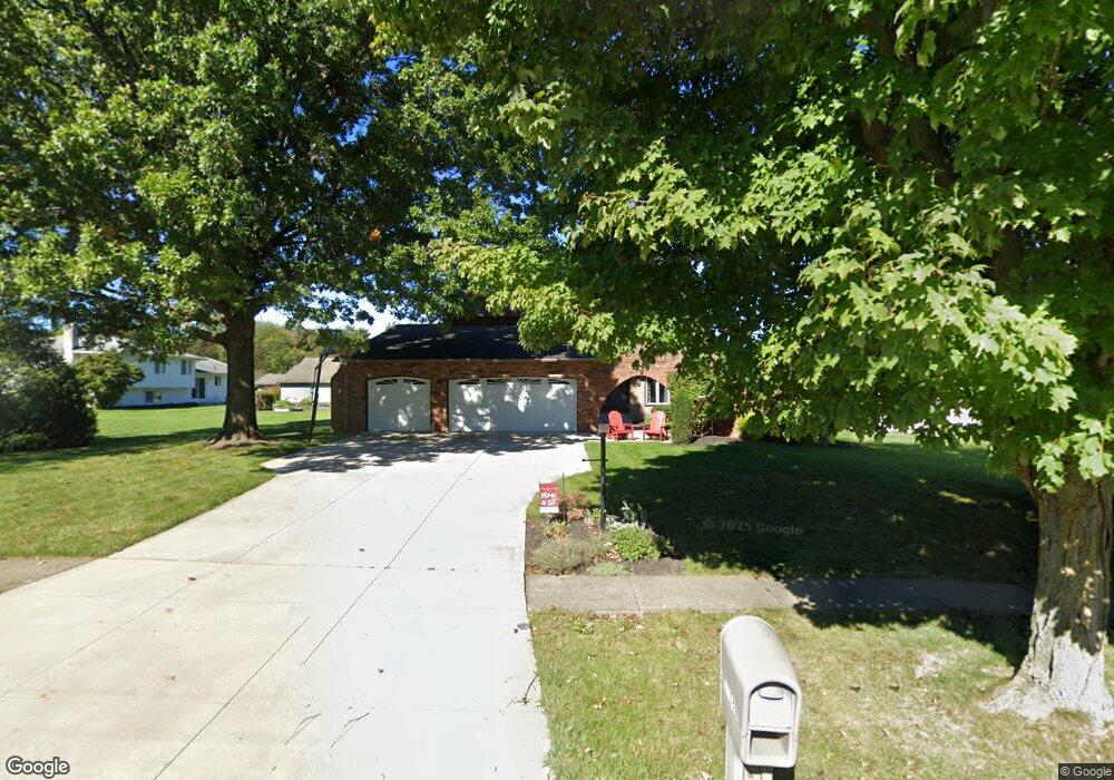
17168 Misty Lake Dr Strongsville, OH 44136
Estimated Value: $401,040 - $431,000
4
Beds
3
Baths
2,852
Sq Ft
$144/Sq Ft
Est. Value
About This Home
This home is located at 17168 Misty Lake Dr, Strongsville, OH 44136 and is currently estimated at $411,010, approximately $144 per square foot. 17168 Misty Lake Dr is a home located in Cuyahoga County with nearby schools including Strongsville High School.
Ownership History
Date
Name
Owned For
Owner Type
Purchase Details
Closed on
May 18, 2001
Sold by
Gregor Rigo H and Gregor Marilyn L
Bought by
Miller Michael D and Miller Greta L
Current Estimated Value
Home Financials for this Owner
Home Financials are based on the most recent Mortgage that was taken out on this home.
Original Mortgage
$156,000
Outstanding Balance
$58,207
Interest Rate
7.02%
Estimated Equity
$352,803
Purchase Details
Closed on
May 29, 1984
Bought by
Rigo H Gregor
Purchase Details
Closed on
Jun 29, 1979
Sold by
Gwinn Paul D
Bought by
Robinson Joseph B and Robinson Mary E
Purchase Details
Closed on
Sep 15, 1977
Bought by
Gwinn Paul D
Purchase Details
Closed on
Jan 1, 1977
Bought by
Production Homes Inc
Create a Home Valuation Report for This Property
The Home Valuation Report is an in-depth analysis detailing your home's value as well as a comparison with similar homes in the area
Home Values in the Area
Average Home Value in this Area
Purchase History
| Date | Buyer | Sale Price | Title Company |
|---|---|---|---|
| Miller Michael D | $195,000 | Insignia Title Agency Ltd | |
| Rigo H Gregor | $145,000 | -- | |
| Equitable Relocation | -- | -- | |
| Robinson Joseph B | $128,000 | -- | |
| Gwinn Paul D | $96,500 | -- | |
| Production Homes Inc | -- | -- |
Source: Public Records
Mortgage History
| Date | Status | Borrower | Loan Amount |
|---|---|---|---|
| Open | Miller Michael D | $156,000 | |
| Closed | Miller Michael D | $29,250 |
Source: Public Records
Tax History Compared to Growth
Tax History
| Year | Tax Paid | Tax Assessment Tax Assessment Total Assessment is a certain percentage of the fair market value that is determined by local assessors to be the total taxable value of land and additions on the property. | Land | Improvement |
|---|---|---|---|---|
| 2024 | $5,505 | $117,250 | $19,355 | $97,895 |
| 2023 | $6,104 | $97,480 | $19,530 | $77,950 |
| 2022 | $6,059 | $97,480 | $19,530 | $77,950 |
| 2021 | $6,012 | $97,480 | $19,530 | $77,950 |
| 2020 | $5,568 | $79,870 | $16,000 | $63,880 |
| 2019 | $5,405 | $228,200 | $45,700 | $182,500 |
| 2018 | $4,905 | $79,870 | $16,000 | $63,880 |
| 2017 | $4,962 | $74,800 | $12,670 | $62,130 |
| 2016 | $4,922 | $74,800 | $12,670 | $62,130 |
| 2015 | $4,991 | $74,800 | $12,670 | $62,130 |
| 2014 | $4,991 | $74,800 | $12,670 | $62,130 |
Source: Public Records
Map
Nearby Homes
- 16486 S Red Rock Dr
- 17130 Golden Star Dr
- 18229 Howe Rd
- 17159 Turkey Meadow Ln
- 16711 Beech Cir
- 17682 Drake Rd
- 17024 Bear Creek Ln
- 16650 Lanier Ave
- 18411 Yorktown Oval
- 17934 Cambridge Oval
- 18294 Drake Rd
- 3550 Boston Rd
- 16450 Howe Rd
- 15604-REAR Boston Rd
- 19694 Benbow Rd
- 14985 Camden Cir
- 19740 Benbow Rd
- 18987 Laurell Cir
- 97 Weathervane Ln
- 15188 Trails Landing
- 17164 Misty Lake Dr
- 16524 Pepper Grass Cir
- 16528 Pepper Grass Cir
- 17160 Misty Lake Dr
- 16532 Pepper Grass Cir
- 16527 S Red Rock Dr
- 16536 Pepper Grass Cir
- 17169 Misty Lake Dr
- 17167 Misty Lake Dr
- 16531 S Red Rock Dr
- 17156 Misty Lake Dr
- 17165 Misty Lake Dr
- 17161 Misty Lake Dr
- 17173 Misty Lake Dr
- 16535 S Red Rock Dr
- 17176 Misty Lake Dr
- 16540 Pepper Grass Cir
- 17175 Misty Lake Dr
- 16539 S Red Rock Dr
- 16517 Morning Star Dr