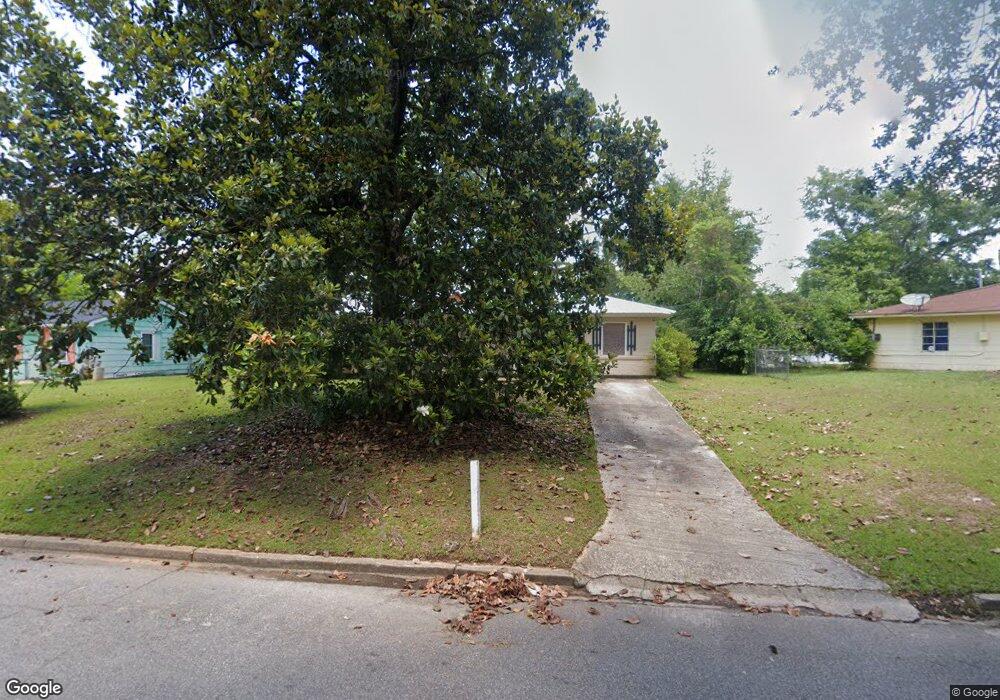
1717 Jean Ave Albany, GA 31705
Estimated Value: $52,000 - $86,000
3
Beds
1
Bath
1,275
Sq Ft
$56/Sq Ft
Est. Value
About This Home
This home is located at 1717 Jean Ave, Albany, GA 31705 and is currently estimated at $71,162, approximately $55 per square foot. 1717 Jean Ave is a home located in Dougherty County with nearby schools including Robert H. Harvey Elementary School, Albany Middle School, and Dougherty Comprehensive High School.
Ownership History
Date
Name
Owned For
Owner Type
Purchase Details
Closed on
Apr 12, 2002
Sold by
Roe Russell W and Roe Teresa L
Bought by
Roe Properties Llc
Current Estimated Value
Purchase Details
Closed on
Oct 4, 2000
Sold by
Becnel Kenneth
Bought by
Roe Russell W and Roe Teresa L
Purchase Details
Closed on
Aug 3, 1999
Sold by
Becnel Kenneth/Do Co Sheriff & City Mars
Bought by
Loomis John A
Purchase Details
Closed on
May 6, 1999
Sold by
Givens Marsha Cloud
Bought by
Becnel Kenneth James
Purchase Details
Closed on
Jul 27, 1992
Sold by
Transouth Mtge Corp
Bought by
Becnel Kenneth
Purchase Details
Closed on
Nov 27, 1991
Sold by
Patrick James R
Bought by
Transouth Mtge Corp
Purchase Details
Closed on
Sep 15, 1969
Sold by
Malone Tom
Bought by
Patrick James
Create a Home Valuation Report for This Property
The Home Valuation Report is an in-depth analysis detailing your home's value as well as a comparison with similar homes in the area
Home Values in the Area
Average Home Value in this Area
Purchase History
| Date | Buyer | Sale Price | Title Company |
|---|---|---|---|
| Roe Properties Llc | $675,300 | -- | |
| Roe Russell W | $27,000 | -- | |
| Loomis John A | -- | -- | |
| Becnel Kenneth James | -- | -- | |
| Becnel Kenneth | $19,500 | -- | |
| Transouth Mtge Corp | $19,600 | -- | |
| Patrick James | -- | -- |
Source: Public Records
Tax History Compared to Growth
Tax History
| Year | Tax Paid | Tax Assessment Tax Assessment Total Assessment is a certain percentage of the fair market value that is determined by local assessors to be the total taxable value of land and additions on the property. | Land | Improvement |
|---|---|---|---|---|
| 2024 | $424 | $8,880 | $1,760 | $7,120 |
| 2023 | $414 | $8,880 | $1,760 | $7,120 |
| 2022 | $415 | $8,880 | $1,760 | $7,120 |
| 2021 | $385 | $8,880 | $1,760 | $7,120 |
| 2020 | $386 | $8,880 | $1,760 | $7,120 |
| 2019 | $387 | $8,880 | $1,760 | $7,120 |
| 2018 | $452 | $10,320 | $1,760 | $8,560 |
| 2017 | $542 | $13,280 | $1,760 | $11,520 |
| 2016 | $542 | $13,280 | $1,760 | $11,520 |
| 2015 | $544 | $13,280 | $1,760 | $11,520 |
| 2014 | $537 | $13,280 | $1,760 | $11,520 |
Source: Public Records
Map
Nearby Homes
- 1618 Beverly Ave
- 1500 Evelyn Ave
- 1901 S Flintlock Dr
- 1978 S Riverview Cir
- 1980 S Riverview Cir
- 1982 S Riverview Cir
- 1604, 1606, 1607 Cromartie Beach Dr
- 1616 Cromartie Beach Dr
- 2034 N Riverview Cir
- 1412 Westcliff Ct
- 1405 Westcliff Ct
- 1323 E Society Ave
- 1107 E 4th Ave
- 1418 E Roosevelt Ave
- 119 N West Rd
- 1410 E Roosevelt Ave
- 309 Acorn St
- 1318 E Roosevelt Ave
- 1007 Swift St
- 307 Acorn St