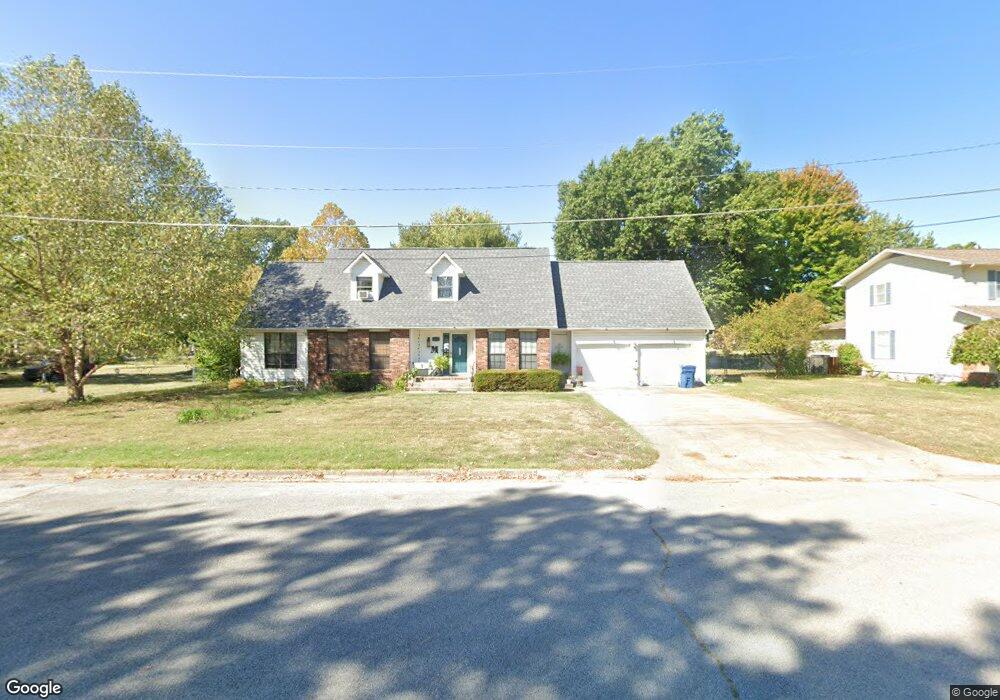
1717 Mimosa Rd Carthage, MO 64836
Estimated Value: $247,000 - $476,000
3
Beds
4
Baths
2,700
Sq Ft
$133/Sq Ft
Est. Value
About This Home
This home is located at 1717 Mimosa Rd, Carthage, MO 64836 and is currently estimated at $359,606, approximately $133 per square foot. 1717 Mimosa Rd is a home located in Jasper County with nearby schools including Carthage High School, St. Ann's Catholic School, and Victory Academy.
Ownership History
Date
Name
Owned For
Owner Type
Purchase Details
Closed on
Sep 17, 2013
Sold by
Colaw Seth K and Colaw Jody
Bought by
Martini Nicholas T and Shelton Matini Stephanie K
Current Estimated Value
Home Financials for this Owner
Home Financials are based on the most recent Mortgage that was taken out on this home.
Original Mortgage
$175,275
Outstanding Balance
$130,450
Interest Rate
4.41%
Mortgage Type
New Conventional
Estimated Equity
$229,156
Purchase Details
Closed on
Nov 13, 2009
Sold by
Meister Gary Shawn and Meister Ashley D
Bought by
Colaw Seth K
Home Financials for this Owner
Home Financials are based on the most recent Mortgage that was taken out on this home.
Original Mortgage
$130,500
Interest Rate
4.93%
Mortgage Type
Future Advance Clause Open End Mortgage
Create a Home Valuation Report for This Property
The Home Valuation Report is an in-depth analysis detailing your home's value as well as a comparison with similar homes in the area
Home Values in the Area
Average Home Value in this Area
Purchase History
We collect this data history from publicly available records. To have your information removed, we recommend requesting removal directly through your county’s website.
| Date | Buyer | Sale Price | Title Company |
|---|---|---|---|
| Martini Nicholas T | -- | Fatco | |
| Martini Nicholas T | -- | Fatco | |
| Colaw Seth K | -- | Fatco |
Source: Public Records
Mortgage History
We collect this data history from publicly available records. To have your information removed, we recommend requesting removal directly through your county’s website.
| Date | Status | Borrower | Loan Amount |
|---|---|---|---|
| Open | Martini Nicholas T | $175,275 | |
| Closed | Martini Nicholas T | $175,275 | |
| Previous Owner | Colaw Seth K | $130,500 |
Source: Public Records
Tax History
| Year | Tax Paid | Tax Assessment Tax Assessment Total Assessment is a certain percentage of the fair market value that is determined by local assessors to be the total taxable value of land and additions on the property. | Land | Improvement |
|---|---|---|---|---|
| 2025 | $1,550 | $32,400 | $5,910 | $26,490 |
| 2024 | $1,550 | $30,120 | $5,910 | $24,210 |
| 2023 | $1,550 | $30,120 | $5,910 | $24,210 |
| 2022 | $1,566 | $30,520 | $5,910 | $24,610 |
| 2021 | $1,549 | $30,520 | $5,910 | $24,610 |
| 2020 | $1,503 | $28,380 | $5,910 | $22,470 |
| 2019 | $1,505 | $28,380 | $5,910 | $22,470 |
| 2018 | $1,575 | $29,760 | $0 | $0 |
| 2017 | $1,579 | $29,760 | $0 | $0 |
| 2016 | $1,633 | $30,880 | $0 | $0 |
| 2015 | $1,509 | $30,880 | $0 | $0 |
| 2014 | $1,509 | $30,880 | $0 | $0 |
Source: Public Records
Map
Nearby Homes
- 911 Euclid Blvd
- 1131 Belle Air Place
- 1647 Glenwood Place
- 1914 S River St
- 1642 Glenwood Place
- 1910 Wynwood Dr
- 702 E Centennial Ave
- 1303 Skyline Dr
- 1925 Wynwood Dr
- Tbd Pacific Highlands
- 1814 Buena Vista Ave
- 1910 Buena Vista Ave
- 1909 Bluebird Way
- 1244 Glenwood Place
- 1431 Quail Place
- 2110 Pearl St
- 1929 Bluebird Way
- 1428 Lark Ln
- 2032 Alison St
- xxxx Sheila Ann Dr
- Xx Belle Air Place
- 1010 Belle Air Place
- 1705 Mimosa Rd
- 1015 Belle Air Place
- 1716 S River St
- 1021 Belle Air Place
- 1726 S River St
- 1026 Belle Air Place
- 1011 E Highland Ave
- 1706 S River St
- 1706 S River St
- 922 Euclid Blvd
- 1019 E Highland Ave
- 914 Euclid Blvd
- 1029 Belle Aire Place
- 1736 S River St
- 1029 Belle Air Place
- 1025 E Highland Ave
- 1004 Euclid Blvd
- 1102 Belle Air Place
Your Personal Tour Guide
Ask me questions while you tour the home.