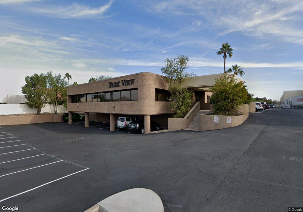
1717 N 77th St Unit 2 Scottsdale, AZ 85257
South Scottsdale NeighborhoodEstimated Value: $2,547,251
--
Bed
--
Bath
10,027
Sq Ft
$254/Sq Ft
Est. Value
About This Home
This home is located at 1717 N 77th St Unit 2, Scottsdale, AZ 85257 and is currently estimated at $2,547,251, approximately $254 per square foot. 1717 N 77th St Unit 2 is a home located in Maricopa County with nearby schools including Tonalea Middle School, Pima Elementary School, and Coronado High School.
Ownership History
Date
Name
Owned For
Owner Type
Purchase Details
Closed on
Mar 17, 2014
Sold by
Hoots Family Investments Lp
Bought by
Power Road Property Llc
Current Estimated Value
Purchase Details
Closed on
Jun 2, 2010
Sold by
The Hoots Family Investments Limited Par
Bought by
Park View Office Llc
Purchase Details
Closed on
Sep 28, 1999
Sold by
Caltrol Inc
Bought by
Hoots Family Investments Ltd Family Part
Home Financials for this Owner
Home Financials are based on the most recent Mortgage that was taken out on this home.
Original Mortgage
$500,000
Interest Rate
7.97%
Mortgage Type
Commercial
Create a Home Valuation Report for This Property
The Home Valuation Report is an in-depth analysis detailing your home's value as well as a comparison with similar homes in the area
Home Values in the Area
Average Home Value in this Area
Purchase History
| Date | Buyer | Sale Price | Title Company |
|---|---|---|---|
| Power Road Property Llc | -- | None Available | |
| Park View Office Llc | -- | Accommodation | |
| Hoots Family Investments Ltd Family Part | $725,000 | Chicago Title Insurance Co |
Source: Public Records
Mortgage History
| Date | Status | Borrower | Loan Amount |
|---|---|---|---|
| Previous Owner | Hoots Family Investments Ltd Family Part | $500,000 |
Source: Public Records
Tax History Compared to Growth
Tax History
| Year | Tax Paid | Tax Assessment Tax Assessment Total Assessment is a certain percentage of the fair market value that is determined by local assessors to be the total taxable value of land and additions on the property. | Land | Improvement |
|---|---|---|---|---|
| 2025 | $12,650 | $179,126 | -- | -- |
| 2024 | $12,728 | $175,927 | -- | -- |
| 2023 | $12,728 | $298,231 | $97,257 | $200,974 |
| 2022 | $12,431 | $181,528 | $80,273 | $101,255 |
| 2021 | $13,585 | $181,332 | $82,566 | $98,766 |
| 2020 | $13,467 | $175,608 | $78,030 | $97,578 |
| 2019 | $12,995 | $160,740 | $77,382 | $83,358 |
| 2018 | $12,583 | $169,272 | $70,632 | $98,640 |
| 2017 | $12,051 | $153,414 | $62,208 | $91,206 |
| 2016 | $11,817 | $136,368 | $51,660 | $84,708 |
| 2015 | $11,561 | $127,151 | $42,421 | $84,730 |
Source: Public Records
Map
Nearby Homes
- 7813 E Coronado Rd
- 7808 E Coronado Rd
- 7807 E Granada Rd
- 7701 E Hubbell St
- 7839 E Palm Ln
- 1731 N Miller Rd
- 7806 E Loma Land Dr
- 7820 E Loma Land Dr
- 7826 E Willetta St
- 2023 N 79th Place
- 7726 E Oak St
- 2015 N 80th Place
- 2009 N 80th Place
- 7729 E Harvard St
- 7741 E Harvard St
- 1703 N 74th Place
- 8024 E Hubbell St
- 7440 E Hubbell St
- 8130 E Pine Dr Unit 4
- 1720 N 74th Place
- 1717 N 77th St Unit 20
- 1717 N 77th St Unit 6
- 1717 N 77th St Unit 17
- 1717 N 77th St Unit 4
- 1717 N 77th St Unit 11
- 1717 N 77th St Unit 9
- 1717 N 77th St Unit 14
- 1819 N 77th St
- 1821 N 77th St
- 1823 N 77th St
- 1815 N 77th St
- 1814 N 78th St
- 1825 N 77th St
- 1829 N 77th St
- 1827 N 77th St
- 1820 N 78th St
- 7801 E Coronado Rd
- 1826 N 78th St
- 1835 N 77th St
- 1839 N 77th St