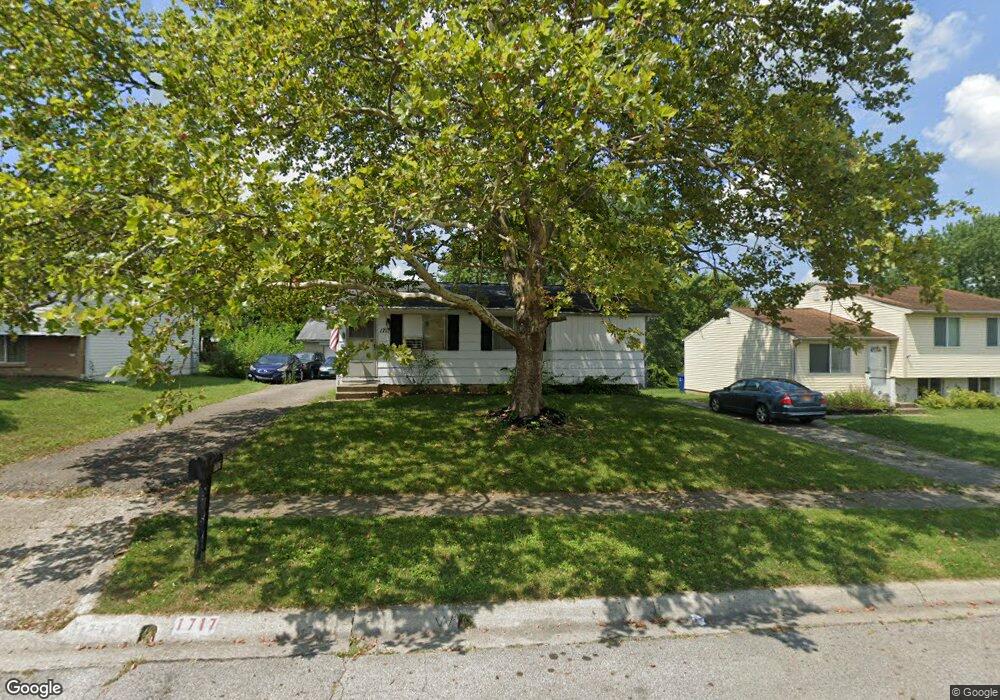
1717 Ripplebrook Rd Columbus, OH 43223
Riverbend NeighborhoodEstimated Value: $177,753 - $209,000
3
Beds
1
Bath
838
Sq Ft
$230/Sq Ft
Est. Value
About This Home
This home is located at 1717 Ripplebrook Rd, Columbus, OH 43223 and is currently estimated at $192,438, approximately $229 per square foot. 1717 Ripplebrook Rd is a home located in Franklin County with nearby schools including James A Harmon Elementary School, Franklin Woods Intermediate School, and Finland Middle School.
Ownership History
Date
Name
Owned For
Owner Type
Purchase Details
Closed on
Jan 28, 2015
Sold by
Potter Quentin D and Potter David N
Bought by
Lanthron Jeffrey S
Current Estimated Value
Home Financials for this Owner
Home Financials are based on the most recent Mortgage that was taken out on this home.
Original Mortgage
$32,000
Interest Rate
3.73%
Mortgage Type
New Conventional
Purchase Details
Closed on
Oct 29, 1986
Bought by
Potter Homer Q and Potter Virgie S
Purchase Details
Closed on
Jul 1, 1986
Purchase Details
Closed on
Feb 1, 1984
Create a Home Valuation Report for This Property
The Home Valuation Report is an in-depth analysis detailing your home's value as well as a comparison with similar homes in the area
Home Values in the Area
Average Home Value in this Area
Purchase History
| Date | Buyer | Sale Price | Title Company |
|---|---|---|---|
| Lanthron Jeffrey S | $40,000 | Amerititle | |
| Potter Homer Q | -- | -- | |
| -- | -- | -- | |
| -- | $40,000 | -- |
Source: Public Records
Mortgage History
| Date | Status | Borrower | Loan Amount |
|---|---|---|---|
| Previous Owner | Lanthron Jeffrey S | $32,000 |
Source: Public Records
Tax History Compared to Growth
Tax History
| Year | Tax Paid | Tax Assessment Tax Assessment Total Assessment is a certain percentage of the fair market value that is determined by local assessors to be the total taxable value of land and additions on the property. | Land | Improvement |
|---|---|---|---|---|
| 2024 | $1,756 | $48,170 | $16,910 | $31,260 |
| 2023 | $1,725 | $48,170 | $16,910 | $31,260 |
| 2022 | $1,440 | $29,510 | $10,080 | $19,430 |
| 2021 | $1,469 | $29,510 | $10,080 | $19,430 |
| 2020 | $1,461 | $29,510 | $10,080 | $19,430 |
| 2019 | $1,374 | $24,500 | $8,400 | $16,100 |
| 2018 | $684 | $24,500 | $8,400 | $16,100 |
| 2017 | $1,362 | $24,500 | $8,400 | $16,100 |
| 2016 | $1,360 | $22,480 | $5,570 | $16,910 |
| 2015 | $699 | $22,480 | $5,570 | $16,910 |
| 2014 | $1,400 | $22,480 | $5,570 | $16,910 |
| 2013 | $772 | $24,990 | $6,195 | $18,795 |
Source: Public Records
Map
Nearby Homes
- 3206 Andy Terrace
- 1657 Ripplebrook Rd
- 3326 Bluhm Ct
- 3488 Rocky Rd
- 1830 Winding Hollow Dr
- 2930 Alkire Rd
- 1485 Demorest Rd
- 3623 High Creek Dr
- 1465 Tall Meadows Dr
- 2062 Summer Banks Dr
- 2800 Alkire Rd
- 3728 Greenock Ct
- 1612 Green Friar Dr
- 3766 Dunlane Ct
- 2188 Dry Ridge Ct
- 1226 Pinnacle Dr
- 1520 Fall Brook Rd
- 1181 Onslow Dr
- 2155 Pentress Dr
- 3728 Miltonsburg Dr
- 1723 Ripplebrook Rd
- 1711 Ripplebrook Rd
- 1705 Ripplebrook Rd
- 1729 Ripplebrook Rd
- 1706 Rivermont Rd
- 1714 Rivermont Rd
- 1698 Rivermont Rd
- 1722 Rivermont Rd
- 1735 Ripplebrook Rd
- 1699 Ripplebrook Rd
- 1718 Ripplebrook Rd
- 1724 Ripplebrook Rd
- 1690 Rivermont Rd
- 1736 Ripplebrook Rd
- 1712 Ripplebrook Rd
- 1730 Rivermont Rd
- 1706 Ripplebrook Rd
- 1684 Rivermont Rd
- 1741 Ripplebrook Rd
- 3496 Royal Hill Dr