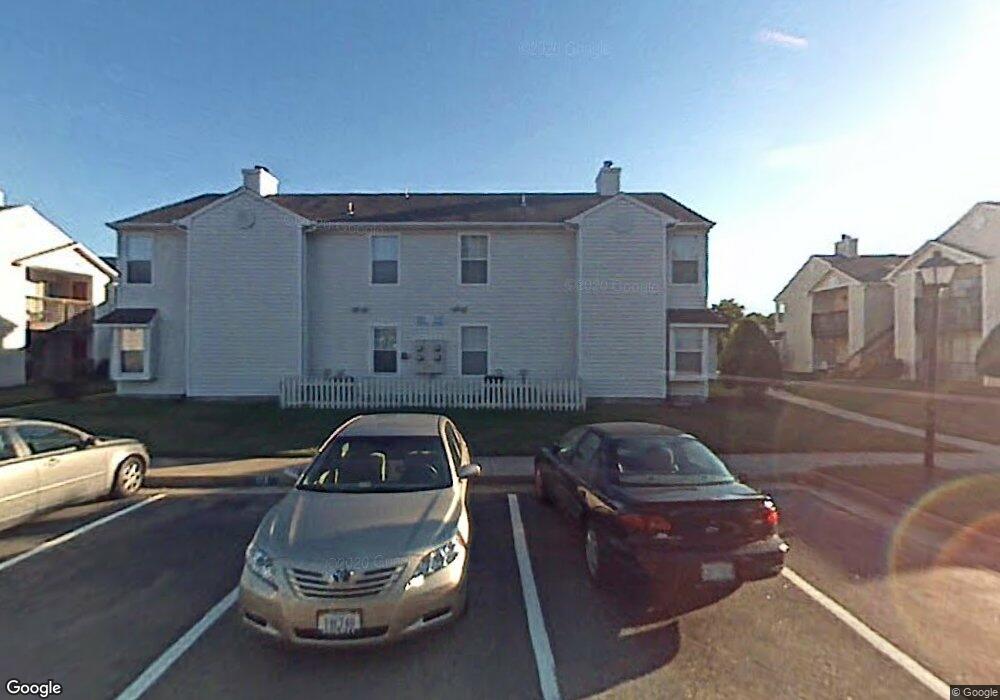
1717 Rock Bridge Mews Unit B Chesapeake, VA 23320
Greenbrier East NeighborhoodEstimated Value: $188,000 - $198,000
2
Beds
1
Bath
822
Sq Ft
$233/Sq Ft
Est. Value
About This Home
This home is located at 1717 Rock Bridge Mews Unit B, Chesapeake, VA 23320 and is currently estimated at $191,208, approximately $232 per square foot. 1717 Rock Bridge Mews Unit B is a home located in Chesapeake City with nearby schools including Greenbrier Primary School, Greenbrier Intermediate School, and Greenbrier Middle.
Ownership History
Date
Name
Owned For
Owner Type
Purchase Details
Closed on
Feb 29, 2024
Sold by
Wiggins Genella
Bought by
Norquist Gabriel and Norquist Sherry
Current Estimated Value
Home Financials for this Owner
Home Financials are based on the most recent Mortgage that was taken out on this home.
Original Mortgage
$176,739
Outstanding Balance
$173,832
Interest Rate
6.69%
Mortgage Type
FHA
Estimated Equity
$17,376
Create a Home Valuation Report for This Property
The Home Valuation Report is an in-depth analysis detailing your home's value as well as a comparison with similar homes in the area
Home Values in the Area
Average Home Value in this Area
Purchase History
| Date | Buyer | Sale Price | Title Company |
|---|---|---|---|
| Norquist Gabriel | $180,000 | Fidelity National Title | |
| Norquist Gabriel | $180,000 | Fidelity National Title |
Source: Public Records
Mortgage History
| Date | Status | Borrower | Loan Amount |
|---|---|---|---|
| Open | Norquist Gabriel | $176,739 | |
| Closed | Norquist Gabriel | $176,739 |
Source: Public Records
Tax History Compared to Growth
Tax History
| Year | Tax Paid | Tax Assessment Tax Assessment Total Assessment is a certain percentage of the fair market value that is determined by local assessors to be the total taxable value of land and additions on the property. | Land | Improvement |
|---|---|---|---|---|
| 2025 | $1,711 | $181,500 | $75,000 | $106,500 |
| 2024 | $1,711 | $169,400 | $65,000 | $104,400 |
| 2023 | $1,532 | $151,700 | $55,000 | $96,700 |
| 2022 | $1,279 | $126,600 | $45,000 | $81,600 |
| 2021 | $1,218 | $116,000 | $40,000 | $76,000 |
| 2020 | $1,185 | $112,900 | $40,000 | $72,900 |
| 2019 | $296 | $112,900 | $40,000 | $72,900 |
| 2018 | $1,380 | $131,400 | $45,000 | $86,400 |
| 2017 | $1,216 | $115,800 | $35,000 | $80,800 |
| 2016 | $1,183 | $112,700 | $35,000 | $77,700 |
| 2015 | $290 | $110,400 | $35,000 | $75,400 |
| 2014 | $1,212 | $115,400 | $40,000 | $75,400 |
Source: Public Records
Map
Nearby Homes
- 1716 Rock Bridge Mews Unit D
- 2108 Rocky Point Run Unit D
- 2115 Rocky Point Run Unit A
- 1701 Stoney Creek Arch Unit C
- 1940 Woodgate Arch
- 1537 Waterside Dr N
- 1363 Cypress Place
- 1244 Quarter Path Trail
- 1244 Mill Lake Quarter
- 1108 Mill Lake Quarter
- 923 Captains Ct
- 919 Captains Ct
- 2420 Trafton Place
- 2449 Fieldsway Dr
- 5916 Baynebridge Dr
- 1443 Thistlewood Ln
- 1425 Blairwood Ln
- 1439 Thistlewood Ln
- 6325 Chestnut Hill Rd
- 1406 Otterbourne Ct
- 1717 Rock Bridge Mews
- 1717 Rock Bridge Mews
- 1717 Rock Bridge Mews
- 1717 Rock Bridge Mews
- 1717 Rock Bridge Mews Unit D
- 1717 Rock Bridge Mews Unit A
- 1717 Rock Bridge Mews Unit C
- 1721 Rock Bridge Mews
- 1721 Rock Bridge Mews
- 1721 Rock Bridge Mews
- 1721 Rock Bridge Mews
- 1721 Rock Bridge Mews Unit C
- 1721 Rock Bridge Mews Unit B
- 1729 Rock Bridge Mews
- 1729 Rock Bridge Mews
- 1729 Rock Bridge Mews
- 1729 Rock Bridge Mews
- 1729 Rock Bridge Mews Unit D
- 1729 B Rockbridge Unit B
- 1729 Rockbridge Mews Unit B