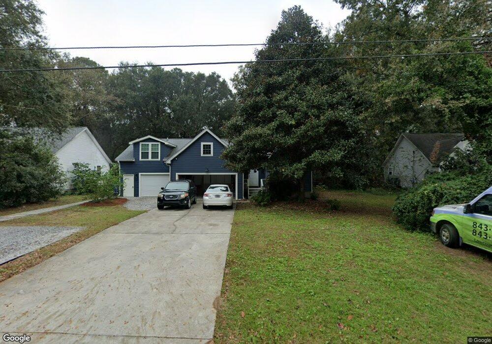
1717 Tower Battery Rd Charleston, SC 29412
James Island NeighborhoodEstimated Value: $624,000 - $803,000
4
Beds
2
Baths
1,520
Sq Ft
$458/Sq Ft
Est. Value
About This Home
This home is located at 1717 Tower Battery Rd, Charleston, SC 29412 and is currently estimated at $696,841, approximately $458 per square foot. 1717 Tower Battery Rd is a home located in Charleston County with nearby schools including James Island Elementary School, Camp Road Middle, and Septima P Clark Corporate Academy.
Ownership History
Date
Name
Owned For
Owner Type
Purchase Details
Closed on
Nov 14, 2014
Sold by
Yohman Christopher D and Yohman Elizabeth L
Bought by
Hudgins David B
Current Estimated Value
Home Financials for this Owner
Home Financials are based on the most recent Mortgage that was taken out on this home.
Original Mortgage
$78,000
Outstanding Balance
$60,101
Interest Rate
4.16%
Mortgage Type
Future Advance Clause Open End Mortgage
Estimated Equity
$636,740
Purchase Details
Closed on
Jul 25, 2008
Sold by
Baker James L and Baker Joyce N
Bought by
Lusk Elizabeth C and Yohman Christopher D
Home Financials for this Owner
Home Financials are based on the most recent Mortgage that was taken out on this home.
Original Mortgage
$234,000
Interest Rate
6.27%
Mortgage Type
Purchase Money Mortgage
Purchase Details
Closed on
Nov 1, 2000
Sold by
Drum Janet E
Bought by
Baker James L and Baker Joyce N
Create a Home Valuation Report for This Property
The Home Valuation Report is an in-depth analysis detailing your home's value as well as a comparison with similar homes in the area
Home Values in the Area
Average Home Value in this Area
Purchase History
| Date | Buyer | Sale Price | Title Company |
|---|---|---|---|
| Hudgins David B | $260,000 | -- | |
| Lusk Elizabeth C | $260,000 | -- | |
| Baker James L | $156,000 | -- |
Source: Public Records
Mortgage History
| Date | Status | Borrower | Loan Amount |
|---|---|---|---|
| Open | Hudgins David B | $78,000 | |
| Previous Owner | Lusk Elizabeth C | $234,000 |
Source: Public Records
Tax History Compared to Growth
Tax History
| Year | Tax Paid | Tax Assessment Tax Assessment Total Assessment is a certain percentage of the fair market value that is determined by local assessors to be the total taxable value of land and additions on the property. | Land | Improvement |
|---|---|---|---|---|
| 2024 | $1,768 | $12,560 | $0 | $0 |
| 2023 | $1,768 | $12,560 | $0 | $0 |
| 2022 | $1,446 | $10,960 | $0 | $0 |
| 2021 | $1,506 | $10,960 | $0 | $0 |
| 2020 | $1,504 | $10,960 | $0 | $0 |
| 2019 | $1,447 | $9,840 | $0 | $0 |
| 2017 | $1,351 | $9,840 | $0 | $0 |
| 2016 | $1,297 | $9,840 | $0 | $0 |
| 2015 | $3,506 | $9,840 | $0 | $0 |
| 2014 | $1,218 | $0 | $0 | $0 |
| 2011 | -- | $0 | $0 | $0 |
Source: Public Records
Map
Nearby Homes
- 1338 Garrison St
- 1427 Battle Ground Rd
- 1447 Fort Lamar Rd
- 1410 Ordinance Point
- 1685 Old Military Rd
- 1087 Clearspring Dr
- 1601 Secessionville Rd
- 0 Cooper Judge Ln Unit 20007881
- 0 Cooper Judge Ln Unit 20007879
- 1245 Lakefront Dr
- 1714 Lotus Ln
- 1144 Clearspring Dr
- 1153 Clearspring Dr
- 1582 Teal Marsh Rd
- 746 Goodlet Cir
- 1028 Hills Plantation Dr
- 114 Sea Cotton Cir
- 1588 Terns Nest Rd
- 1344 Seaside Plantation Dr
- 1590 Terns Nest Rd
- 1717 Tower Battery Rd
- 1721 Tower Battery Rd
- 1713 Tower Battery Rd
- 1731 Tower Battery Rd
- 1347 Garrison St
- 1709 Tower Battery Rd
- 1411 Fort Lamar Rd
- 1348 Garrison St
- 1345 Garrison St
- 1350 Pickett St
- 1415 Fort Lamar Rd
- 1735 Tower Battery Rd
- 1409 Fort Lamar Rd
- 1405 Fort Lamar Rd
- 1344 Garrison St
- 1726 Garrison St
- 1347 Fort Lamar Rd
- 1339 Garrison St
- 1739 Tower Battery Rd
- 1335 Ft Lamar