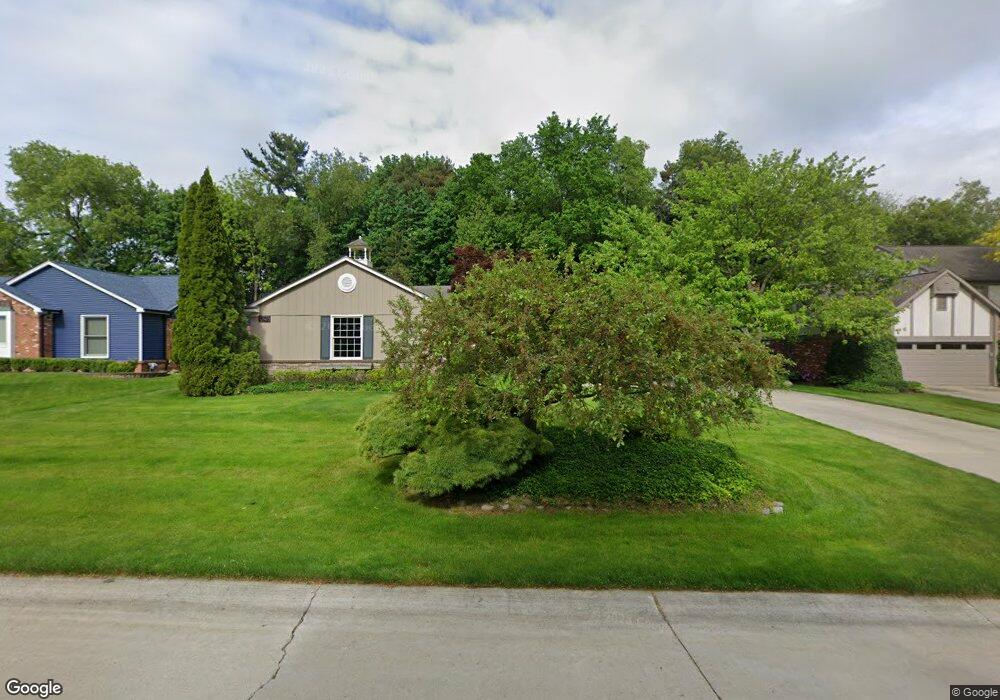
1718 Black Maple Dr Rochester Hills, MI 48309
Estimated Value: $468,890 - $556,000
3
Beds
3
Baths
2,088
Sq Ft
$249/Sq Ft
Est. Value
About This Home
This home is located at 1718 Black Maple Dr, Rochester Hills, MI 48309 and is currently estimated at $520,223, approximately $249 per square foot. 1718 Black Maple Dr is a home located in Oakland County with nearby schools including University Hills Elementary School, West Middle School, and Rochester High School.
Ownership History
Date
Name
Owned For
Owner Type
Purchase Details
Closed on
Nov 4, 2013
Sold by
Mittelstaedt Mary E and Mittelstaedt Tyrone P
Bought by
Mittelstaedt Mary E and Mary E Mittelstaedt Revocable Living Tru
Current Estimated Value
Purchase Details
Closed on
Jul 27, 2010
Sold by
Mittelstaedt Tyrone P and Mittelstaedt Mary E
Bought by
Mittelstaedt Tyrone P and Mittelstaedt Mary E
Home Financials for this Owner
Home Financials are based on the most recent Mortgage that was taken out on this home.
Original Mortgage
$130,700
Outstanding Balance
$85,615
Interest Rate
4.36%
Mortgage Type
New Conventional
Estimated Equity
$434,608
Purchase Details
Closed on
Jun 6, 2006
Sold by
Mittelstaedt Tyrone P and Mittelstaedt Mary E
Bought by
Mittelstaedt Tyrone P and Mittelstaedt Mary E
Purchase Details
Closed on
Aug 15, 1997
Sold by
Courtright James H
Bought by
Mittelstaedt Tyrone P
Create a Home Valuation Report for This Property
The Home Valuation Report is an in-depth analysis detailing your home's value as well as a comparison with similar homes in the area
Home Values in the Area
Average Home Value in this Area
Purchase History
| Date | Buyer | Sale Price | Title Company |
|---|---|---|---|
| Mittelstaedt Mary E | -- | None Available | |
| Mittelstaedt Tyrone P | -- | None Available | |
| Mittelstaedt Tyrone P | -- | None Available | |
| Mittelstaedt Tyrone P | $260,000 | -- |
Source: Public Records
Mortgage History
| Date | Status | Borrower | Loan Amount |
|---|---|---|---|
| Open | Mittelstaedt Tyrone P | $130,700 |
Source: Public Records
Tax History Compared to Growth
Tax History
| Year | Tax Paid | Tax Assessment Tax Assessment Total Assessment is a certain percentage of the fair market value that is determined by local assessors to be the total taxable value of land and additions on the property. | Land | Improvement |
|---|---|---|---|---|
| 2022 | $2,371 | $162,270 | $0 | $0 |
| 2018 | $3,885 | $167,450 | $0 | $0 |
| 2017 | $3,809 | $166,250 | $0 | $0 |
| 2015 | -- | $149,440 | $0 | $0 |
| 2014 | -- | $131,000 | $0 | $0 |
| 2011 | -- | $108,000 | $0 | $0 |
Source: Public Records
Map
Nearby Homes
- 1665 Huntington Park Unit E
- 126 Orchardale Dr
- 184 Shagbark Dr
- 2072 Belle Vernon Dr
- 73 Nevada Ave
- 123 Longford Dr
- 2247 Walton Blvd Unit 46
- 2222 Walton Blvd
- 2245 Walton Blvd Unit 58
- 51 Manor Way Unit 30
- 2152 Avoncrest Dr
- 2270 Walton Blvd
- 2377 Walton Blvd Unit 15
- 2311 Walton Blvd Unit 40
- 147 Stratford Ln Unit 129
- 448 Streamview Ct
- 65 Stratford Ln
- 121 Stratford Ln
- 110 Stratford Ln
- 830 Croydon Rd
- 1710 Black Maple Dr
- 213 Nesbit Ln
- 1683 Black Maple Dr
- 1740 Black Maple Dr
- 1692 Black Maple Dr
- 1735 Black Maple Dr
- 231 Nesbit Ln
- 1684 Black Maple Dr
- 1669 Black Maple Dr
- 195 Nesbit Ln
- 1676 Black Maple Dr
- 221 Tanglewood Dr
- 1685 Huntington Park Unit 11
- 1685 Huntington Park
- 1685 Huntington Park
- 1685 Huntington Park
- 1685 Huntington Park
- 1685 Huntington Park
- 1685 Huntington Park
- 1685 Huntington Park