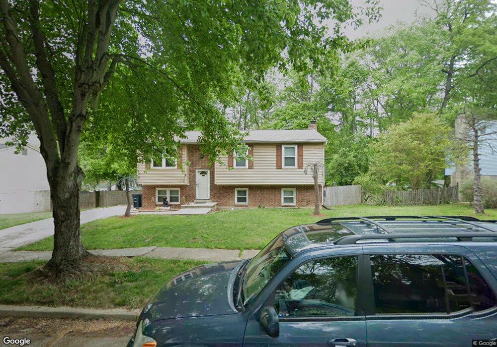
1718 Blount Dr Fort Washington, MD 20744
Estimated Value: $347,129 - $432,000
--
Bed
2
Baths
1,028
Sq Ft
$386/Sq Ft
Est. Value
About This Home
This home is located at 1718 Blount Dr, Fort Washington, MD 20744 and is currently estimated at $397,282, approximately $386 per square foot. 1718 Blount Dr is a home located in Prince George's County with nearby schools including Rose Valley Elementary School, Friendly High School, and St Columba Catholic School.
Ownership History
Date
Name
Owned For
Owner Type
Purchase Details
Closed on
Oct 29, 2002
Sold by
Jackson Harry O
Bought by
Jackson Harry O
Current Estimated Value
Purchase Details
Closed on
Jul 21, 1994
Sold by
Rivers William T
Bought by
Jackson Harry O
Home Financials for this Owner
Home Financials are based on the most recent Mortgage that was taken out on this home.
Original Mortgage
$119,900
Interest Rate
8.19%
Purchase Details
Closed on
Aug 3, 1983
Sold by
Page Builders Inc
Bought by
Rivers William T and Rivers Diane M
Create a Home Valuation Report for This Property
The Home Valuation Report is an in-depth analysis detailing your home's value as well as a comparison with similar homes in the area
Home Values in the Area
Average Home Value in this Area
Purchase History
| Date | Buyer | Sale Price | Title Company |
|---|---|---|---|
| Jackson Harry O | -- | -- | |
| Jackson Harry O | $89,800 | -- | |
| Rivers William T | $70,400 | -- |
Source: Public Records
Mortgage History
| Date | Status | Borrower | Loan Amount |
|---|---|---|---|
| Previous Owner | Jackson Harry O | $119,900 |
Source: Public Records
Tax History Compared to Growth
Tax History
| Year | Tax Paid | Tax Assessment Tax Assessment Total Assessment is a certain percentage of the fair market value that is determined by local assessors to be the total taxable value of land and additions on the property. | Land | Improvement |
|---|---|---|---|---|
| 2025 | $4,092 | $328,433 | -- | -- |
| 2024 | $4,092 | $322,500 | $101,200 | $221,300 |
| 2023 | $3,918 | $299,700 | $0 | $0 |
| 2022 | $3,709 | $276,900 | $0 | $0 |
| 2021 | $3,505 | $254,100 | $100,600 | $153,500 |
| 2020 | $3,442 | $245,000 | $0 | $0 |
| 2019 | $3,361 | $235,900 | $0 | $0 |
| 2018 | $3,264 | $226,800 | $75,600 | $151,200 |
| 2017 | $3,144 | $209,267 | $0 | $0 |
| 2016 | -- | $191,733 | $0 | $0 |
| 2015 | $3,280 | $174,200 | $0 | $0 |
| 2014 | $3,280 | $174,200 | $0 | $0 |
Source: Public Records
Map
Nearby Homes
- 1704 Dania Dr
- 1720 Rhodesia Ave
- 9004 Mill Ct
- 9600 Caltor Ln
- 8910 Palmer St
- 2201 Monticello Ct
- 0 Old Palmer Rd Unit MDPG2181376
- 9410 Dashia Dr
- 1270 Palmer Rd Unit 92
- 9824 Old Fort Rd
- 1470 Potomac Heights Dr Unit 126
- 1456 Potomac Heights Dr Unit 145
- 1498 Potomac Heights Dr Unit 140
- 8768 Grasmere Ct
- 1152 Windemere Ct
- 921 Palmer Rd
- 8707 Grasmere Ct
- 9903 Allen Gayle Dr
- 1532 Potomac Heights Dr Unit 204
- 8706 Devon Hills Dr Unit D
- 1720 Blount Dr
- 1716 Blount Dr
- 1703 Lorelei Dr
- 1705 Lorelei Dr
- 1714 Blount Dr
- 1722 Blount Dr
- 1701 Lorelei Dr
- 1717 Blount Dr
- 1719 Blount Dr
- 1707 Lorelei Dr
- 1715 Blount Dr
- 1721 Blount Dr
- 1611 Lorelei Dr
- 1724 Blount Dr
- 1712 Blount Dr
- 1709 Lorelei Dr
- 1723 Blount Dr
- 1713 Blount Dr
- 1702 Lorelei Dr
- 1609 Lorelei Dr