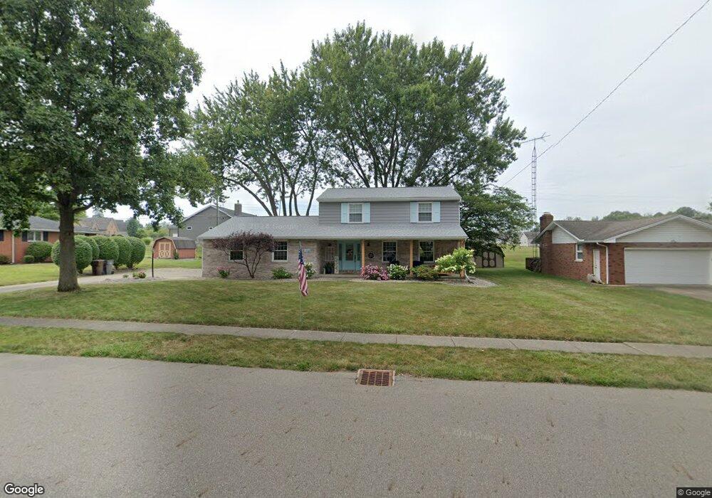
1718 Edmar St Louisville, OH 44641
Estimated Value: $234,000 - $280,000
4
Beds
3
Baths
1,887
Sq Ft
$138/Sq Ft
Est. Value
About This Home
This home is located at 1718 Edmar St, Louisville, OH 44641 and is currently estimated at $259,822, approximately $137 per square foot. 1718 Edmar St is a home located in Stark County with nearby schools including Louisville High School and St. Thomas Aquinas High School & Middle School.
Ownership History
Date
Name
Owned For
Owner Type
Purchase Details
Closed on
Oct 19, 2004
Sold by
Martin Darrell L and Martin Annette L
Bought by
Harsh Jerald W and Harsh Marne L
Current Estimated Value
Home Financials for this Owner
Home Financials are based on the most recent Mortgage that was taken out on this home.
Original Mortgage
$130,700
Outstanding Balance
$60,265
Interest Rate
4.75%
Mortgage Type
Purchase Money Mortgage
Estimated Equity
$199,557
Purchase Details
Closed on
Sep 22, 1997
Sold by
Glass Richard A
Bought by
Martin Darrell L and Martin Annette L
Home Financials for this Owner
Home Financials are based on the most recent Mortgage that was taken out on this home.
Original Mortgage
$106,000
Interest Rate
7.55%
Mortgage Type
New Conventional
Purchase Details
Closed on
Jul 7, 1992
Purchase Details
Closed on
Nov 3, 1988
Create a Home Valuation Report for This Property
The Home Valuation Report is an in-depth analysis detailing your home's value as well as a comparison with similar homes in the area
Home Values in the Area
Average Home Value in this Area
Purchase History
| Date | Buyer | Sale Price | Title Company |
|---|---|---|---|
| Harsh Jerald W | $147,700 | Grimsley Title Agency | |
| Martin Darrell L | $127,000 | -- | |
| -- | $106,000 | -- | |
| -- | $82,000 | -- |
Source: Public Records
Mortgage History
| Date | Status | Borrower | Loan Amount |
|---|---|---|---|
| Open | Harsh Jerald W | $130,700 | |
| Closed | Martin Darrell L | $106,000 |
Source: Public Records
Tax History Compared to Growth
Tax History
| Year | Tax Paid | Tax Assessment Tax Assessment Total Assessment is a certain percentage of the fair market value that is determined by local assessors to be the total taxable value of land and additions on the property. | Land | Improvement |
|---|---|---|---|---|
| 2025 | -- | $70,460 | $17,290 | $53,170 |
| 2024 | -- | $70,460 | $17,290 | $53,170 |
| 2023 | $2,414 | $56,180 | $16,310 | $39,870 |
| 2022 | $2,420 | $56,180 | $16,310 | $39,870 |
| 2021 | $2,427 | $56,180 | $16,310 | $39,870 |
| 2020 | $2,038 | $51,240 | $14,700 | $36,540 |
| 2019 | $2,047 | $52,150 | $14,700 | $37,450 |
| 2018 | $2,075 | $52,150 | $14,700 | $37,450 |
| 2017 | $1,903 | $46,140 | $12,920 | $33,220 |
| 2016 | $1,942 | $46,140 | $12,920 | $33,220 |
| 2015 | $1,947 | $46,140 | $12,920 | $33,220 |
| 2014 | $1,810 | $39,870 | $11,170 | $28,700 |
| 2013 | $909 | $39,870 | $11,170 | $28,700 |
Source: Public Records
Map
Nearby Homes
- 2110 Edmar St
- 1715 High St
- 1812 E Broad St
- 641 S Nickelplate St
- 908 Sand Lot Cir
- 520 S Silver St
- 308 Superior St
- 3390 Meese Rd NE
- 728 E Broad St
- 2015 E Main St
- 0 Michigan Blvd
- 510 S Bauman Ct
- 204 E Broad St
- 107 E Broad St
- 8225 Georgetown St
- 1702 View Pointe Ave
- 325 Lincoln Ave
- 1639 Horizon Dr
- 1170 Winding Ridge Ave
- 910 Crosswyck Cir
- 1708 Edmar St
- 1728 Edmar St
- 1217 S Marion Ave
- 1719 Edmar St
- 1638 Edmar St
- 1731 Edmar St
- 1709 Edmar St
- 1227 S Marion Ave
- 1218 S Marion Ave
- 1804 Edmar St
- 1637 Edmar St
- 1635 Presidents Square Unit 48
- 1628 Edmar St
- 1720 Opal St
- 1805 Edmar St
- 1730 Opal St
- 1237 S Marion Ave
- 1641 Presidents Square Unit 49
- 1710 Opal St
- 1627 Edmar St