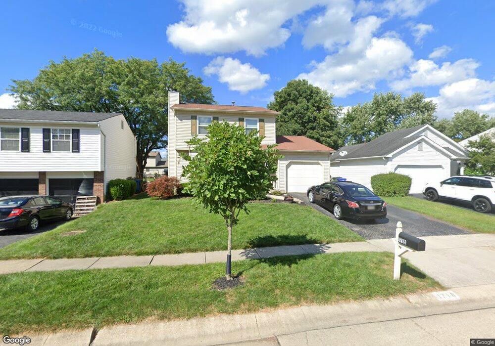
1718 Laredo Ct Powell, OH 43065
Western Hills NeighborhoodEstimated Value: $309,000 - $343,000
3
Beds
2
Baths
1,320
Sq Ft
$249/Sq Ft
Est. Value
About This Home
This home is located at 1718 Laredo Ct, Powell, OH 43065 and is currently estimated at $328,485, approximately $248 per square foot. 1718 Laredo Ct is a home located in Franklin County with nearby schools including Liberty Elementary School, McCord Middle School, and Worthington Kilbourne High School.
Ownership History
Date
Name
Owned For
Owner Type
Purchase Details
Closed on
Sep 6, 2024
Sold by
Henwood Michael J and Henwood Theresa A
Bought by
Michael J Henwood And Theresa A Henwood Trust and Henwood
Current Estimated Value
Purchase Details
Closed on
Mar 15, 2001
Sold by
Skehan Kevin H and Skehan Mary B
Bought by
Henwood Michael J and Henwood Theresa A
Home Financials for this Owner
Home Financials are based on the most recent Mortgage that was taken out on this home.
Original Mortgage
$109,038
Interest Rate
7.03%
Mortgage Type
FHA
Purchase Details
Closed on
Mar 11, 1985
Bought by
Skehan Kevin J and Skehan Mary B
Purchase Details
Closed on
Jan 1, 1985
Create a Home Valuation Report for This Property
The Home Valuation Report is an in-depth analysis detailing your home's value as well as a comparison with similar homes in the area
Home Values in the Area
Average Home Value in this Area
Purchase History
| Date | Buyer | Sale Price | Title Company |
|---|---|---|---|
| Michael J Henwood And Theresa A Henwood Trust | -- | None Listed On Document | |
| Henwood Michael J | $109,900 | Title First Agency Inc | |
| Skehan Kevin J | $68,100 | -- | |
| -- | $11,000 | -- |
Source: Public Records
Mortgage History
| Date | Status | Borrower | Loan Amount |
|---|---|---|---|
| Previous Owner | Henwood Michael J | $109,038 |
Source: Public Records
Tax History
| Year | Tax Paid | Tax Assessment Tax Assessment Total Assessment is a certain percentage of the fair market value that is determined by local assessors to be the total taxable value of land and additions on the property. | Land | Improvement |
|---|---|---|---|---|
| 2025 | $5,985 | $97,480 | $27,230 | $70,250 |
| 2024 | $5,985 | $97,480 | $27,230 | $70,250 |
| 2023 | $5,723 | $97,475 | $27,230 | $70,245 |
| 2022 | $7,320 | $67,700 | $14,460 | $53,240 |
| 2021 | $4,621 | $67,700 | $14,460 | $53,240 |
| 2020 | $4,451 | $67,700 | $14,460 | $53,240 |
| 2019 | $4,119 | $56,530 | $12,040 | $44,490 |
| 2018 | $3,720 | $56,530 | $12,040 | $44,490 |
| 2017 | $3,691 | $56,530 | $12,040 | $44,490 |
| 2016 | $3,450 | $48,590 | $12,500 | $36,090 |
| 2015 | $3,450 | $48,590 | $12,500 | $36,090 |
| 2014 | $3,449 | $48,590 | $12,500 | $36,090 |
| 2013 | $1,716 | $48,580 | $12,495 | $36,085 |
Source: Public Records
Map
Nearby Homes
- 8205 Longhorn Rd
- 8213 Longhorn Rd
- 1539 Clubview Blvd S
- 1908 Lost Valley Rd
- 1760 Fallhaven Dr
- 1986 Sutter Pkwy
- 1436 Park Ridge Dr
- 7898 Sarahurst Dr
- 7907 Sarahurst Dr
- 2074 Hard Rd
- 8622 Renford Ct
- 7746 Sagemeadow Ct
- 8208 Copperfield Dr
- 2001 Sawbury Blvd Unit 2001
- 1327 Donahey St
- 8292 Breckenridge Way
- 941 Clubview Blvd S
- 1930 Shallowford Ave
- 1001 Rutherglen Dr
- 1978 Shallowford Ave
- 1710 Laredo Ct
- 1724 Laredo Ct
- 1700 Laredo Ct
- 8120 Saddle Run
- 1713 Laramie Dr
- 1705 Laramie Dr
- 1721 Laramie Dr
- 1694 Laredo Ct
- 1729 Laramie Dr
- 1713 Laredo Ct
- 1721 Laredo Ct
- 1697 Laramie Dr
- 1705 Laredo Ct
- 1689 Laramie Dr
- 1686 Laredo Ct
- 1729 Laredo Ct
- 1697 Laredo Ct
- 1681 Laramie Dr
- 1689 Laredo Ct
- 8100 Saddle Run
Your Personal Tour Guide
Ask me questions while you tour the home.