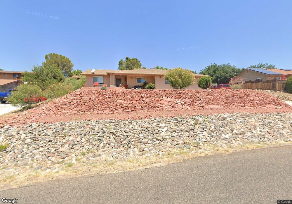
1718 S Destry Ln Cottonwood, AZ 86326
Estimated Value: $439,708 - $459,000
3
Beds
2
Baths
1,420
Sq Ft
$315/Sq Ft
Est. Value
About This Home
This home is located at 1718 S Destry Ln, Cottonwood, AZ 86326 and is currently estimated at $446,927, approximately $314 per square foot. 1718 S Destry Ln is a home located in Yavapai County with nearby schools including Dr Daniel Bright Elementary School, Cottonwood Elementary School, and Cottonwood Community School.
Ownership History
Date
Name
Owned For
Owner Type
Purchase Details
Closed on
Apr 21, 2016
Sold by
Kvetko Robin and Estate Of Edward Kvetko
Bought by
Day Guy E and Day Dora M
Current Estimated Value
Home Financials for this Owner
Home Financials are based on the most recent Mortgage that was taken out on this home.
Original Mortgage
$215,033
Outstanding Balance
$171,222
Interest Rate
3.75%
Mortgage Type
FHA
Estimated Equity
$275,705
Purchase Details
Closed on
Dec 18, 2013
Sold by
Silver Linings Investment Group Llc
Bought by
Kvetko Ed
Purchase Details
Closed on
Mar 21, 2013
Sold by
Lim Martin and Bouquet Gena
Bought by
Silver Linings Investment Group Llc
Purchase Details
Closed on
Aug 6, 2003
Sold by
Ballard Cz and Ballard Cris
Bought by
Bouquet Gena
Create a Home Valuation Report for This Property
The Home Valuation Report is an in-depth analysis detailing your home's value as well as a comparison with similar homes in the area
Home Values in the Area
Average Home Value in this Area
Purchase History
| Date | Buyer | Sale Price | Title Company |
|---|---|---|---|
| Day Guy E | $219,000 | Yavapai Title | |
| Kvetko Ed | $17,500 | Lawyers Title Yavapai-Coconi | |
| Silver Linings Investment Group Llc | $142,000 | Empire West Title Agency Sed | |
| Bouquet Gena | $30,600 | Transnation Title Ins Co |
Source: Public Records
Mortgage History
| Date | Status | Borrower | Loan Amount |
|---|---|---|---|
| Open | Day Guy E | $215,033 |
Source: Public Records
Tax History Compared to Growth
Tax History
| Year | Tax Paid | Tax Assessment Tax Assessment Total Assessment is a certain percentage of the fair market value that is determined by local assessors to be the total taxable value of land and additions on the property. | Land | Improvement |
|---|---|---|---|---|
| 2026 | $1,920 | $36,748 | -- | -- |
| 2024 | $1,845 | $36,351 | -- | -- |
| 2023 | $1,845 | $29,558 | $3,534 | $26,024 |
| 2022 | $1,813 | $24,264 | $2,854 | $21,410 |
| 2021 | $1,894 | $22,644 | $2,985 | $19,659 |
| 2020 | $1,859 | $0 | $0 | $0 |
| 2019 | $1,826 | $0 | $0 | $0 |
| 2018 | $1,752 | $0 | $0 | $0 |
| 2017 | $1,675 | $0 | $0 | $0 |
| 2016 | $1,633 | $0 | $0 | $0 |
| 2015 | -- | $0 | $0 | $0 |
| 2014 | -- | $0 | $0 | $0 |
Source: Public Records
Map
Nearby Homes
- 1775 Camino Real Unit 2841
- 1532 Camino Real Unit 2983
- 1851 E Donner Trail
- 1736 S Gold Rush Rd
- 1546 E Sunset Cir
- 1675 S Carpenter Ln
- 1537 S Verde Dr
- 1379 E Hermits Cir
- 2092 E Arrowhead Ln
- 1476 S Verde Dr
- 923 E Buena Vista Dr
- 869 E Bow Maker Trail
- 000 S Lost Spur Ln Unit 5
- 784 Desert Jewel Dr
- 1196 S 16th Place
- 743 E Cherry Hills Way
- 2647 Lobo Cir
- 1922 S Jewel Cir
- 1751 E Parada Del Sol
- 2102 S Arrowhead Ln Unit 3697
- 1710 S Destry Ln
- 1730 S Destry Ln
- 1647 E Sandy Ln
- 1627 E Sandy Ln
- 1657 E Sandy Ln
- 1711 S Destry Ln
- 1727 S Destry Ln
- 1694 S Destry Ln
- 1742 S Destry Ln
- 1663 S Sky View Cir
- 1695 S Destry Ln
- 1630 E Sandy Ln
- 1656 E Sandy Ln
- 1615 E Sandy Ln
- 1669 E Sandy Ln
- 1686 S Destry Ln
- 1750 S Destry Ln
- 1828 E Rio Mesa Trail
- 1670 E Sandy Ln
- 1604 E Sandy Ln