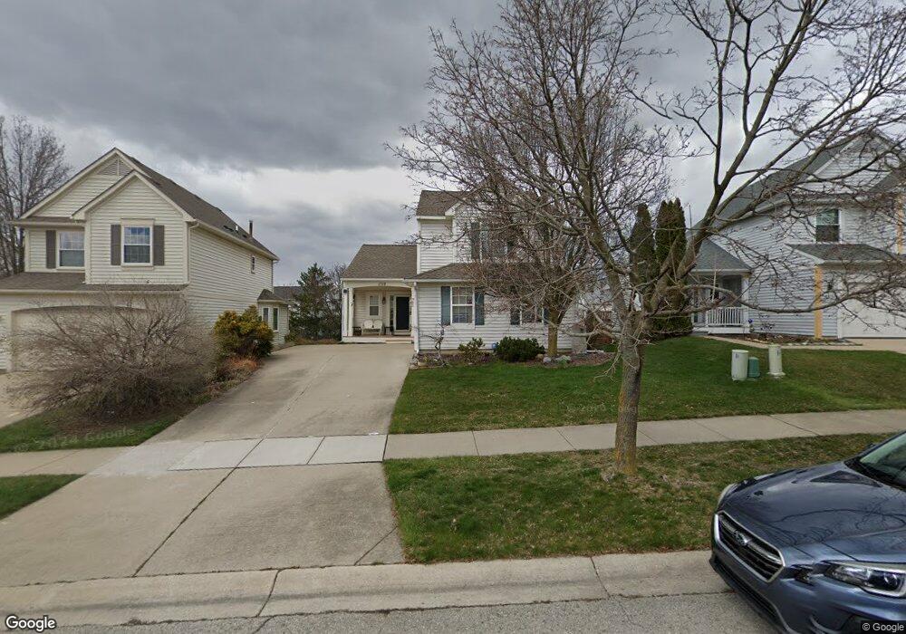
1718 Scio Ridge Rd Ann Arbor, MI 48103
Estimated Value: $472,261 - $516,000
3
Beds
3
Baths
1,901
Sq Ft
$258/Sq Ft
Est. Value
About This Home
This home is located at 1718 Scio Ridge Rd, Ann Arbor, MI 48103 and is currently estimated at $490,815, approximately $258 per square foot. 1718 Scio Ridge Rd is a home located in Washtenaw County with nearby schools including Dicken Elementary School, Slauson Middle School, and Pioneer High School.
Ownership History
Date
Name
Owned For
Owner Type
Purchase Details
Closed on
Oct 15, 1997
Sold by
John Richards Homes and John Wexf
Bought by
Catherine Martin
Current Estimated Value
Home Financials for this Owner
Home Financials are based on the most recent Mortgage that was taken out on this home.
Original Mortgage
$110,000
Outstanding Balance
$17,983
Interest Rate
7.65%
Mortgage Type
New Conventional
Estimated Equity
$472,832
Create a Home Valuation Report for This Property
The Home Valuation Report is an in-depth analysis detailing your home's value as well as a comparison with similar homes in the area
Home Values in the Area
Average Home Value in this Area
Purchase History
| Date | Buyer | Sale Price | Title Company |
|---|---|---|---|
| Catherine Martin | $172,750 | -- |
Source: Public Records
Mortgage History
| Date | Status | Borrower | Loan Amount |
|---|---|---|---|
| Open | Catherine Martin | $110,000 |
Source: Public Records
Tax History Compared to Growth
Tax History
| Year | Tax Paid | Tax Assessment Tax Assessment Total Assessment is a certain percentage of the fair market value that is determined by local assessors to be the total taxable value of land and additions on the property. | Land | Improvement |
|---|---|---|---|---|
| 2025 | -- | $202,800 | $0 | $0 |
| 2024 | $3,156 | $202,900 | $0 | $0 |
| 2023 | $3,032 | $160,400 | $0 | $0 |
| 2022 | $4,275 | $143,900 | $0 | $0 |
| 2021 | $4,066 | $141,200 | $0 | $0 |
| 2020 | $4,163 | $139,000 | $0 | $0 |
| 2019 | $3,848 | $131,900 | $131,900 | $0 |
| 2018 | $3,747 | $126,300 | $0 | $0 |
| 2017 | $3,614 | $123,200 | $0 | $0 |
| 2016 | $2,520 | $99,104 | $0 | $0 |
| 2015 | -- | $98,808 | $0 | $0 |
| 2014 | -- | $95,721 | $0 | $0 |
| 2013 | -- | $95,721 | $0 | $0 |
Source: Public Records
Map
Nearby Homes
- 1770 Harley Dr
- 1599 Scio Ridge Rd
- 1929 Harley Dr
- 1860 Chicory Ridge
- 1419 N Bay Dr Unit 73
- 2512 Jade Ct Unit 18
- 1740 S Maple Rd Unit 2
- 1366 N Bay Dr Unit 144
- 2126 Pauline Blvd Unit 104
- 1225 S Maple Rd Unit 307
- 2165 Pauline Ct Unit 14
- 1235 S Maple Rd Unit 202
- 2120 Pauline Blvd Unit 305
- 1265 S Maple Rd Unit 207
- 2147 Pauline Ct Unit 17
- 2104 Pauline Blvd Unit 305
- 2033 Pauline Ct
- 813 E Summerfield Glen Cir
- 1021 Bluestem Ln Unit 29
- 1720 Avondale Ave
- 1706 Scio Ridge Rd
- 1730 Scio Ridge Rd
- 1683 Abigail Way
- 1689 Abigail Way
- 1675 Abigail Way
- 1695 Abigail Way
- 1700 Scio Ridge Rd
- 1669 Abigail Way
- 1736 Scio Ridge Rd
- 1741 Reserve Way
- 1717 Scio Ridge Rd
- 1735 Reserve Way
- 1711 Scio Ridge Rd
- 1692 Scio Ridge Rd
- 1663 Abigail Way
- 1733 Scio Ridge Rd
- 1729 Reserve Way
- 1705 Scio Ridge Rd
- 1699 Scio Ridge Rd
- 1739 Scio Ridge Rd