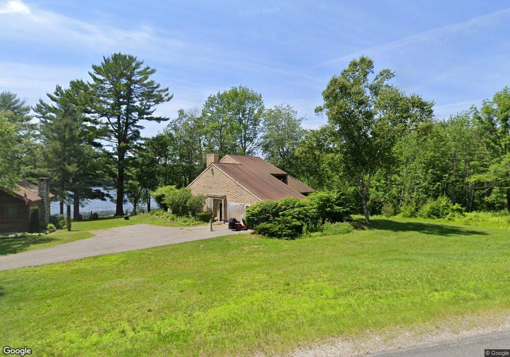
1718 State Route 46 Bucksport, ME 04416
Estimated Value: $500,000 - $701,000
--
Bed
1
Bath
1,988
Sq Ft
$311/Sq Ft
Est. Value
About This Home
This home is located at 1718 State Route 46, Bucksport, ME 04416 and is currently estimated at $618,539, approximately $311 per square foot. 1718 State Route 46 is a home with nearby schools including G. Herbert Jewett School, Miles Lane School, and Bucksport Middle School.
Ownership History
Date
Name
Owned For
Owner Type
Purchase Details
Closed on
Nov 8, 2019
Sold by
Borguss Erich F and Borguss Laura A
Bought by
Fernandez Jessica C
Current Estimated Value
Home Financials for this Owner
Home Financials are based on the most recent Mortgage that was taken out on this home.
Original Mortgage
$164,000
Outstanding Balance
$144,278
Interest Rate
3.6%
Mortgage Type
New Conventional
Estimated Equity
$474,261
Purchase Details
Closed on
Jul 31, 2015
Sold by
Blake-Kline Bonnie
Bought by
Borguss Erich F and Borguss Laura A
Create a Home Valuation Report for This Property
The Home Valuation Report is an in-depth analysis detailing your home's value as well as a comparison with similar homes in the area
Home Values in the Area
Average Home Value in this Area
Purchase History
| Date | Buyer | Sale Price | Title Company |
|---|---|---|---|
| Fernandez Jessica C | -- | -- | |
| Borguss Erich F | -- | -- |
Source: Public Records
Mortgage History
| Date | Status | Borrower | Loan Amount |
|---|---|---|---|
| Open | Fernandez Jessica C | $164,000 |
Source: Public Records
Tax History Compared to Growth
Tax History
| Year | Tax Paid | Tax Assessment Tax Assessment Total Assessment is a certain percentage of the fair market value that is determined by local assessors to be the total taxable value of land and additions on the property. | Land | Improvement |
|---|---|---|---|---|
| 2024 | $7,076 | $534,040 | $216,140 | $317,900 |
| 2023 | $6,809 | $534,040 | $216,140 | $317,900 |
| 2022 | $6,956 | $410,410 | $204,600 | $205,810 |
| 2021 | $6,669 | $410,410 | $204,600 | $205,810 |
| 2020 | $6,494 | $399,610 | $193,800 | $205,810 |
| 2019 | $6,514 | $399,610 | $193,800 | $205,810 |
| 2018 | $6,188 | $399,610 | $193,800 | $205,810 |
| 2017 | $6,543 | $398,950 | $193,800 | $205,150 |
| 2016 | $6,584 | $399,000 | $193,850 | $205,150 |
| 2015 | $6,823 | $399,000 | $194,000 | $205,000 |
| 2014 | $5,632 | $399,145 | $193,850 | $205,295 |
| 2013 | $5,412 | $399,150 | $193,850 | $205,300 |
Source: Public Records
Map
Nearby Homes
- 1548 State Route 46
- 1365 Bucksmills Rd
- M 15 L 43 Brookview Dr
- MAP16LOT10 Upper Long Pond Rd
- MAP15LOT56 Upper Long Pond Rd
- 51 Brookview Dr
- 1420 Bucksmills Rd
- Lots 2&3 Maple Ridge Rd
- M25 L12-02 Maine 46
- 88 Adams Ln
- 151 Mill Rd
- 0 Bald Mountain Rd Unit 1635891
- 672 Lower Dedham Rd
- 11 High Hill Ct
- 00 Moosehorn Dr
- 1076 State Route 46
- Lot 005 Maine 46
- 48 Bluff Rd
- 53 Winkumpaugh Rd
- 1, 23, 24 Cottage Shore Dr
- 1708 State Route 46
- 1704 State Route 46
- 34 Nason Hollow
- 33 Nason Hollow
- 1690 State Route 46
- 1747 State Route 46
- 1765 State Route 46
- 1668 State Route 46
- 1677 State Route 46
- 1651 State Route 46
- 1801 State Route 46
- 1622 State Route 46
- 1625 State Route 46
- 00 State Route 46
- 38 Stone House Rd
- 1616 State Route 46
- 1812 State Route 46
- 1817 State Route 46
- 1610 State Route 46
- 1606 State Route 46
