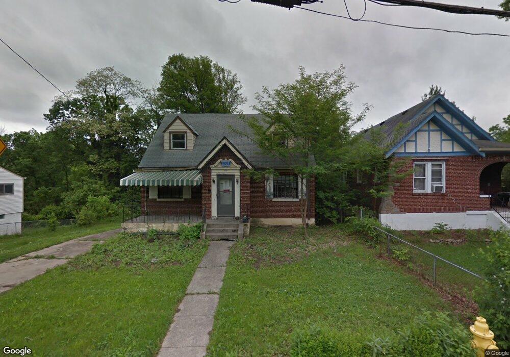
1718 Wyoming Ave Cincinnati, OH 45205
West Price Hill NeighborhoodEstimated Value: $142,005 - $152,000
3
Beds
2
Baths
928
Sq Ft
$158/Sq Ft
Est. Value
About This Home
This home is located at 1718 Wyoming Ave, Cincinnati, OH 45205 and is currently estimated at $147,001, approximately $158 per square foot. 1718 Wyoming Ave is a home located in Hamilton County with nearby schools including Carson School, Gilbert A. Dater High School, and Western Hills High School.
Ownership History
Date
Name
Owned For
Owner Type
Purchase Details
Closed on
Jun 4, 2024
Sold by
Price Hill Will
Bought by
Carter Crystal Lynn and Carter Richard Joseph
Current Estimated Value
Purchase Details
Closed on
May 24, 2019
Sold by
Will Price Hill
Bought by
Mayes Crystal Lynn and Carter Richard Joseph
Home Financials for this Owner
Home Financials are based on the most recent Mortgage that was taken out on this home.
Original Mortgage
$31,550
Interest Rate
4.2%
Mortgage Type
Land Contract Argmt. Of Sale
Purchase Details
Closed on
Jan 16, 2018
Sold by
Hamilton County Land Reutilization Corpo
Bought by
Will Price Hill
Purchase Details
Closed on
Dec 21, 2004
Sold by
Polaris Properties Llc
Bought by
Smith Regina A
Home Financials for this Owner
Home Financials are based on the most recent Mortgage that was taken out on this home.
Original Mortgage
$79,900
Interest Rate
8.5%
Mortgage Type
Fannie Mae Freddie Mac
Create a Home Valuation Report for This Property
The Home Valuation Report is an in-depth analysis detailing your home's value as well as a comparison with similar homes in the area
Home Values in the Area
Average Home Value in this Area
Purchase History
| Date | Buyer | Sale Price | Title Company |
|---|---|---|---|
| Carter Crystal Lynn | $15,775,000 | None Listed On Document | |
| Mayes Crystal Lynn | $33,060 | None Available | |
| Will Price Hill | -- | None Available | |
| Smith Regina A | $79,900 | Precision Land Title Agency |
Source: Public Records
Mortgage History
| Date | Status | Borrower | Loan Amount |
|---|---|---|---|
| Previous Owner | Mayes Crystal Lynn | $31,550 | |
| Previous Owner | Smith Regina A | $79,900 |
Source: Public Records
Tax History Compared to Growth
Tax History
| Year | Tax Paid | Tax Assessment Tax Assessment Total Assessment is a certain percentage of the fair market value that is determined by local assessors to be the total taxable value of land and additions on the property. | Land | Improvement |
|---|---|---|---|---|
| 2024 | $536 | $36,750 | $2,660 | $34,090 |
| 2023 | $685 | $50,803 | $2,660 | $48,143 |
| 2022 | $579 | $33,555 | $3,017 | $30,538 |
| 2021 | $567 | $33,555 | $3,017 | $30,538 |
| 2020 | $2,334 | $33,555 | $3,017 | $30,538 |
| 2019 | $567 | $7,378 | $2,744 | $4,634 |
| 2018 | $5 | $19,705 | $2,744 | $16,961 |
| 2017 | $5 | $19,705 | $2,744 | $16,961 |
| 2016 | $1,534 | $21,522 | $2,566 | $18,956 |
| 2015 | $1,383 | $21,522 | $2,566 | $18,956 |
| 2014 | $1,393 | $21,522 | $2,566 | $18,956 |
| 2013 | $1,609 | $24,455 | $2,916 | $21,539 |
Source: Public Records
Map
Nearby Homes
- 1709 Wyoming Ave
- 1702 Wyoming Ave
- 1506 Beech Ave
- 1438 Manss Ave
- 1318 Beech Ave
- 1697 Atson Ln
- 1605 Ross Ave
- 3810 W Liberty St
- 1601 Manss Ave
- 3744 Mayfield Ave
- 3742 Mayfield Ave
- 3910 W Liberty St
- 4000 W Liberty St
- 3634 W Liberty St
- 1645 Iliff Ave
- 1273 Iliff Ave
- 1660 Dewey Ave
- 1646 Dewey Ave
- 1215 Ridlen Ave
- 1634 Dewey Ave
- 1722 Wyoming Ave
- 1716 Wyoming Ave
- 1726 Wyoming Ave
- 1710 Wyoming Ave
- 1730 Wyoming Ave
- 1708 Wyoming Ave
- 1734 Wyoming Ave
- 1717 Wyoming Ave
- 1719 Wyoming Ave
- 1713 Wyoming Ave
- 1723 Wyoming Ave
- 1711 Wyoming Ave
- 1738 Wyoming Ave
- 1706 Wyoming Ave
- 1731 Wyoming Ave
- 1742 Wyoming Ave
- 1735 Wyoming Ave
- 1707 Wyoming Ave
- 1737 Wyoming Ave
- 1704 Wyoming Ave