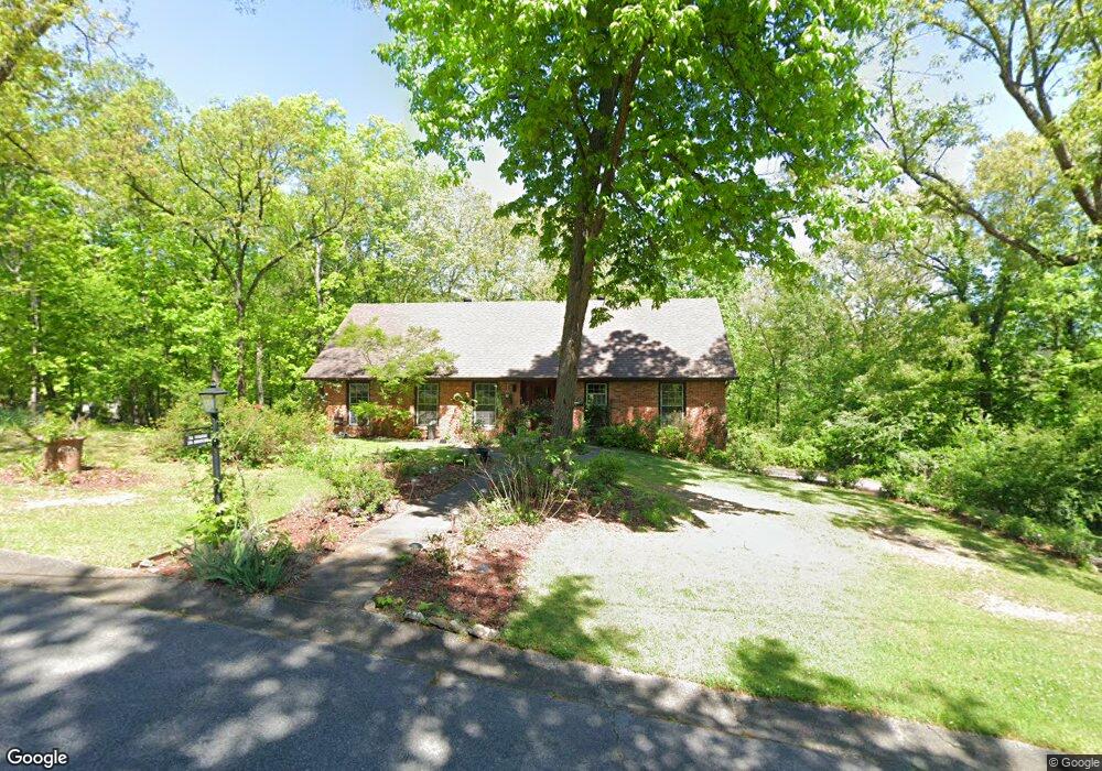
1719 Burningtree Dr Pelham, AL 35124
Estimated Value: $304,000 - $347,000
4
Beds
2
Baths
1,688
Sq Ft
$195/Sq Ft
Est. Value
About This Home
This home is located at 1719 Burningtree Dr, Pelham, AL 35124 and is currently estimated at $329,664, approximately $195 per square foot. 1719 Burningtree Dr is a home located in Shelby County with nearby schools including Pelham Oaks Elementary School, Pelham Park Middle School, and Pelham High School.
Ownership History
Date
Name
Owned For
Owner Type
Purchase Details
Closed on
Mar 14, 2024
Sold by
Goodacre Neal
Bought by
Goodacre Chun-Lin
Current Estimated Value
Purchase Details
Closed on
Oct 10, 2015
Sold by
Lin Ho Min
Bought by
Goodacre Chun Li and Goodacre Neal
Purchase Details
Closed on
Dec 28, 2010
Sold by
Lin Ho Min
Bought by
Ho Min Lin Living Trust
Purchase Details
Closed on
Aug 2, 2010
Sold by
Quinn Robert Michael and Quinn Gemma Faye
Bought by
Lin Ho Min
Purchase Details
Closed on
Feb 1, 2008
Sold by
Quinn Robert Michael and Quinn Gemma Faye
Bought by
Quinn Robert Micahel
Create a Home Valuation Report for This Property
The Home Valuation Report is an in-depth analysis detailing your home's value as well as a comparison with similar homes in the area
Home Values in the Area
Average Home Value in this Area
Purchase History
| Date | Buyer | Sale Price | Title Company |
|---|---|---|---|
| Goodacre Chun-Lin | $130,500 | None Listed On Document | |
| Goodacre Chun Li | $179,900 | None Available | |
| Ho Min Lin Living Trust | -- | None Available | |
| Lin Ho Min | -- | None Available | |
| Quinn Robert Micahel | $140,400 | None Available | |
| Quinn Robert Michael | $175,500 | None Available |
Source: Public Records
Tax History
| Year | Tax Paid | Tax Assessment Tax Assessment Total Assessment is a certain percentage of the fair market value that is determined by local assessors to be the total taxable value of land and additions on the property. | Land | Improvement |
|---|---|---|---|---|
| 2024 | $1,623 | $27,980 | $0 | $0 |
| 2023 | $1,468 | $26,020 | $0 | $0 |
| 2022 | $1,363 | $24,200 | $0 | $0 |
| 2021 | $1,170 | $20,880 | $0 | $0 |
| 2020 | $1,220 | $21,740 | $0 | $0 |
| 2019 | $1,102 | $19,700 | $0 | $0 |
| 2017 | $1,044 | $18,700 | $0 | $0 |
| 2015 | -- | $18,000 | $0 | $0 |
| 2014 | $721 | $17,640 | $0 | $0 |
Source: Public Records
Map
Nearby Homes
- 4704 Chippewa Ln
- 4526 Wooddale Dr
- 2221 Pelham Pkwy
- 4671 Wooddale Ln
- 114 Hayesbury Ln
- 143 Hayesbury Ln
- 3429 Mitoba Trail Unit 9
- 3449 Mitoba Trail Unit 8
- 3470 Mitoba Trail Unit 5
- 3469 Mitoba Trail Unit 7
- 3390 Mitoba Trail Unit 2
- 3370 Mitoba Trail Unit 1
- 3410 Mitoba Trail Unit 3
- 3489 Mitoba Trail Unit 6
- 2526 Chandawood Ln
- 133 Keeneland Green
- 2041 Parkview Rd
- 144 Stratford Cir
- 123 Braxton Way
- 111 Stratshire Ln
- 1708 Burningtree Dr
- 1800 Indian Hills Rd
- 1715 Burningtree Dr
- 1798 Indian Hills Rd
- 4722 Chippewa Ln
- 1804 Indian Hills Rd
- 1706 Burningtree Dr
- 1794 Indian Hills Rd
- 1709 Burningtree Dr
- 1795 Indian Hills Rd
- 1799 Indian Hills Rd
- 1805 Indian Hills Rd
- 4705 Chippewa Ln
- 4712 Chippewa Ln
- 1790 Indian Hills Rd
- 4720 Chippewa Ln
- 1704 Burningtree Dr
- 0 Indian Hills Rd Unit 495914
- 4724 Chippewa Ln
Your Personal Tour Guide
Ask me questions while you tour the home.