Estimated Value: $750,757 - $789,000
4
Beds
3
Baths
2,708
Sq Ft
$284/Sq Ft
Est. Value
About This Home
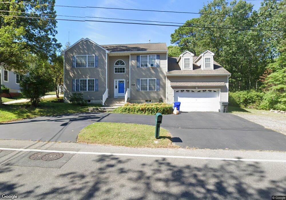
This home is located at 1719 Burrsville Rd, Brick, NJ 08724 and is currently estimated at $769,439, approximately $284 per square foot. 1719 Burrsville Rd is a home located in Ocean County with nearby schools including Lanes Mill Elementary School, Veterans Memorial Middle School, and Brick Township Memorial High School.
Ownership History
Date
Name
Owned For
Owner Type
Purchase Details
Closed on
Feb 3, 2005
Sold by
Anderson Richard G
Bought by
Lucas Vincent P and Lucas Dorothy G
Current Estimated Value
Home Financials for this Owner
Home Financials are based on the most recent Mortgage that was taken out on this home.
Original Mortgage
$299,000
Outstanding Balance
$152,776
Interest Rate
5.83%
Mortgage Type
Stand Alone First
Estimated Equity
$616,663
Purchase Details
Closed on
May 24, 2004
Sold by
Permaco Homes Inc
Bought by
Anderson Richard
Create a Home Valuation Report for This Property
The Home Valuation Report is an in-depth analysis detailing your home's value as well as a comparison with similar homes in the area
Home Values in the Area
Average Home Value in this Area
Purchase History
| Date | Buyer | Sale Price | Title Company |
|---|---|---|---|
| Lucas Vincent P | $379,000 | Fidelity Natl Title Ins Co | |
| Anderson Richard | $152,900 | -- |
Source: Public Records
Mortgage History
| Date | Status | Borrower | Loan Amount |
|---|---|---|---|
| Open | Lucas Vincent P | $299,000 |
Source: Public Records
Tax History Compared to Growth
Tax History
| Year | Tax Paid | Tax Assessment Tax Assessment Total Assessment is a certain percentage of the fair market value that is determined by local assessors to be the total taxable value of land and additions on the property. | Land | Improvement |
|---|---|---|---|---|
| 2025 | $10,171 | $389,700 | $117,600 | $272,100 |
| 2024 | $9,653 | $389,700 | $117,600 | $272,100 |
| 2023 | $9,513 | $389,700 | $117,600 | $272,100 |
| 2022 | $9,513 | $389,700 | $117,600 | $272,100 |
| 2021 | $8,679 | $389,700 | $117,600 | $272,100 |
| 2020 | $9,193 | $389,700 | $117,600 | $272,100 |
| 2019 | $9,029 | $389,700 | $117,600 | $272,100 |
| 2018 | $8,823 | $389,700 | $117,600 | $272,100 |
| 2017 | $8,585 | $389,700 | $117,600 | $272,100 |
| 2016 | $8,538 | $389,700 | $117,600 | $272,100 |
| 2015 | $8,316 | $389,700 | $117,600 | $272,100 |
| 2014 | $8,246 | $389,700 | $117,600 | $272,100 |
Source: Public Records
Map
Nearby Homes
- 1728 Burrsville Rd
- 40 Patmore Rd
- 1412 Forest Ave
- 1759 Burrsville Rd
- 10 Kingsley Ct
- 1430 Forest Ave
- 213 Blake Cir
- 1658 Burrsville Rd
- 7 Robinson Rd
- 1624 Patriot Ave
- 802 Sandra Place
- 56 Darley Cir
- 8 Constable St
- 41 Central Blvd
- 6 Hardy Ct
- 65 Central Blvd
- 60 Central Blvd
- 1449 Flintoft Ave
- 45 Tony Ct
- 5 Gray Ln
- 1717 Burrsville Rd
- 1725 Burrsville Rd
- 1722 Burrsville Rd
- 1711 Burrsville Rd
- Block 808 Hillcrest Ave Unit Block 808-Lot 12
- 1724 Burrsville Rd
- 31 Patmore Rd
- 33 Patmore Rd
- 29 Patmore Rd
- 27 Patmore Rd
- 1730 Burrsville Rd
- 1707 Burrsville Rd
- 17 Markham Rd
- 25 Patmore Rd
- 37 Patmore Rd
- 1747 Burrsville Rd
- 1734 Burrsville Rd
- 1753 Burrsville Rd
- 13 Markham Rd
- 19 Markham Rd