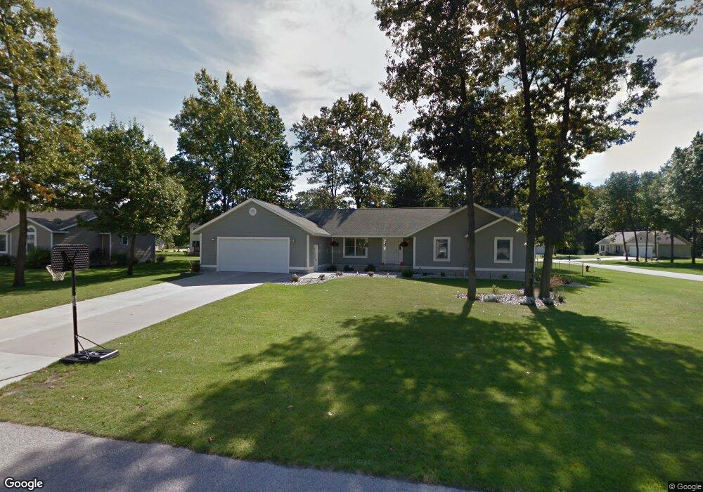
1719 Cornerstone Dr Muskegon, MI 49445
Estimated Value: $369,000 - $523,000
4
Beds
4
Baths
2,438
Sq Ft
$189/Sq Ft
Est. Value
About This Home
This home is located at 1719 Cornerstone Dr, Muskegon, MI 49445 and is currently estimated at $460,427, approximately $188 per square foot. 1719 Cornerstone Dr is a home located in Muskegon County with nearby schools including Reeths-Puffer High School.
Ownership History
Date
Name
Owned For
Owner Type
Purchase Details
Closed on
Jul 2, 2007
Sold by
Morris Edward B
Bought by
Norwood Ernest K and Norwood Janine A
Current Estimated Value
Home Financials for this Owner
Home Financials are based on the most recent Mortgage that was taken out on this home.
Original Mortgage
$195,570
Outstanding Balance
$121,405
Interest Rate
6.37%
Mortgage Type
New Conventional
Estimated Equity
$339,022
Purchase Details
Closed on
Mar 19, 2003
Sold by
Horton Woods Association Ii Llc
Bought by
Morris Edward B
Create a Home Valuation Report for This Property
The Home Valuation Report is an in-depth analysis detailing your home's value as well as a comparison with similar homes in the area
Home Values in the Area
Average Home Value in this Area
Purchase History
| Date | Buyer | Sale Price | Title Company |
|---|---|---|---|
| Norwood Ernest K | $217,300 | Harbor Title | |
| Morris Edward B | -- | -- |
Source: Public Records
Mortgage History
| Date | Status | Borrower | Loan Amount |
|---|---|---|---|
| Open | Norwood Ernest K | $195,570 |
Source: Public Records
Tax History Compared to Growth
Tax History
| Year | Tax Paid | Tax Assessment Tax Assessment Total Assessment is a certain percentage of the fair market value that is determined by local assessors to be the total taxable value of land and additions on the property. | Land | Improvement |
|---|---|---|---|---|
| 2025 | $3,513 | $237,800 | $0 | $0 |
| 2024 | $1,249 | $236,800 | $0 | $0 |
| 2023 | $1,194 | $212,800 | $0 | $0 |
| 2022 | $3,194 | $163,000 | $0 | $0 |
| 2021 | $3,109 | $146,700 | $0 | $0 |
| 2020 | $3,076 | $138,100 | $0 | $0 |
| 2019 | $3,019 | $127,400 | $0 | $0 |
| 2018 | $2,980 | $125,700 | $0 | $0 |
| 2017 | $3,015 | $97,900 | $0 | $0 |
| 2016 | $1,018 | $90,300 | $0 | $0 |
| 2015 | -- | $90,000 | $0 | $0 |
| 2014 | -- | $90,000 | $0 | $0 |
| 2013 | -- | $82,500 | $0 | $0 |
Source: Public Records
Map
Nearby Homes
- 1709 Hampstead Dr
- 1024 Bear Lake Rd
- 1596 Nottingham Ct
- 1516 W Addison Way Unit 54
- 1513 W Addison Way Unit 28
- 1518 W Addison Way Unit 54
- 1603 Horton Rd
- 1310 W Giles Rd
- 780 Horton Rd
- 1234 W Giles Rd
- 1045 Greenbriar Dr
- 1141 N Robinhood Dr
- 0 Horton Rd Unit 25046889
- 690 W Wedgewood Dr
- V/L W Giles Rd
- 1641 N Buys Rd
- 2055 Horton Rd
- 421 W Chadwick Dr
- 1463 Glenwood Ave
- 1616 Westwind Ct
- 1703 Cornerstone Dr
- 1718 Hampstead Dr
- 1702 Hampstead Dr
- 1720 Cornerstone Dr
- 1687 Cornerstone Dr
- 1704 Cornerstone Dr
- 1261 N Hampstead Dr
- 1734 Cornerstone Dr
- 1235 N Hampstead Dr
- 1686 Hampstead Dr
- 1255 N Hampstead Dr
- 1688 Cornerstone Dr
- 1221 N Hampstead Dr
- 1723 Hampstead Dr
- 1671 Cornerstone Dr
- 1735 Hampstead Dr
- 1670 Hampstead Dr
- 1697 Charlevoix Dr
- 1695 Hampstead Dr
- 1672 Cornerstone Dr