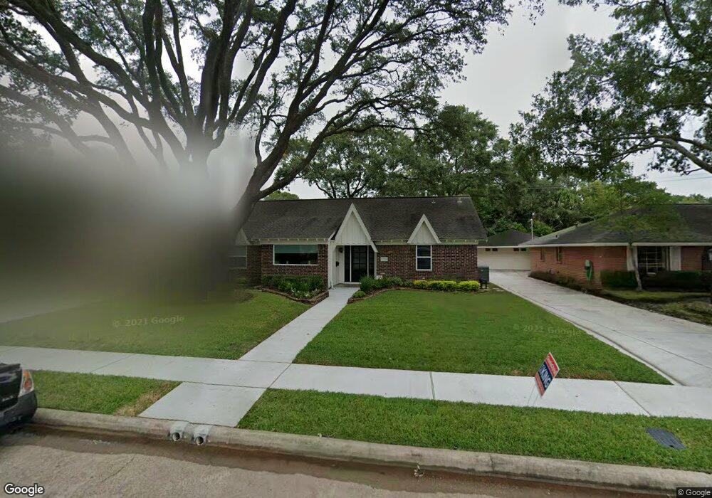
1719 Droxford Dr Houston, TX 77008
Lazy Brook-Timbergrove NeighborhoodEstimated Value: $708,000 - $818,000
3
Beds
2
Baths
2,073
Sq Ft
$371/Sq Ft
Est. Value
About This Home
This home is located at 1719 Droxford Dr, Houston, TX 77008 and is currently estimated at $769,346, approximately $371 per square foot. 1719 Droxford Dr is a home located in Harris County with nearby schools including Sinclair Elementary School, Frank Black Middle School, and Waltrip High School.
Ownership History
Date
Name
Owned For
Owner Type
Purchase Details
Closed on
Jul 23, 2004
Sold by
Simmons Clifford E and Simmons Cindy J
Bought by
Turner Michael and Turner Lisa
Current Estimated Value
Home Financials for this Owner
Home Financials are based on the most recent Mortgage that was taken out on this home.
Original Mortgage
$207,200
Outstanding Balance
$103,319
Interest Rate
6.3%
Mortgage Type
Purchase Money Mortgage
Estimated Equity
$666,027
Purchase Details
Closed on
Jul 18, 1995
Sold by
Boyle Joe B and Boyle Jan M
Bought by
Simmons Clifford E and Simmons Cindy J
Create a Home Valuation Report for This Property
The Home Valuation Report is an in-depth analysis detailing your home's value as well as a comparison with similar homes in the area
Home Values in the Area
Average Home Value in this Area
Purchase History
| Date | Buyer | Sale Price | Title Company |
|---|---|---|---|
| Turner Michael | -- | North American Title Company | |
| Simmons Clifford E | -- | Texas State Title |
Source: Public Records
Mortgage History
| Date | Status | Borrower | Loan Amount |
|---|---|---|---|
| Open | Turner Michael | $207,200 | |
| Closed | Turner Michael | $38,850 |
Source: Public Records
Tax History Compared to Growth
Tax History
| Year | Tax Paid | Tax Assessment Tax Assessment Total Assessment is a certain percentage of the fair market value that is determined by local assessors to be the total taxable value of land and additions on the property. | Land | Improvement |
|---|---|---|---|---|
| 2025 | $11,823 | $702,067 | $448,470 | $253,597 |
| 2024 | $11,823 | $756,913 | $407,700 | $349,213 |
| 2023 | $11,823 | $722,314 | $407,700 | $314,614 |
| 2022 | $14,148 | $642,544 | $350,622 | $291,922 |
| 2021 | $13,875 | $595,340 | $326,160 | $269,180 |
| 2020 | $14,133 | $583,625 | $326,160 | $257,465 |
| 2019 | $13,917 | $550,000 | $285,390 | $264,610 |
| 2018 | $11,829 | $596,300 | $277,236 | $319,064 |
| 2017 | $11,632 | $460,708 | $277,236 | $183,472 |
| 2016 | $9,665 | $399,632 | $277,236 | $122,396 |
| 2015 | $6,351 | $435,356 | $277,236 | $158,120 |
| 2014 | $6,351 | $361,836 | $244,620 | $117,216 |
Source: Public Records
Map
Nearby Homes
- 1723 Tannehill Dr
- 1814 Haverhill Dr
- 1606 Tannehill Dr
- 1607 Haverhill Dr
- 6518 Kury Ln
- 1607 Willowby Dr
- 1506 Foxwood Rd
- 1406 Foxwood Rd
- 1803 Sea Queen Ct
- 1803 Seaspray Ct
- 1727 Stacy Crest
- 1839 Stacy Crest
- 6322 Wynnwood Ln
- 1524 W 21st St
- 1726 Stacy Falls
- 1426 W 21st St Unit A
- 3130 Heritage Creek Terrace
- 3106 Heritage Creek Oaks
- 1546 W 23rd St
- 1516 W 23rd St
- 1715 Droxford Dr
- 1723 Droxford Dr
- 1718 Tannehill Dr
- 1714 Tannehill Dr
- 1711 Droxford Dr
- 1727 Droxford Dr
- 1722 Tannehill Dr
- 1710 Tannehill Dr
- 1726 Tannehill Dr
- 1718 Droxford Dr
- 1722 Droxford Dr
- 1714 Droxford Dr
- 1803 Droxford Dr
- 1706 Tannehill Dr
- 1710 Droxford Dr
- 1726 Droxford Dr
- 1802 Tannehill Dr
- 1807 Droxford Dr
- 1706 Droxford Dr
- 1802 Droxford Dr