R
Seller's Agent in 2022
Ronnie Pettiford
Century 21 Smith Branch & Pope

Estimated Value: $211,000 - $348,000
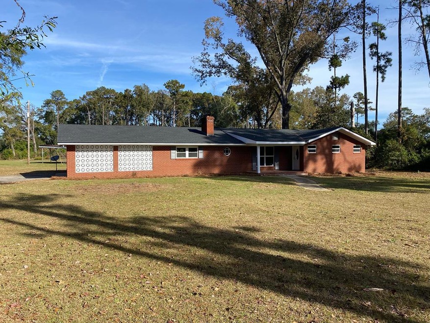
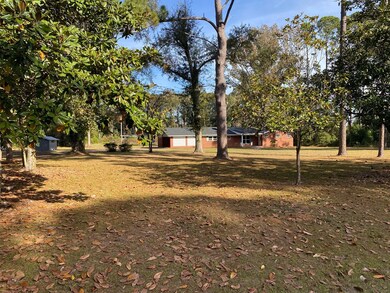
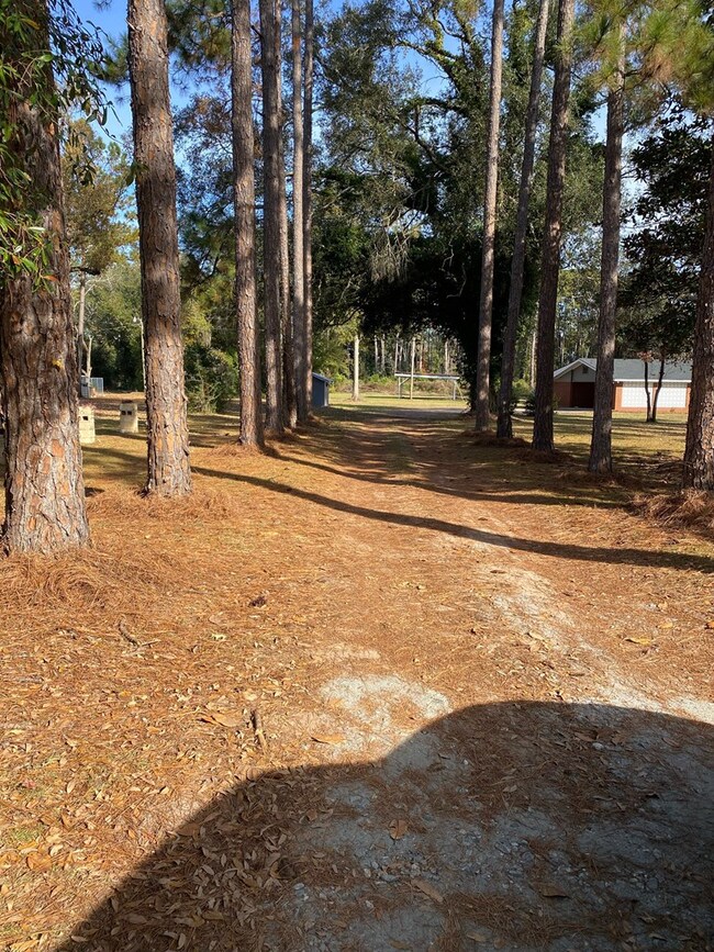
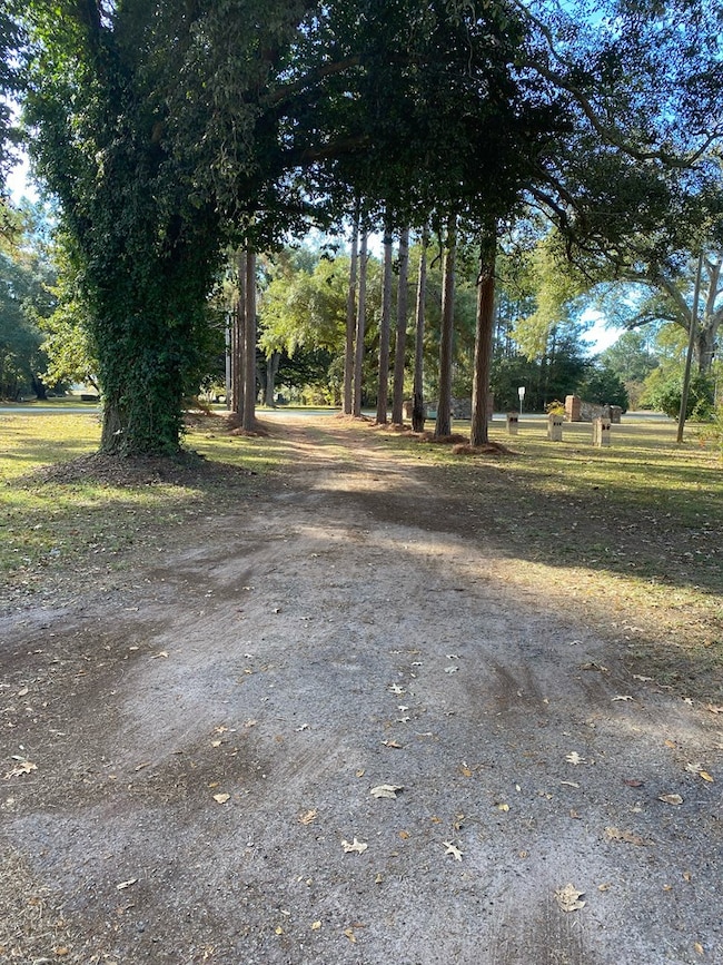
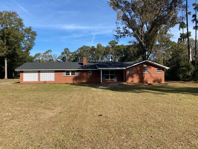
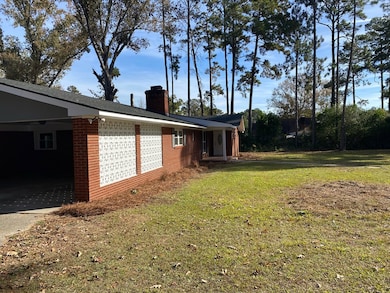
NEW ROOF!!!!!!! NEW HVAC!!!!!!NEWLY RENOVATED!!!!! LOTS OF FEATURES!!!! WELCOME HOME!!!!! Turning on to this beautiful tree-lined driveway you approach this newly renovated 3 bedroom 2 bathroom home with a bonus room, that sits on just over 3.5 acres. This home features an open concept kitchen and dining area, with striking accent walls to give the space plenty of character. This space features stainless steel appliances, granite countertops, and an island with Butcher's Block Top and plenty of cabinet storage. The spacious living room contains a fireplace and a built-in bookshelf, along with a remotely controlled ceiling fan. The floorplan places the large laundry room directly across the hallway from the master bedroom. Which features a large, shelved walk-in closet and a master bathroom with a glass and tiled shower and his and hers vanity sinks. The other 2 bedrooms are also very spacious and contain large closets. The hallway bathroom has a tub and shower combo and new vanity. The bonus room, separated from the main home by the carport would be great as a Mother-in-law suite, home office, or man cave, and has multiple entrances. The outdoor area is great for entertaining and has a large shelter for storage and a well house. Plenty of space means plenty of options to make truly make this house, Home.
Last Agent to Sell the Property
Ronnie Pettiford
Century 21 Smith Branch & Pope Brokerage Phone: 2293868737 License #386687 Listed on: 02/01/2022
| Date | Buyer | Sale Price | Title Company |
|---|---|---|---|
| Kincade Jean Ann | $265,500 | -- | |
| M & R Legacy Partners Llc | $60,000 | -- | |
| Norris Bishop Investments Inc | $34,000 | -- | |
| Moore James | -- | -- | |
| Moore James | $61,000 | -- | |
| White John | $84,500 | -- |
| Date | Event | Price | List to Sale | Price per Sq Ft | Prior Sale |
|---|---|---|---|---|---|
| 02/23/2022 02/23/22 | Sold | $265,500 | +342.5% | $125 / Sq Ft | |
| 02/01/2022 02/01/22 | Pending | -- | -- | -- | |
| 04/20/2021 04/20/21 | Sold | $60,000 | -1.6% | $28 / Sq Ft | View Prior Sale |
| 03/27/2021 03/27/21 | Pending | -- | -- | -- | |
| 07/20/2018 07/20/18 | Sold | $61,000 | -- | $29 / Sq Ft | View Prior Sale |
| 07/02/2018 07/02/18 | Pending | -- | -- | -- |
| Year | Tax Paid | Tax Assessment Tax Assessment Total Assessment is a certain percentage of the fair market value that is determined by local assessors to be the total taxable value of land and additions on the property. | Land | Improvement |
|---|---|---|---|---|
| 2024 | $2,231 | $50,280 | $12,280 | $38,000 |
| 2023 | $1,400 | $50,280 | $12,280 | $38,000 |
| 2022 | $2,050 | $44,240 | $12,280 | $31,960 |
| 2021 | $1,898 | $44,240 | $12,280 | $31,960 |
| 2020 | $1,815 | $44,240 | $12,280 | $31,960 |
| 2019 | $965 | $44,240 | $12,280 | $31,960 |
| 2018 | $1,824 | $44,240 | $12,280 | $31,960 |
| 2017 | $1,697 | $44,240 | $12,280 | $31,960 |
| 2016 | $1,698 | $44,240 | $12,280 | $31,960 |
| 2015 | $1,701 | $44,240 | $12,280 | $31,960 |
| 2014 | $1,587 | $41,960 | $10,000 | $31,960 |
R
Seller's Agent in 2022
Ronnie Pettiford
Century 21 Smith Branch & Pope

Buyer's Agent in 2022
Vickki Blanch
Love That House Realty Co, LLC
(229) 854-1952
108 Total Sales
Seller's Agent in 2021
Norris Bishop
Norris Bishop Realty, LLC
(229) 589-1044
452 Total Sales
N
Buyer's Agent in 2021
Non-Member Agent
Non Member Office
Seller's Agent in 2018
Lauren Watson
Coldwell Banker Walden & Kirkland
(229) 343-3714
42 Total Sales
Source: Albany Board of REALTORS®
MLS Number: 149026
APN: 00208-00001-103