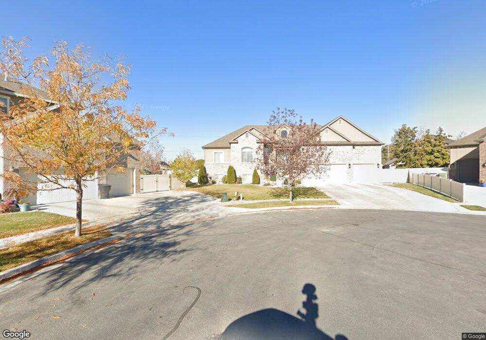
1719 S 3660 W Syracuse, UT 84075
Estimated Value: $679,272 - $776,000
3
Beds
3
Baths
3,800
Sq Ft
$189/Sq Ft
Est. Value
About This Home
This home is located at 1719 S 3660 W, Syracuse, UT 84075 and is currently estimated at $720,068, approximately $189 per square foot. 1719 S 3660 W is a home located in Davis County with nearby schools including Buffalo Point School, Syracuse Junior High School, and Syracuse High School.
Ownership History
Date
Name
Owned For
Owner Type
Purchase Details
Closed on
Jun 3, 2016
Sold by
Jordan William L
Bought by
Lawrenson Mark and Lawrenson Crystal
Current Estimated Value
Purchase Details
Closed on
Mar 21, 2013
Sold by
Richmond American Homes Of Utah Inc
Bought by
Jordon William L and Jordon Connie J
Home Financials for this Owner
Home Financials are based on the most recent Mortgage that was taken out on this home.
Original Mortgage
$448,480
Interest Rate
3.49%
Mortgage Type
Reverse Mortgage Home Equity Conversion Mortgage
Purchase Details
Closed on
Sep 10, 2010
Sold by
Wells Fargo Bank National Association
Bought by
Richmond American Homes Of Utah Inc
Purchase Details
Closed on
Apr 7, 2009
Sold by
Us Development Inc
Bought by
Wells Fargo Bank National Association
Create a Home Valuation Report for This Property
The Home Valuation Report is an in-depth analysis detailing your home's value as well as a comparison with similar homes in the area
Home Values in the Area
Average Home Value in this Area
Purchase History
| Date | Buyer | Sale Price | Title Company |
|---|---|---|---|
| Lawrenson Mark | -- | Backman Title Services | |
| Jordon William L | -- | First American Title Company | |
| Richmond American Homes Of Utah Inc | -- | First American Title Ncs | |
| Wells Fargo Bank National Association | -- | None Available |
Source: Public Records
Mortgage History
| Date | Status | Borrower | Loan Amount |
|---|---|---|---|
| Previous Owner | Jordon William L | $448,480 |
Source: Public Records
Tax History Compared to Growth
Tax History
| Year | Tax Paid | Tax Assessment Tax Assessment Total Assessment is a certain percentage of the fair market value that is determined by local assessors to be the total taxable value of land and additions on the property. | Land | Improvement |
|---|---|---|---|---|
| 2025 | $3,609 | $348,150 | $123,782 | $224,368 |
| 2024 | $3,426 | $332,750 | $106,418 | $226,332 |
| 2023 | $3,232 | $572,000 | $152,981 | $419,019 |
| 2022 | $3,503 | $339,900 | $80,982 | $258,918 |
| 2021 | $3,063 | $460,000 | $117,512 | $342,488 |
| 2020 | $2,751 | $400,000 | $99,717 | $300,283 |
| 2019 | $2,682 | $385,000 | $101,062 | $283,938 |
| 2018 | $2,491 | $355,000 | $96,732 | $258,268 |
| 2016 | $2,466 | $184,305 | $38,237 | $146,068 |
| 2015 | $2,477 | $176,275 | $38,237 | $138,038 |
| 2014 | $2,453 | $177,892 | $38,237 | $139,655 |
| 2013 | -- | $115,636 | $38,210 | $77,426 |
Source: Public Records
Map
Nearby Homes
- 1430 Heather Ln
- 3478 Brookshire Dr
- 3704 W 2170 S Unit 111
- 3867 Rungsted Cir
- 3951 Baltimore Cir
- 4191 W 1425 S
- 3360 W 2280 S
- 2982 S 3000 W
- 2912 S 3000 W
- 1084 S 4090 W
- 1238 S 4290 W
- 895 Dunes Dr
- 851 S 3525 W
- 3661 W 800 S
- 3565 W 800 S
- 1157 S 4425 W
- 2961 S 2425 W Unit 1123
- 2840 W 1200 S
- 1155 S 4475 W
- 1139 S 4475 W
- 1733 S 3660 W
- 1722 S 3660 W Unit 307
- 1718 Doral Dr
- 1736 Doral Dr
- 1736 Doral Dr Unit 30
- 1734 S 3660 W Unit 308
- 1747 S 3660 W
- 1731 S 3720 W Unit 317
- 1731 S 3720 W
- 1756 Doral Dr
- 1748 S 3660 W
- 1748 S 3660 W Unit 309
- 1763 S 3660 W
- 1724 S 3720 W Unit 318
- 1724 S 3720 W
- 1719 Doral Dr
- 1739 S 3600 W
- 1774 Doral Dr
- 1743 S 3720 W Unit 316
- 1766 S 3660 W Unit 310